MyTopo
Busseyville Wisconsin US Topo Map
Couldn't load pickup availability
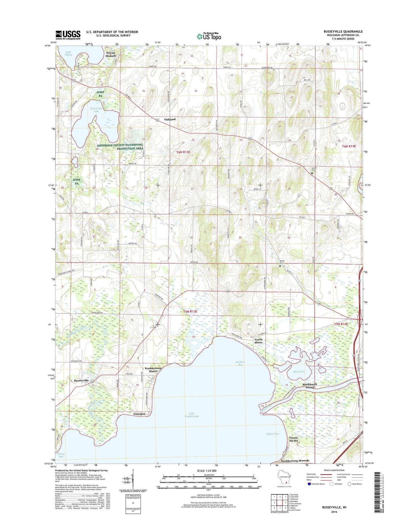
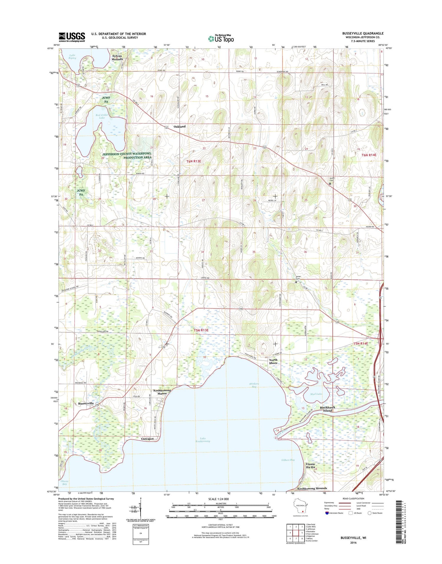
2018 topographic map quadrangle Busseyville in the state of Wisconsin. Scale: 1:24000. Based on the newly updated USGS 7.5' US Topo map series, this map is in the following counties: Jefferson. The map contains contour data, water features, and other items you are used to seeing on USGS maps, but also has updated roads and other features. This is the next generation of topographic maps. Printed on high-quality waterproof paper with UV fade-resistant inks.
Quads adjacent to this one:
West: Rockdale
Northwest: Deerfield
North: Lake Mills
Northeast: Jefferson
East: Fort Atkinson
Southeast: Lima Center
South: Milton
Southwest: Edgerton
Contains the following named places: Blackhawk Island, Blackhawk School, Busseyville, Busseyville Cemetery, Carcajou, Gilbert Bay, Glenn Oaks Beach, Jefferson County Waterfowl Production Area, Koshkonong Creek, Koshkonong Manor, Lake Koshkonong, Lake Koshkonong Census Designated Place, Mud Lake, North Shore, Oakland, Oakland Center Cemetery, Oakland Evergreen Cemetery, Oakland School, Oakland Seventh - Day Cemetery, Olsons Bay, Red Cedar Lake, Red Cedar Lake State Natural Area, Royce School, Saint Johns Church, Stinkers Bay, Strasburg Pit, Sylvan Mounds, Town of Oakland, Town of Sumner, Union Cemetery, Vinnie Ha Ha, Ward Cemetery