MyTopo
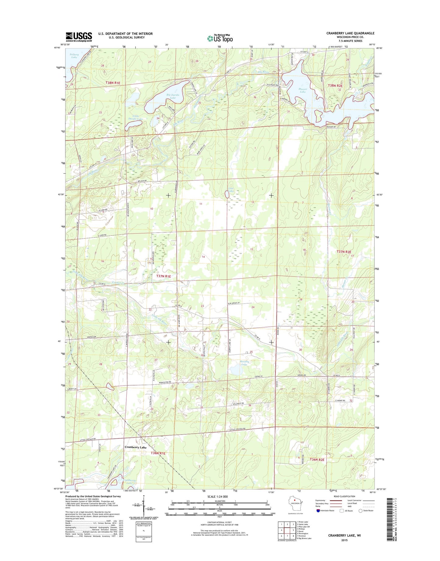
Cranberry Lake Wisconsin US Topo Map
Couldn't load pickup availability
2018 topographic map quadrangle Cranberry Lake in the state of Wisconsin. Scale: 1:24000. Based on the newly updated USGS 7.5' US Topo map series, this map is in the following counties: Price. The map contains contour data, water features, and other items you are used to seeing on USGS maps, but also has updated roads and other features. This is the next generation of topographic maps. Printed on high-quality waterproof paper with UV fade-resistant inks.
Quads adjacent to this one:
West: Phillips
Northwest: Priest Lake
North: Gates Lake
Northeast: Pike Lake SW
East: Dover
Southeast: Big Briens Lake
South: Prentice
Southwest: Pennington
Contains the following named places: Bass Lake, Big Dardis Lake, Chase Creek, Cramer Creek, Cranberry Lake, Donavan Lake, East Highland School, Hoffman Creek, Little Dardis Lake, Little Elk Church, Little Elk River, Little Elk School, Lost Lake, Mount Hope School, Murphy Lake, Musser 2WP235 Dam, Musser Creek, Musser Dam, Musser Lake, Pine Grove School, Popple Creek, Price County, Town of Worcester, Worcester School