MyTopo
Genesee Wisconsin US Topo Map
Couldn't load pickup availability
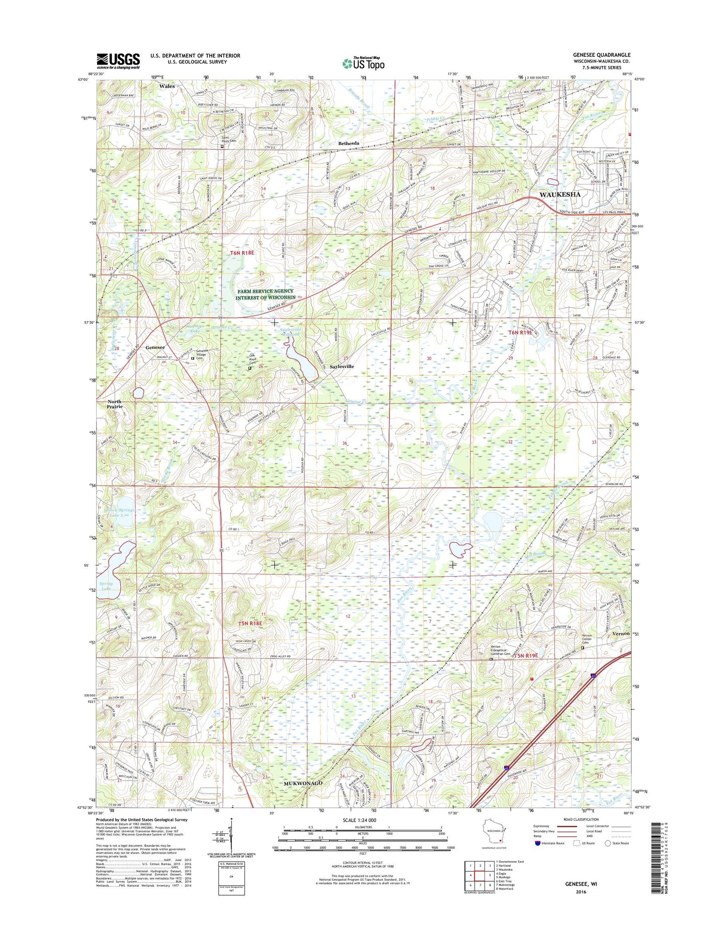
2018 topographic map quadrangle Genesee in the state of Wisconsin. Scale: 1:24000. Based on the newly updated USGS 7.5' US Topo map series, this map is in the following counties: Waukesha. The map contains contour data, water features, and other items you are used to seeing on USGS maps, but also has updated roads and other features. This is the next generation of topographic maps. Printed on high-quality waterproof paper with UV fade-resistant inks.
Quads adjacent to this one:
West: Eagle
Northwest: Oconomowoc East
North: Hartland
Northeast: Waukesha
East: Muskego
Southeast: Waterford
South: Mukwonago
Southwest: East Troy
Contains the following named places: Bethesda, Bethesda School, Big Bend - Vernon Fire Department Station 2, Brandy Brook, Fox Run Shopping Center, Genesee, Genesee Creek, Genesee Depot, Genesee Depot Post Office, Genesee Oak Opening And Fen State Natural Area, Genesee Village Cemetery, Hayslope Lake, Hidden Lakes Dam G 1167, Laitsch D2938 Dam, Lawrence School, Magee Elementary School, Merrill Hills Country Club, Mill Brook, North Branch Genesee Creek, Oak Knoll Cemetery, Oakdale School, Pebble Brook, Pebble Creek, Rose Glen Elementary School, Saint Johns Evangelical Lutheran School, Saint Pauls Cemetery, Saylesville, Saylesville Millpond, Saylesville Roller Mill Dam, South Branch Genesee Creek, Spring Brook, Spring Lake, Town of Genesee, Town of Mukwonago, Vernon, Vernon Center Cemetery, Vernon Church, Vernon Evangelical Lutheran Cemetery, Vernon Marsh Refuge Flowage H2.117 Dam, Vernon Marsh Refuge Middle Flowage H2.117 Dam, Vernon Station, Waukesha Christian Academy, Waukesha Fire Department Station 3, Waukesha West High School, Willow Springs Lake 3.10, ZIP Codes: 53149, 53189