MyTopo
Middle Ridge Wisconsin US Topo Map
Couldn't load pickup availability
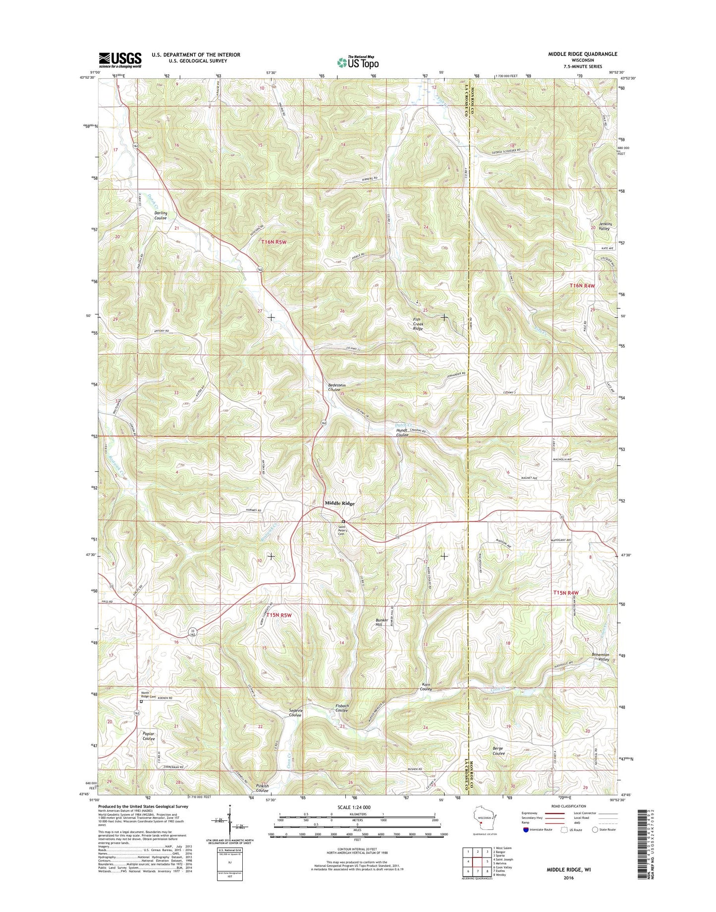
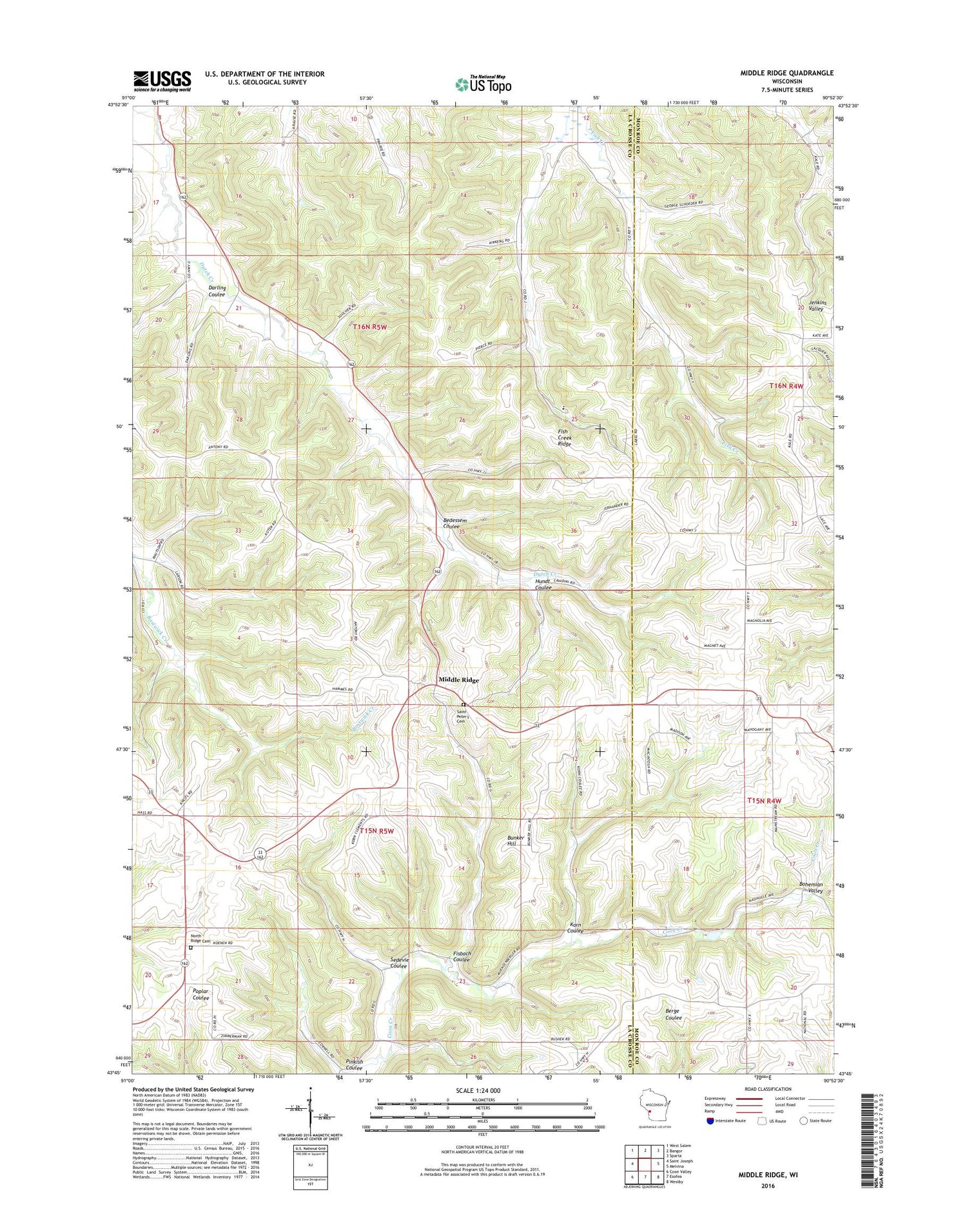
2018 topographic map quadrangle Middle Ridge in the state of Wisconsin. Scale: 1:24000. Based on the newly updated USGS 7.5' US Topo map series, this map is in the following counties: La Crosse, Monroe. The map contains contour data, water features, and other items you are used to seeing on USGS maps, but also has updated roads and other features. This is the next generation of topographic maps. Printed on high-quality waterproof paper with UV fade-resistant inks.
Quads adjacent to this one:
West: Saint Joseph
Northwest: West Salem
North: Bangor
Northeast: Sparta
East: Melvina
Southeast: Westby
South: Esofea
Southwest: Coon Valley
Contains the following named places: 1 Reservoir, 1.22 Reservoir, 1.93 Reservoir, 3 Reservoir, 54653, Bedessem Coulee, Bunker Hill, Clements School, Cleveland School, Coon Creek 29 D-6025 Dam, Coon Creek 31 D-6025 Dam, Coon Creek 33 D-6025 Dam, Coon Creek 35 D-6025 Dam, Darling Coulee, Fisbach Coulee, Fish Creek Church, Fish Creek Ridge, Grand View School, Hundt Coulee, Hylandale Church School, Korn Coulee, Lincoln School, Lower Dutch Creek School, Meadowbrook School, Middle Ridge, Middle Ridge School, Newberg Corners, North Ridge Cemetery, Pinkish Coulee, Pleasant View School, Saint Peter Church, Saint Peter's Cemetery, Sedevie Coulee, Town of Bangor, Town of Washington, Upper Dutch Creek School, West Portland School