
MyTopo
North Cape Wisconsin US Topo Map
Couldn't load pickup availability
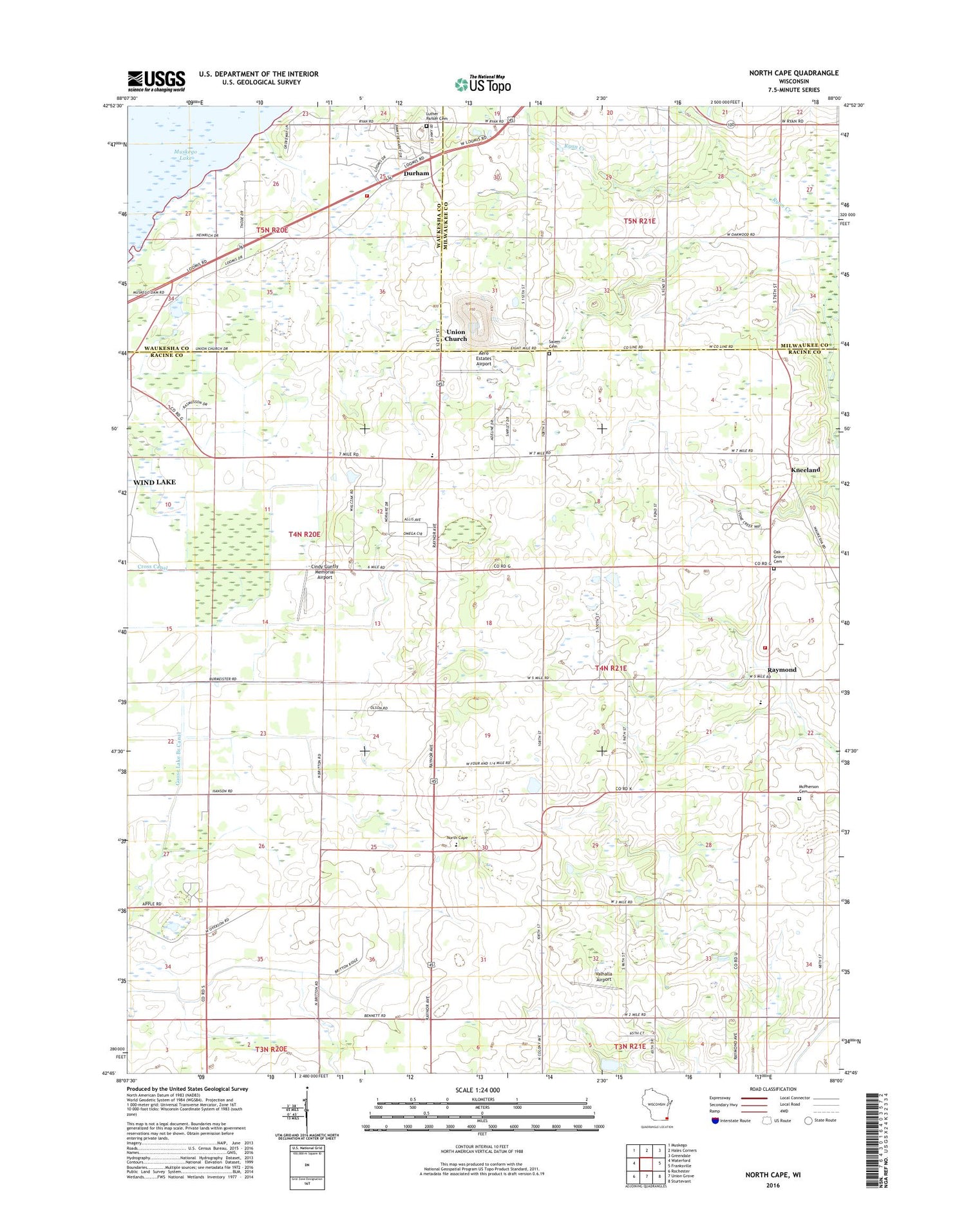
2018 topographic map quadrangle North Cape in the state of Wisconsin. Scale: 1:24000. Based on the newly updated USGS 7.5' US Topo map series, this map is in the following counties: Racine, Milwaukee, Waukesha. The map contains contour data, water features, and other items you are used to seeing on USGS maps, but also has updated roads and other features. This is the next generation of topographic maps. Printed on high-quality waterproof paper with UV fade-resistant inks.
Quads adjacent to this one:
West: Waterford
Northwest: Muskego
North: Hales Corners
Northeast: Greendale
East: Franksville
Southeast: Sturtevant
South: Union Grove
Southwest: Rochester
Contains the following named places: Aero Estates Airport, Aero Estates Landing Field, Apple School, Bethlehem Lutheran Church, Cindy Guntly Memorial Airport, Deremer School, Drought Elementary School, Durham, Durham Hill Nursery, East Cape School, Franklin Park Savanna State Natural Area, Garfield School, Goose Lake Branch Canal, Kneeland, Luther Parker Cemetery, McPherson Cemetery, Muskego Lakes County Club, North Cape, North Cape Elementary School, North Cape Lutheran Church, Oak Grove Cemetery, Oak Grove School, Rainbow Airport, Raymond, Raymond Baptist Church, Raymond Fire and Rescue Department, Raymond School, Raymond Seventh Day Adventist Church, Raymond Town Hall, Raymond United Church of Christ, Salem Cemetery, Tess Corners Volunteer Fire Department Station 2, Town of Raymond, Union Church, Valhalla Airport, Village of Raymond, WBZN-FM (Racine), Willow Edge School, WISN-AM (Milwaukee)


