
MyTopo
Phillips Wisconsin US Topo Map
Couldn't load pickup availability
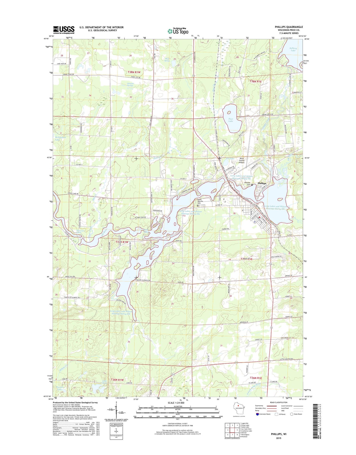
2018 topographic map quadrangle Phillips in the state of Wisconsin. Scale: 1:24000. Based on the newly updated USGS 7.5' US Topo map series, this map is in the following counties: Price. The map contains contour data, water features, and other items you are used to seeing on USGS maps, but also has updated roads and other features. This is the next generation of topographic maps. Printed on high-quality waterproof paper with UV fade-resistant inks.
Quads adjacent to this one:
West: Lac Sault Dore
Northwest: Lugerville
North: Priest Lake
Northeast: Gates Lake
East: Cranberry Lake
Southeast: Prentice
South: Pennington
Southwest: Kennan
Contains the following named places: Arbutus Hill School, Central Price County Ambulance Service, Chase Creek, City of Phillips, Cranberry Lake, Cranberry Lake Dam, Crane and Chase School, Deer Creek, Deer Lake, Duroy Lake, Elk Duroy Long Lakes and Wilson Flowage, Elk Lake, Excelsior School, Flemmings Rapids, Hartman School, Hillside School, Janacek Springs, Jobes 2WP132 Dam, Jobes Dam, Kerr Slashing School, Lake Three, Lakeside Cemetery, Long Lake, Long Lake School, Mink Spring, Our Lady of the North Church, Phillips, Phillips 6 - 12 Schools, Phillips Elementary School, Phillips Fire Department, Phillips Middle School, Phillips Police Department, Phillips Post Office, Pioneer School, Pot Lake, Price County Airport, Price County Courthouse, Price County Fairground, Price County Sheriff's Department and Price County Jail, Saint John Lutheran Church, Saint Patrick Cemetery, Solberg 2WP456 Dam, Solberg Dam, Squaw Creek, Squaw Creek School, Warner Lake, Wilson Creek, Wilson Lake, ZIP Code: 54555


