
MyTopo
Saint Joseph Wisconsin US Topo Map
Couldn't load pickup availability
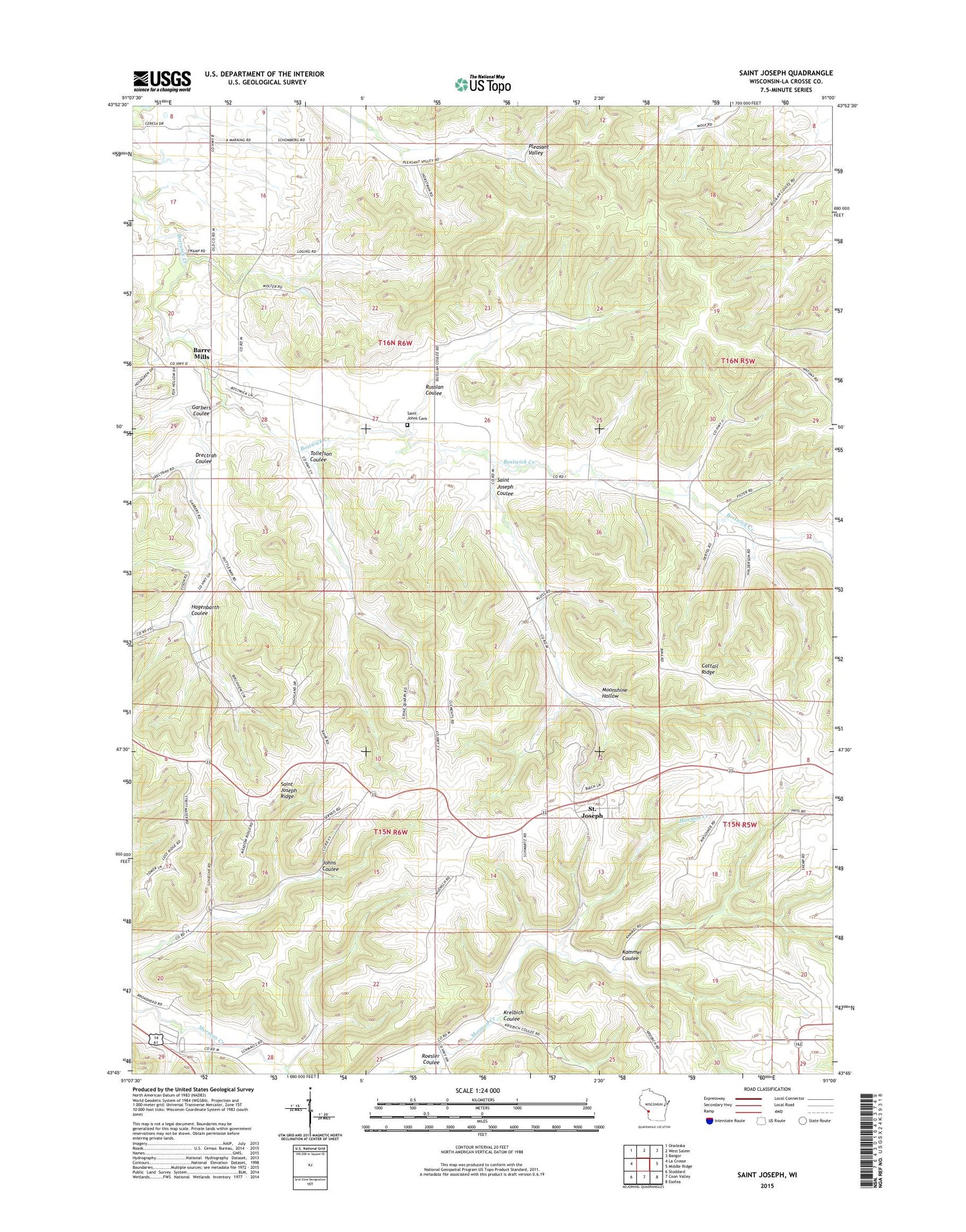
2018 topographic map quadrangle Saint Joseph in the state of Wisconsin. Scale: 1:24000. Based on the newly updated USGS 7.5' US Topo map series, this map is in the following counties: La Crosse. The map contains contour data, water features, and other items you are used to seeing on USGS maps, but also has updated roads and other features. This is the next generation of topographic maps. Printed on high-quality waterproof paper with UV fade-resistant inks.
Quads adjacent to this one:
West: La Crosse
Northwest: Onalaska
North: West Salem
Northeast: Bangor
East: Middle Ridge
Southeast: Esofea
South: Coon Valley
Southwest: Stoddard
Contains the following named places: Barre Mills, Barre Mills Cemetery, Cattail Ridge, Coulee State Experimental Forest, Drectrah Coulee, Garbers Coulee, Grandview School, Hagenbarth Coulee, Irish Coulee School, Kammel Coulee, Krelbich Coulee, Maple Grove Country Club, Moonshine Hollow, Old Saint Johns Cemetery, Pershing School, Pleasant Valley School, Roesler Coulee, Russlan Coulee, Saint Johns Cemetery, Saint Johns School, Saint Joseph, Saint Joseph Census Designated Place, Saint Joseph Coulee, Saint Joseph Ridge, Saint Joseph Ridge Catholic Cemetery, Saint Joseph School, Sunny Mede School, Sunnybrook School, Tollefson Coulee, Town of Barre, Town of Greenfield, Valley View School, Victory School


