MyTopo
Sharon Wisconsin US Topo Map
Couldn't load pickup availability
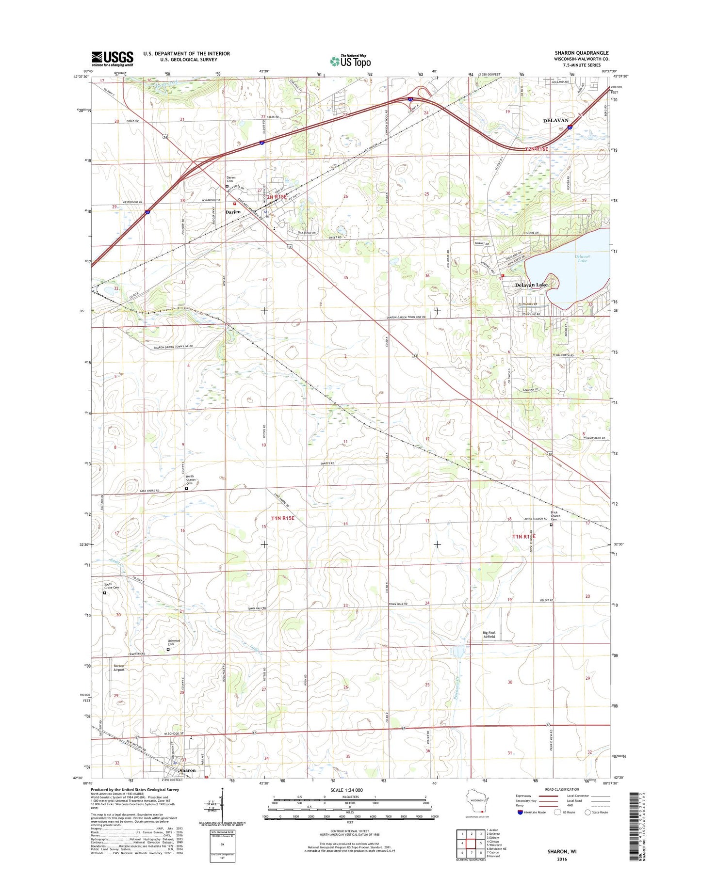
2018 topographic map quadrangle Sharon in the state of Wisconsin. Scale: 1:24000. Based on the newly updated USGS 7.5' US Topo map series, this map is in the following counties: Walworth. The map contains contour data, water features, and other items you are used to seeing on USGS maps, but also has updated roads and other features. This is the next generation of topographic maps. Printed on high-quality waterproof paper with UV fade-resistant inks.
Quads adjacent to this one:
West: Clinton
Northwest: Avalon
North: Delavan
Northeast: Elkhorn
East: Walworth
Southeast: Harvard
South: Capron
Southwest: Belvidere NE
Contains the following named places: Barten Airport, Big Foot Airfield, Brick Church, Brick Church Cemetery, Christ Lutheran Church, Community Baptist Church, Darien, Darien Cemetery, Darien Elementary School, Darien Emergency Medical Services, Darien Fire - Emergency Medical Service Department, Darien Police Department, Darien Post Office, Delavan Lake, Delavan Township Volunteer Fire Department Station 3, Elton School, Fest Park, North Sharon Cemetery, Oakwood Cemetery, Pioneer Estates, Red School, Saint Catherine Catholic Church, Salt Box School, Sharon, Sharon Community School, Sharon Fire and Rescue, Sharon Police Department, Sharon Post Office, Smilin' Sam's Airport, South Grove Cemetery, Town of Sharon, Town of Walworth, Van Dell Farms, Village of Darien, Village of Sharon, ZIP Code: 53585