MyTopo
Sheboygan South Wisconsin US Topo Map
Couldn't load pickup availability
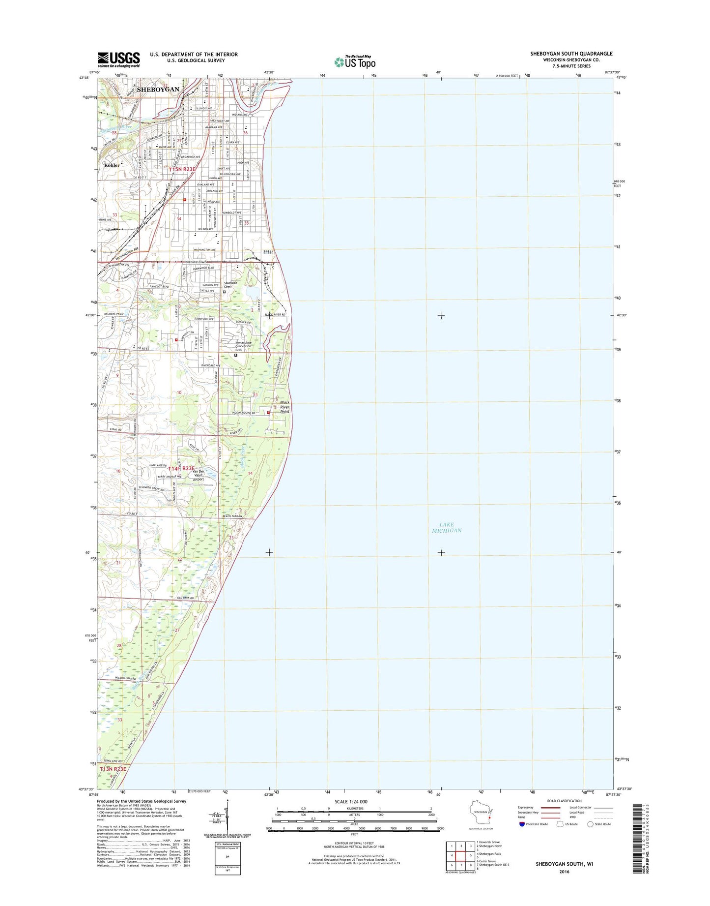
2018 topographic map quadrangle Sheboygan South in the state of Wisconsin. Scale: 1:24000. Based on the newly updated USGS 7.5' US Topo map series, this map is in the following counties: Sheboygan. The map contains contour data, water features, and other items you are used to seeing on USGS maps, but also has updated roads and other features. This is the next generation of topographic maps. Printed on high-quality waterproof paper with UV fade-resistant inks.
Quads adjacent to this one:
West: Sheboygan Falls
Northwest: Howards Grove
North: Sheboygan North
South: Sheboygan South OE S
Southwest: Cedar Grove
Contains the following named places: A2 Charter School, Bethany Reformed Church, Bethel Baptist Church, Bethlehem Lutheran Church, Bethlehem Lutheran School, Black River, Black River Point, Camp Taswood, Central High School, Charter Northbrooke Center, Christ Child Academy, Christ Church, Christ Lutheran Church, City of Sheboygan, Early Learning Center School, Edgewater Generating Station, Eighth Street Boat Ramp, Farnsworth Middle School, Franklin School, Good Shepherd Lutheran Church, Hmong Community Alliance Church, Holy Cross Cemetery, Horace Mann Middle School, Immaculate Conception Catholic Church, Immaculate Conception Cemetery, Immanuel Evangelical Lutheran Church, Immanuel Lutheran School, Indian Meadows, Jackson Elementary School, James Madison Elementary School, King Park, Kingdom Hall of Jehovahs Witnesses, Kohler Park Dunes State Natural Area, Lake View Park, Leslie Johnson Theatre, Longfellow Elementary School, Moose Park, Municipal Auditorium, New Covenant Parish, New World Montessori School, Optimist Park, Orange Cross Ambulance, Our Saviours Lutheran Church, Riverdale Public Golf Course, Roosevelt Playground, Rotary Riverfront Park, Saint Andrew Lutheran Church, Saint Cyril and Methodius Catholic Church, Saint Pauls United Church of Christ, Saint Peter Claver Catholic Church, Saint Spyridon Greek Orthodox Church, Salem Plank Road United Church, Sanderling Nature Center, Sheboygan County, Sheboygan County Christian High School, Sheboygan County Detention Center, Sheboygan Fire Department Station 2, Sheboygan Fire Department Station 5, Sheboygan Port + Warehouse Terminal Limited, Sheboygan River, Sheboygan Yacht Club, Sheridan Elementary School, Sheridan Park, Sommer's Woodhaven Mobile Home Park, South High School, South Pierhead Light, South Side Municipal Beach, Southside Alliance Church, Terry Andrae State Park, Third Ward School, Van Der Vaart Airport, Veterans Park, Wesley United Methodist Church, WHBL-AM (Sheboygan), Wildwood Athletic Complex, Wilson - Black River Fire Department, Wilson Elementary School, WWJR-FM (Sheboygan), Zion Christian Assembly Church, ZIP Code: 53081