MyTopo
Tipler Wisconsin US Topo Map
Couldn't load pickup availability
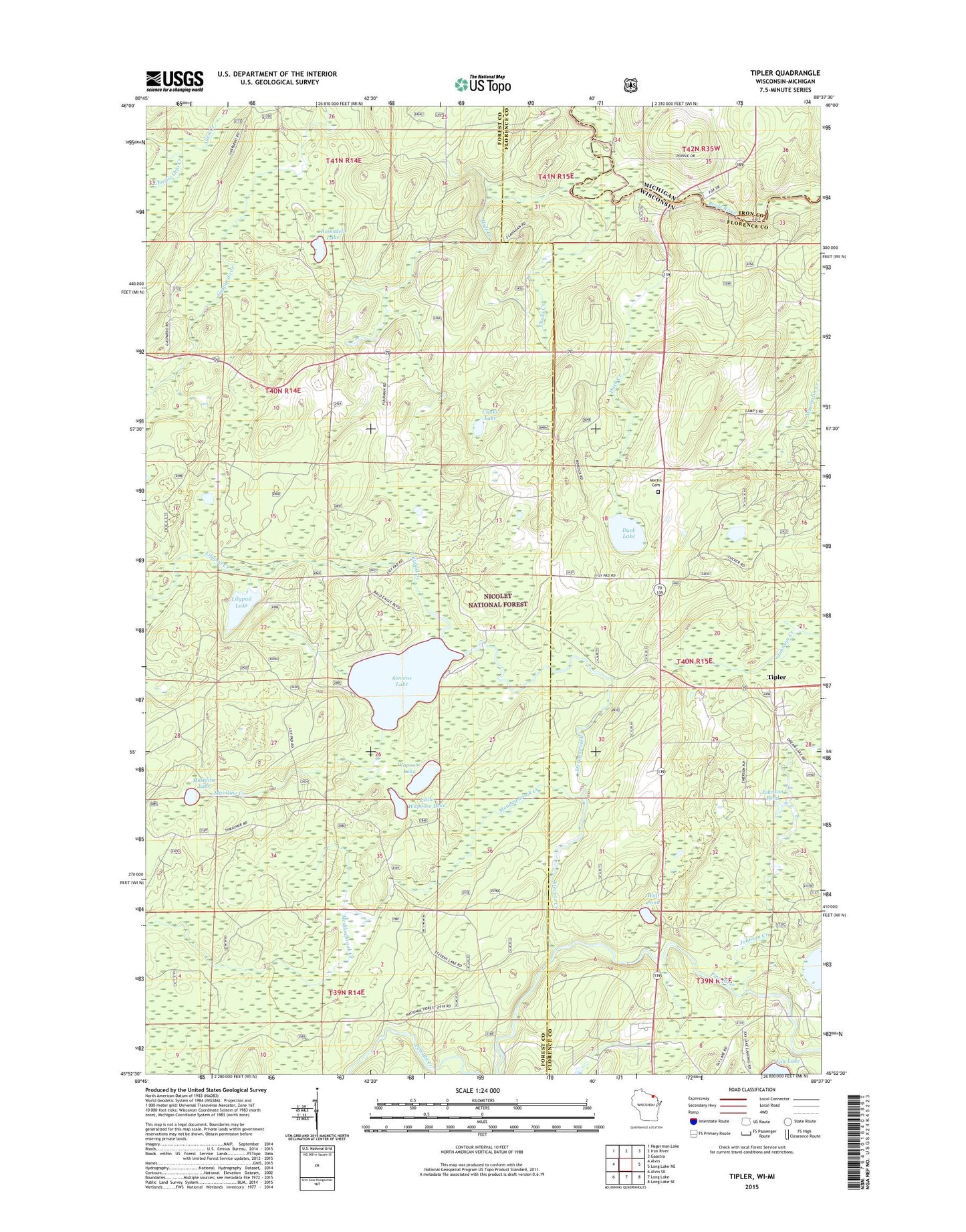
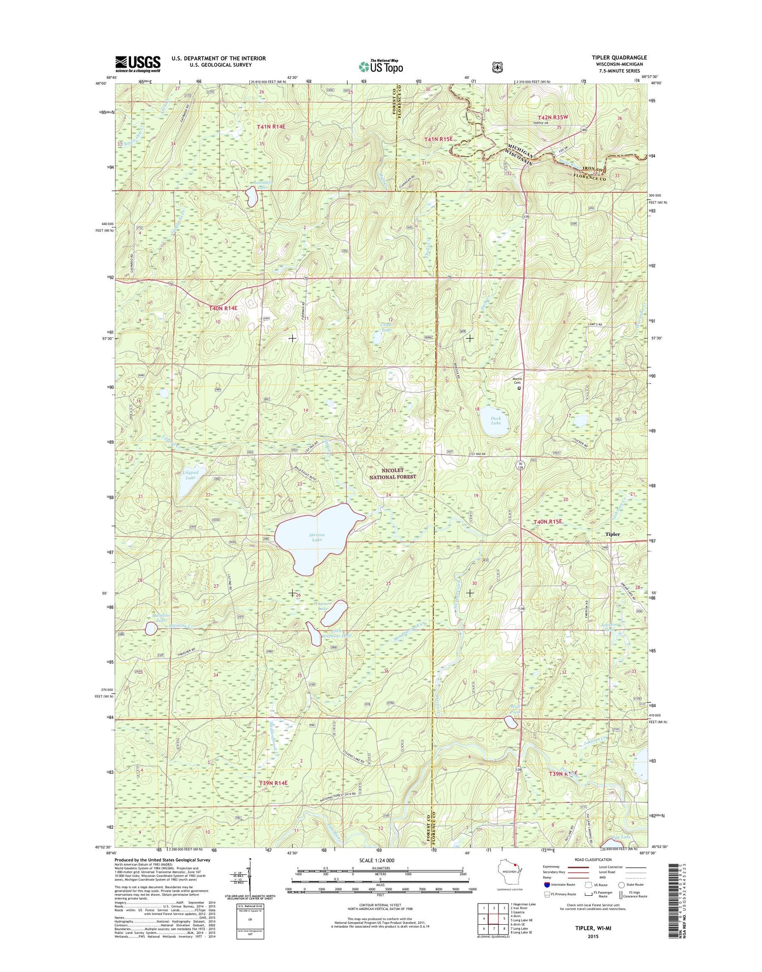
2018 topographic map quadrangle Tipler in the state of Wisconsin. Scale: 1:24000. Based on the newly updated USGS 7.5' US Topo map series, this map is in the following counties: Forest, Florence, Iron. The map contains contour data, water features, and other items you are used to seeing on USGS maps, but also has updated roads and other features. This is the next generation of topographic maps. Printed on high-quality waterproof paper with UV fade-resistant inks.
Quads adjacent to this one:
West: Alvin
Northwest: Hagerman Lake
North: Iron River
Northeast: Gaastra
East: Long Lake NE
Southeast: Long Lake SE
South: Long Lake
Southwest: Alvin SE
Contains the following named places: Camp Number 5 Siding, Charlie Otto Creek, Chuks Creek, Chuks Lake, Duck Creek, Duck Lake, Huff Creek, Johnson Creek, Johnson Pond, Klocks Resort, Lilypad Creek, Lilypad Lake, Lindels Spur, Little Wapoose Lake, Mainline Creek, Mainline Lake, Maple Grove Church, Martin Cemetery, Meadowbrook Creek, Mud Lake, Ramsdell Lake, Stevens Creek, Stevens Lake, Stevens Lake Campground, Tipler, Tipler Census Designated Place, Wapoose Lake, Wild Rose School, Wolf Pond, ZIP Code: 54542