MyTopo
Two Creeks Wisconsin US Topo Map
Couldn't load pickup availability
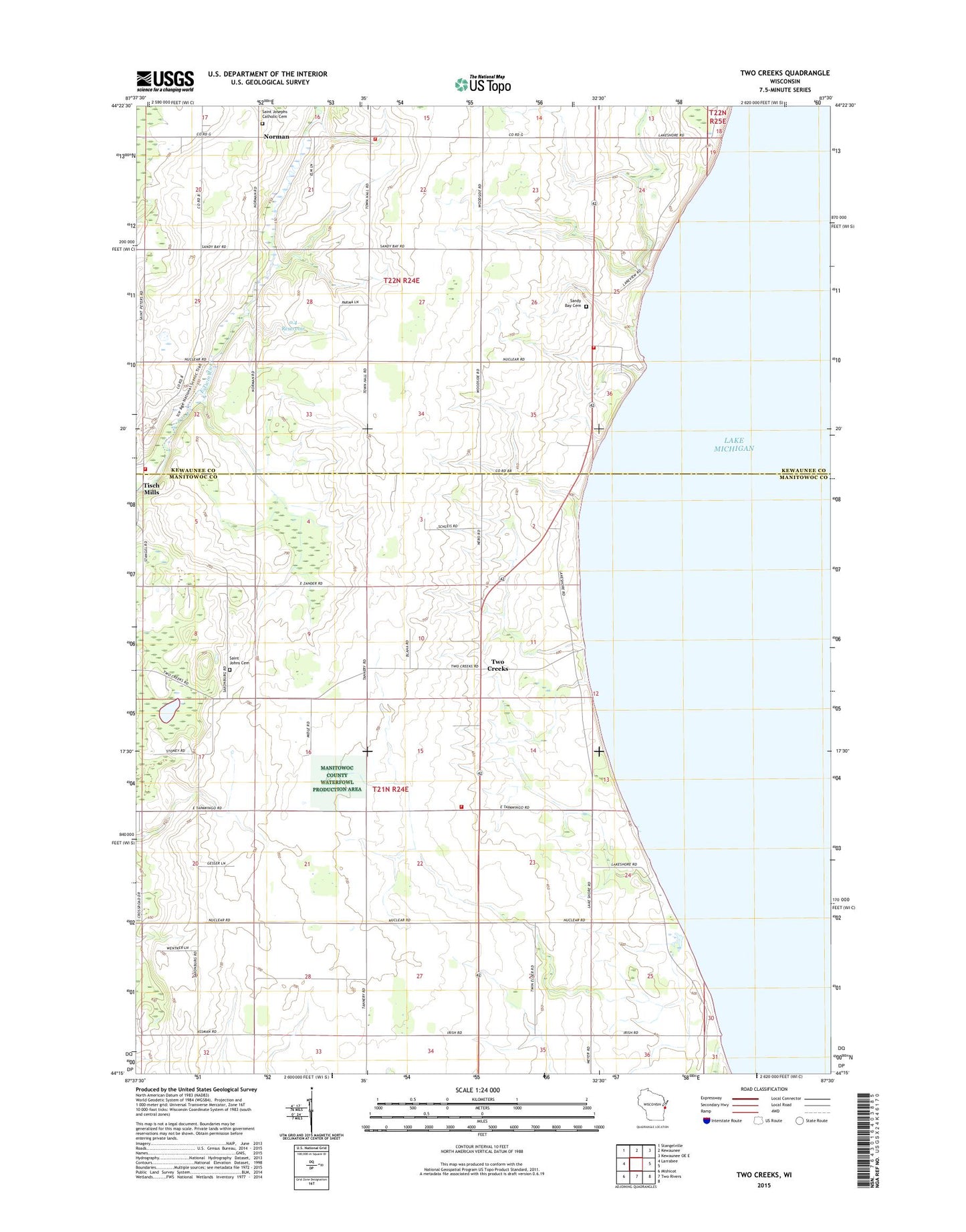
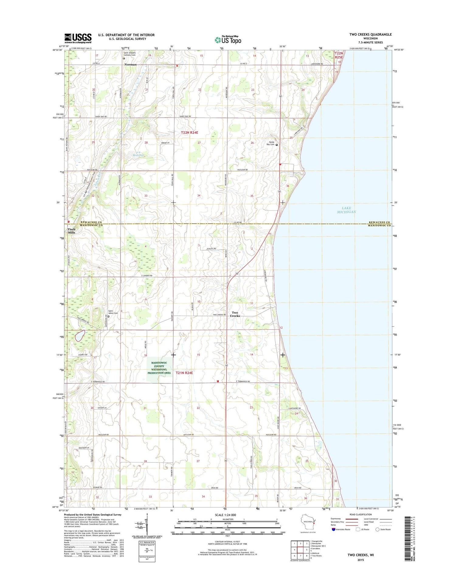
2018 topographic map quadrangle Two Creeks in the state of Wisconsin. Scale: 1:24000. Based on the newly updated USGS 7.5' US Topo map series, this map is in the following counties: Manitowoc, Kewaunee. The map contains contour data, water features, and other items you are used to seeing on USGS maps, but also has updated roads and other features. This is the next generation of topographic maps. Printed on high-quality waterproof paper with UV fade-resistant inks.
Quads adjacent to this one:
West: Larrabee
Northwest: Stangelville
North: Kewaunee
Northeast: Kewaunee OE E
South: Two Rivers
Southwest: Mishicot
Contains the following named places: 0.4 Reservoir, Breezy Acres Dairy, Carlton Town Volunteer Fire Department, Clay Valley Dairy Farms, Dominion Energy Kewaunee Nuclear Plant Fire Brigade, East Twin Farm, East Twin River School, Half Half Dairy Farm, Hasselman Farm, Kewaunee Nuclear Powerplant, Kewoc Dairy Farm, Klimesh Dairy Farm, Langer Farms, Lee L Farms, Manitowoc County Waterfowl Production Area, Michalski Dairy Farm, Morning Glory Dairy, Mueller Farms, Nike Site CM-01R, Norman, Pleasant View School, Point Beach Nuclear Powerplant, Rabas Dairy Farm, Ranch Side Airport, Saint Johns Lutheran Cemetery, Saint Joseph Catholic Cemetery, Saint Joseph Catholic Church, Sandy Bay, Sandy Bay Cemetery, Schleis Farms, Strutz Farms, Tisch Mills, Tisch Mills Fire Department, Tisch Mills Post Office, Tisch Mills School, Town of Carlton, Town of Mishicot, Town of Two Creeks, Twin Elder School, Two Creek Buried Forest State Natural Area, Two Creeks, Two Creeks Air Force Station, Two Creeks Buried State Forest, Two Creeks County Park, Two Creeks Fire Department, Two Creeks Gap Filler Annex, Wayside School, Zellner 3WR-1928 Dam