MyTopo
Cattail Ranch Wyoming US Topo Map
Couldn't load pickup availability
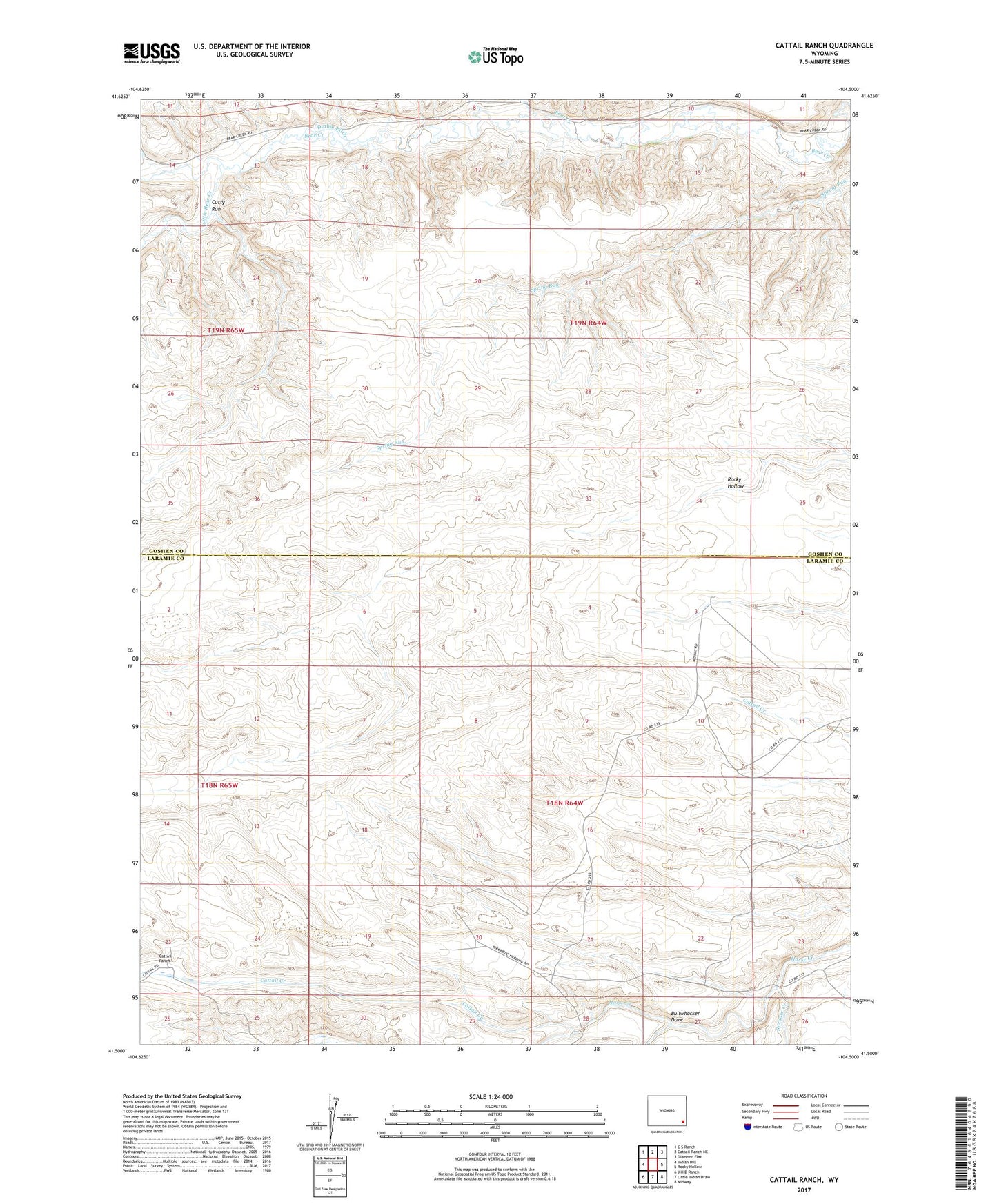
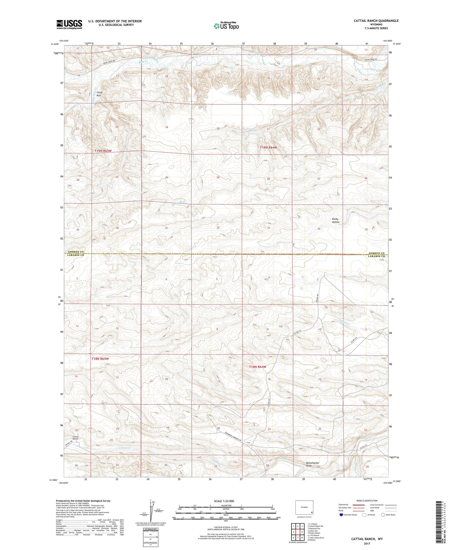
2021 topographic map quadrangle Cattail Ranch in the state of Wyoming. Scale: 1:24000. Based on the newly updated USGS 7.5' US Topo map series, this map is in the following counties: Laramie, Goshen. The map contains contour data, water features, and other items you are used to seeing on USGS maps, but also has updated roads and other features. This is the next generation of topographic maps. Printed on high-quality waterproof paper with UV fade-resistant inks.
Quads adjacent to this one:
West: Indian Hill
Northwest: C S Ranch
North: Cattail Ranch NE
Northeast: Diamond Flat
East: Rocky Hollow
Southeast: Midway
South: Little Indian Draw
Southwest: J H D Ranch
Contains the following named places: Bullwhacker Draw, Cattail Creek, Cattail Ranch, Curty Run, D Kirkbride Ranch, Durbin Ditch, Griffin Homestead, L Kirkbride Ranch, Little Bear Creek, Robinson Place, Sprager Creek, Weaver Homestead, Wilkinson Place