MyTopo
Craig Pass Wyoming US Topo Map
Couldn't load pickup availability
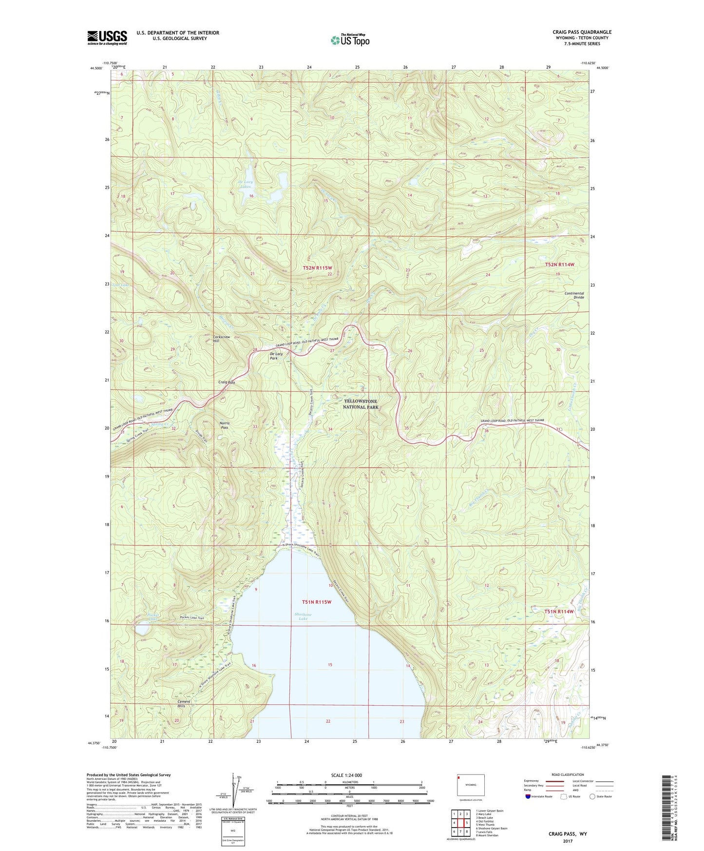
2021 topographic map quadrangle Craig Pass in the state of Wyoming. Scale: 1:24000. Based on the newly updated USGS 7.5' US Topo map series, this map is in the following counties: Teton. The map contains contour data, water features, and other items you are used to seeing on USGS maps, but also has updated roads and other features. This is the next generation of topographic maps. Printed on high-quality waterproof paper with UV fade-resistant inks.
Quads adjacent to this one:
West: Old Faithful
Northwest: Lower Geyser Basin
North: Mary Lake
Northeast: Beach Lake
East: West Thumb
Southeast: Mount Sheridan
South: Lewis Falls
Southwest: Shoshone Geyser Basin
Contains the following named places: Corkscrew Hill, Craig Pass, De Lacy Creek, De Lacy Creek Trail, De Lacy Lakes, De Lacy Park, Dry Creek, Herron Creek, Isa Lake, Norris Pass, Pocket Lake