MyTopo
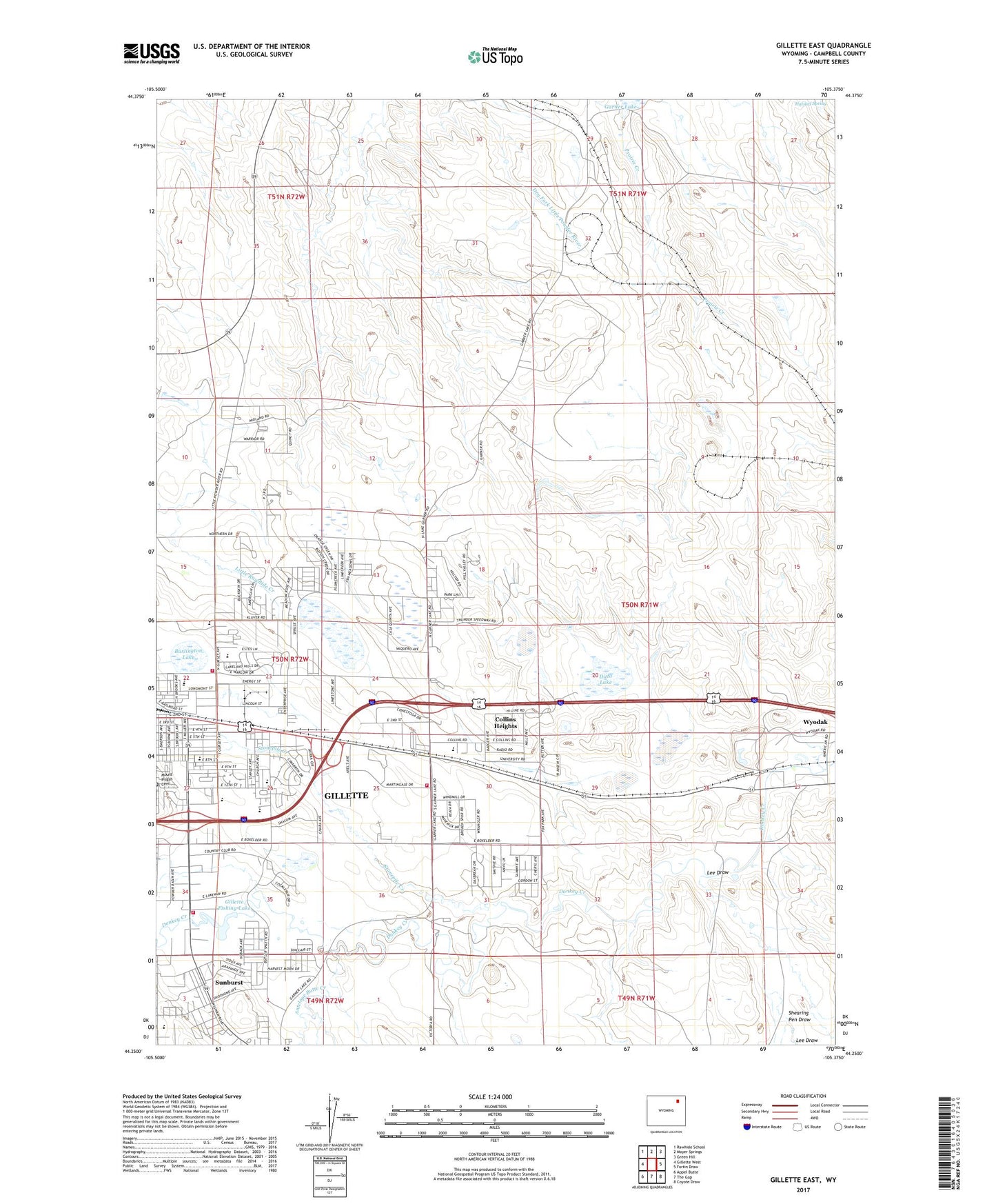
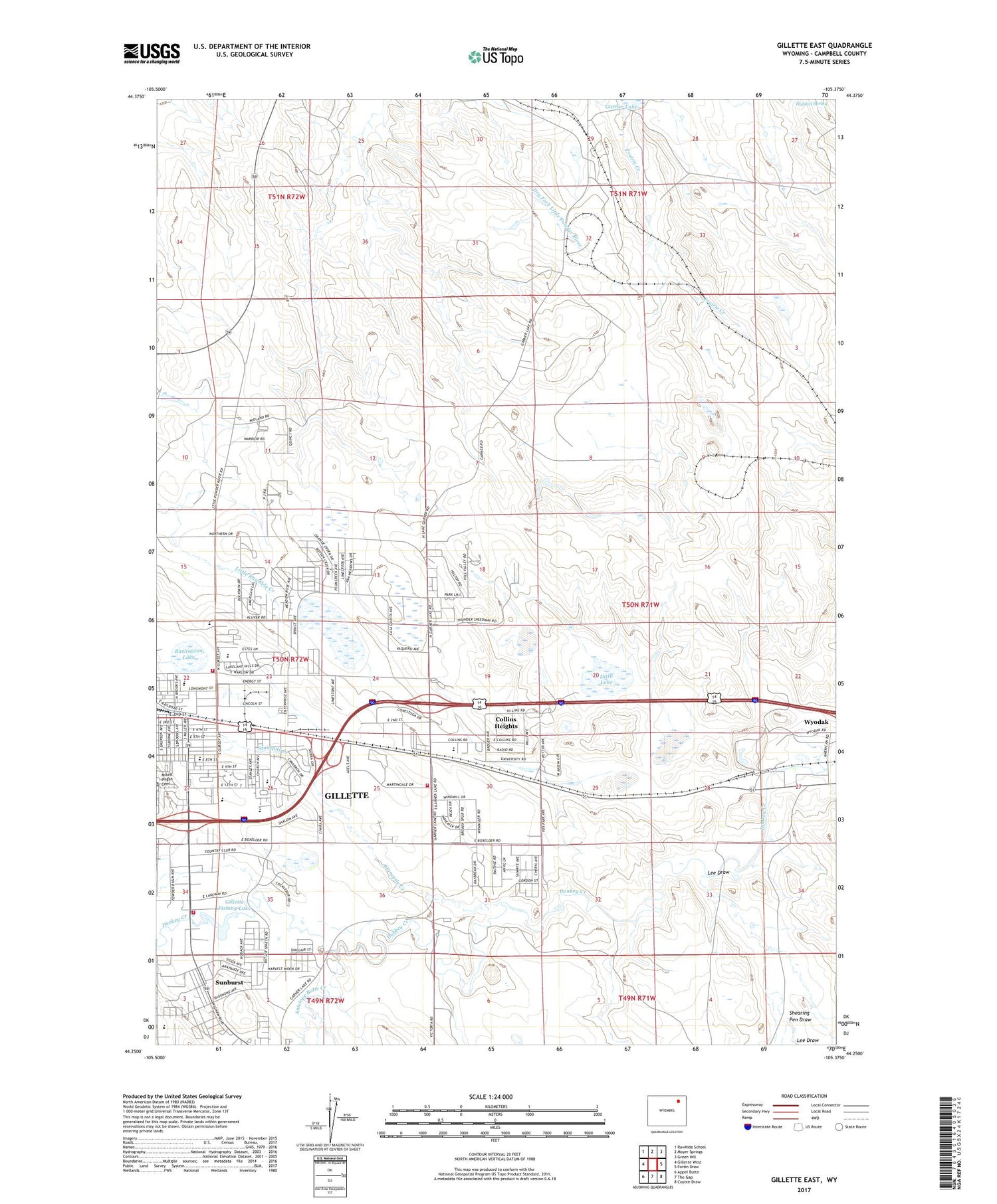
Gillette East Wyoming US Topo Map
Couldn't load pickup availability
2021 topographic map quadrangle Gillette East in the state of Wyoming. Scale: 1:24000. Based on the newly updated USGS 7.5' US Topo map series, this map is in the following counties: Campbell. The map contains contour data, water features, and other items you are used to seeing on USGS maps, but also has updated roads and other features. This is the next generation of topographic maps. Printed on high-quality waterproof paper with UV fade-resistant inks.
Quads adjacent to this one:
West: Gillette West
Northwest: Rawhide School
North: Moyer Springs
Northeast: Green Hill
East: Fortin Draw
Southeast: Coyote Draw
South: The Gap
Southwest: Appel Butte
Contains the following named places: Antelope Butte Creek, Burlington Lake, Camel Plaza Shopping Center, Campbell County Fire Department Station 2, Campbell County Fire Department Station 7, City of Gillette, Clovis Point Mine, Collins Heights, Dalbey Memorial Park, Ditto Lake, Gillete Fishing Lake Dam, Gillette Country Club, Gillette Dam, Gillette Fishing Lake, High View Mobile Home Park, Hillcrest Elementary School, Holiday Plaza Shopping Center, Hornet Pit, KAML-FM (Gillette), KIML-AM (Gillette), Lee Draw, Mount Pisgah Cemetery, North Side School, Peerless Mine, Powder Basin Center, Shearing Pen Draw, Springen Ranch Oil Field, Stonepile Creek, Sunburst, Willamette Mobile Home Park, Wyodak, Wyodak Ash Pond Dam, Wyodak Ash Pond Reservoir, Wyodak Strip Mine, Wyoming Highway Patrol District 4 Division L