MyTopo
Hudson Wyoming US Topo Map
Couldn't load pickup availability
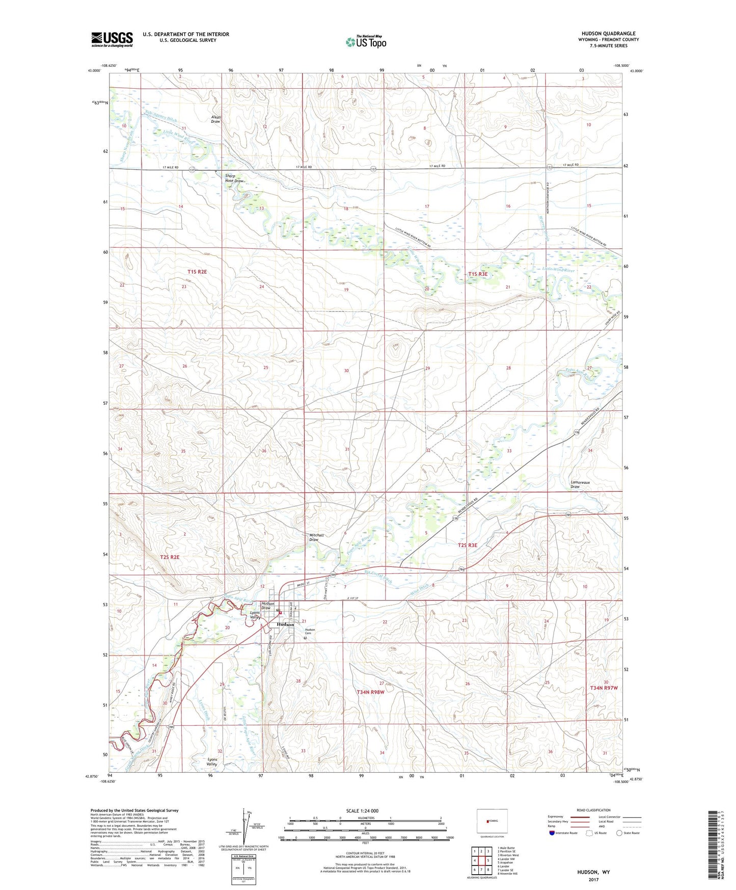
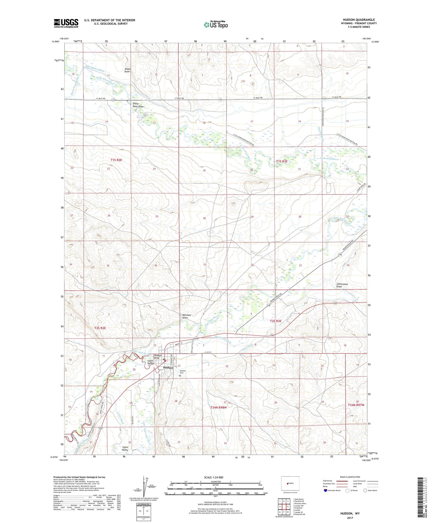
2021 topographic map quadrangle Hudson in the state of Wyoming. Scale: 1:24000. Based on the newly updated USGS 7.5' US Topo map series, this map is in the following counties: Fremont. The map contains contour data, water features, and other items you are used to seeing on USGS maps, but also has updated roads and other features. This is the next generation of topographic maps. Printed on high-quality waterproof paper with UV fade-resistant inks.
Quads adjacent to this one:
West: Lander NW
Northwest: Mule Butte
North: Pavillion SE
Northeast: Riverton West
East: Arapahoe
Southeast: Ninemile Hill
South: Lander SE
Southwest: Lander
Contains the following named places: Alkali Draw, Big Corral Ditch, Concetta Palicichio Mine, Fremont County Fire Protection District Battalion 10 Hudson, Hudson, Hudson Cemetery, Hudson Draw, Hudson Post Office, Hudson School, Lamoreaux Draw, Little Popo Agie River, Lyons Valley, Mitchell Draw, Schroeder Mine, Sharp Nose Draw, Town of Hudson, Warren Drain, Wise Ditch, Wyoming Central Mine, ZIP Codes: 82510, 82515