MyTopo
Moyer Springs Wyoming US Topo Map
Couldn't load pickup availability
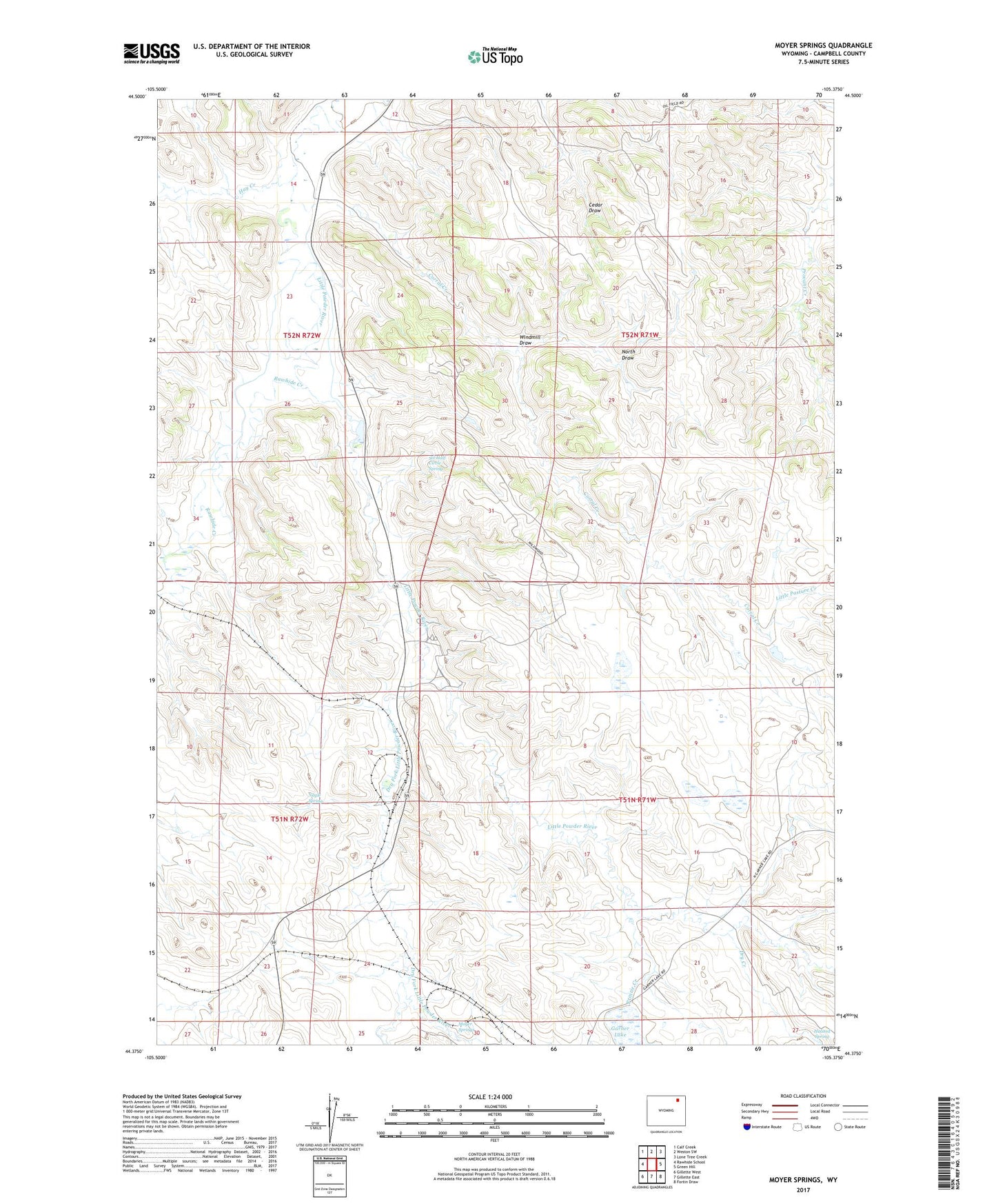
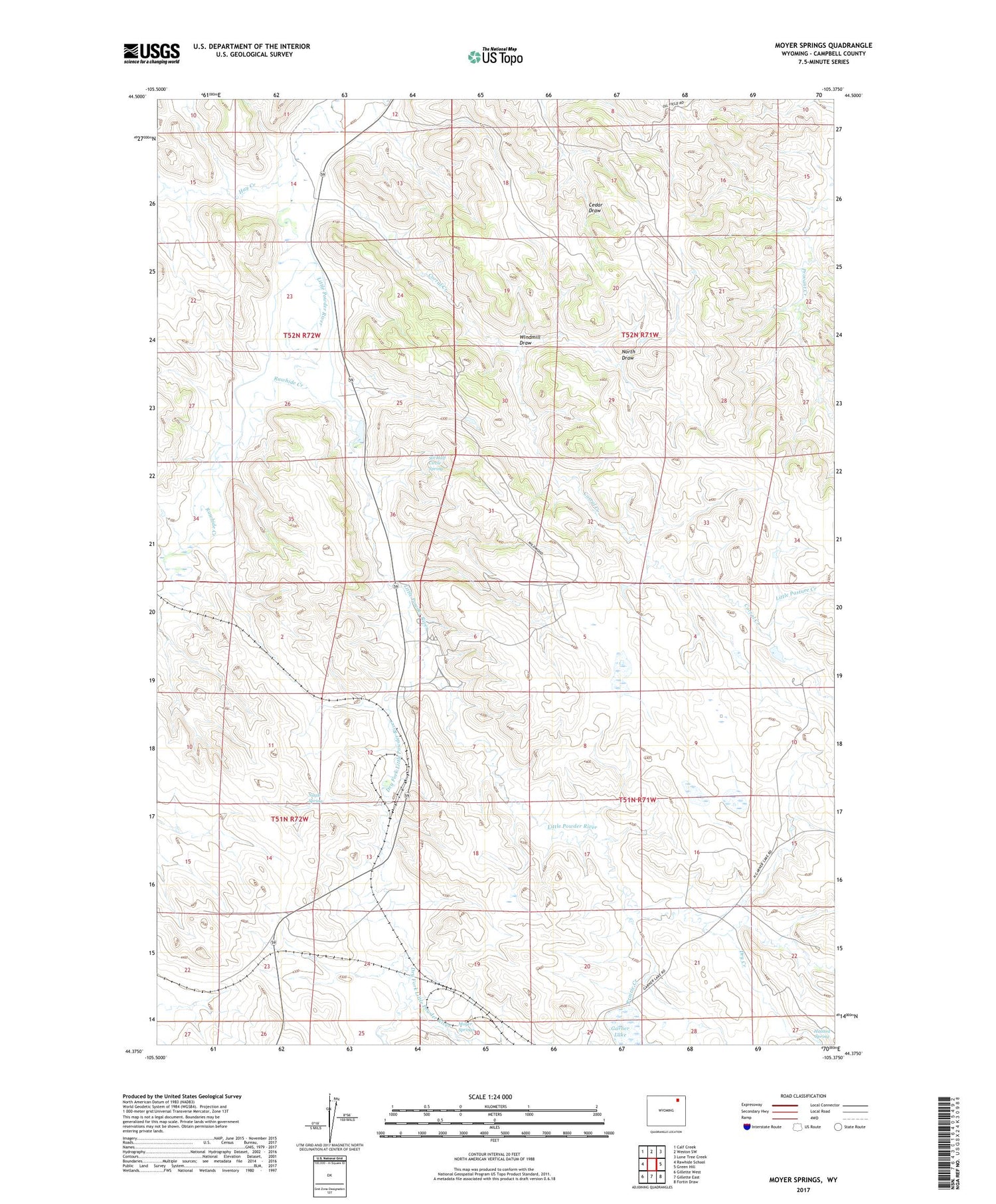
2021 topographic map quadrangle Moyer Springs in the state of Wyoming. Scale: 1:24000. Based on the newly updated USGS 7.5' US Topo map series, this map is in the following counties: Campbell. The map contains contour data, water features, and other items you are used to seeing on USGS maps, but also has updated roads and other features. This is the next generation of topographic maps. Printed on high-quality waterproof paper with UV fade-resistant inks.
Quads adjacent to this one:
West: Rawhide School
Northwest: Calf Creek
North: Weston SW
Northeast: Lone Tree Creek
East: Green Hill
Southeast: Fortin Draw
South: Gillette East
Southwest: Gillette West
Contains the following named places: Cook Dam, Cook Reservoir, Corral Creek, Dry Creek, Dry Fork Little Powder River, Elmore Mine, Garner Lake, Halsted Spring, Hay Creek, Little Pasture Creek, Moyer Mine, Moyer Springs, Nagle Spring, North Draw, North Fork Hay Creek, North Rawhide Mine, Prairie Creek, Raw Hide Dam, Rawhide Creek, Rawhide Dam, Rawhide Mine, Rawhide Mine Main Dam, Rawhide Mine Main Reservoir, Rawhide Reservoir, Six Half Circle Spring, Wildwood Christian Retreat, Windmill Draw