MyTopo
Opal Wyoming US Topo Map
Couldn't load pickup availability
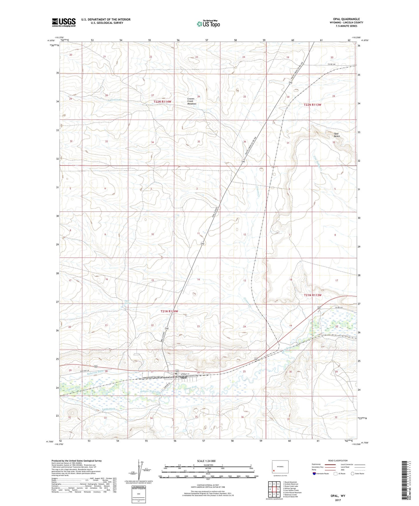
2021 topographic map quadrangle Opal in the state of Wyoming. Scale: 1:24000. Based on the newly updated USGS 7.5' US Topo map series, this map is in the following counties: Lincoln. The map contains contour data, water features, and other items you are used to seeing on USGS maps, but also has updated roads and other features. This is the next generation of topographic maps. Printed on high-quality waterproof paper with UV fade-resistant inks.
Quads adjacent to this one:
West: Willow Springs
Northwest: Round Mountain
North: Graham Reservoir
Northeast: Shute Creek Lake
East: Cow Hollow Creek
Southeast: Church Butte NW
South: Roberson Creek
Southwest: Little Round Mountain
Contains the following named places: Anderson Ditch, Craven Creek, Craven Creek Meadows, Kidman Well Canal, Opal, Opal Post Office, Opal Springs, Roberson Ditch, South Side Ditch, Town of Opal