MyTopo
Sugar Loaf NW Wyoming US Topo Map
Couldn't load pickup availability
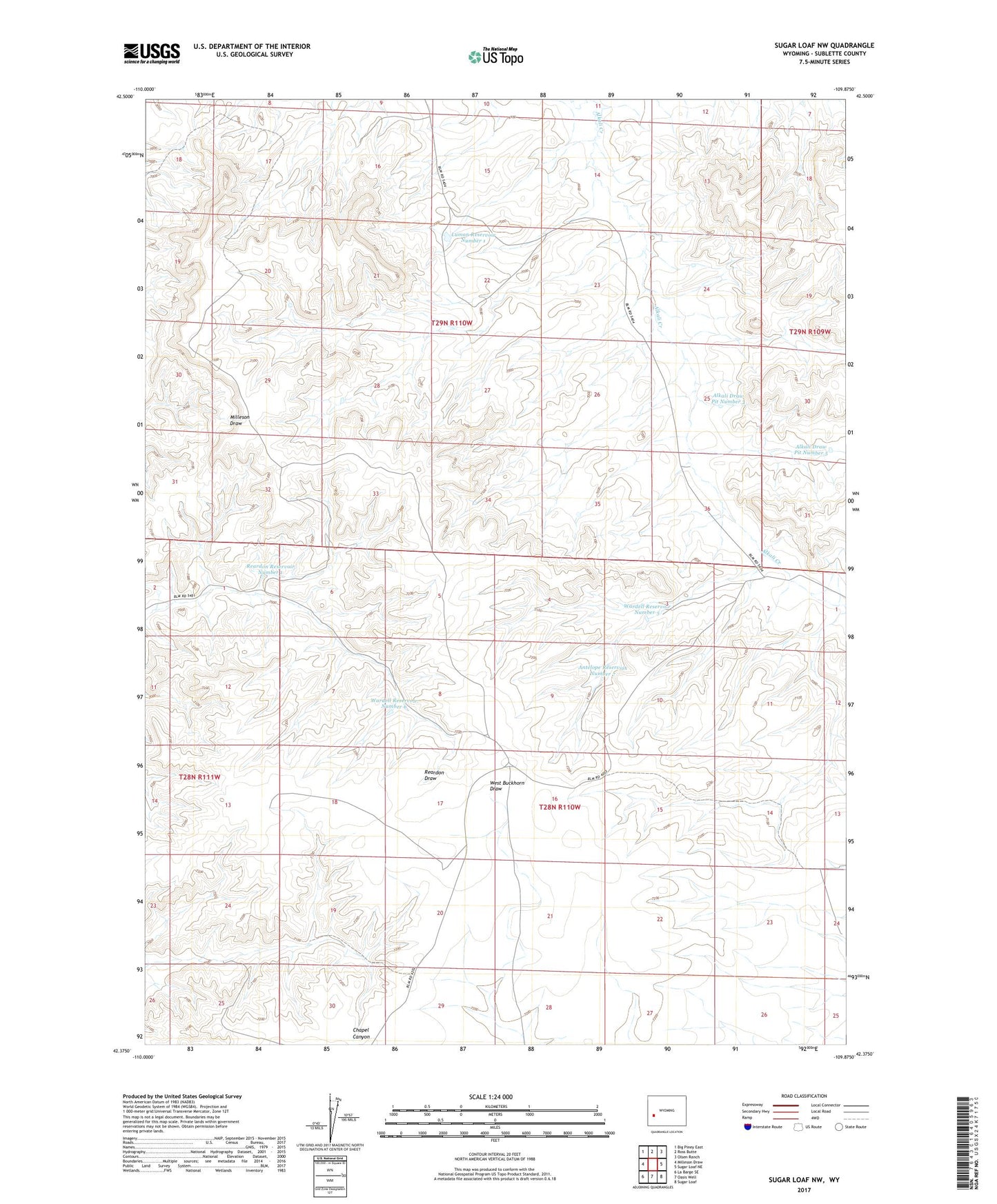
2021 topographic map quadrangle Sugar Loaf NW in the state of Wyoming. Scale: 1:24000. Based on the newly updated USGS 7.5' US Topo map series, this map is in the following counties: Sublette. The map contains contour data, water features, and other items you are used to seeing on USGS maps, but also has updated roads and other features. This is the next generation of topographic maps. Printed on high-quality waterproof paper with UV fade-resistant inks.
Quads adjacent to this one:
West: Milleson Draw
Northwest: Big Piney East
North: Ross Butte
Northeast: Olsen Ranch
East: Sugar Loaf NE
Southeast: Sugar Loaf
South: Oasis Well
Southwest: La Barge SE
Contains the following named places: Alkali Draw Pit Number 1, Alkali Draw Pit Number 2, Alkali Draw Pit Number 3, Alkali Draw Pit Number 4, Alkali Draw Pit Number 5, Antelope Reservoir Number 5, Antelope Reservoir Number 7, Chapel Canyon Pit, Luman Reservoir Number 1, Reardon Check Dam Number 4, Reardon Pit, Reardon Reservoir Number 1, Reardon Reservoir Number 2, Vital Reservoir, Wardell Reservoir Number 1, Wardell Reservoir Number 2, Wardell Reservoir Number 3, Wardell Reservoir Number 5, Wardell Reservoir Number 6, Wardell Reservoir Number 7