MyTopo
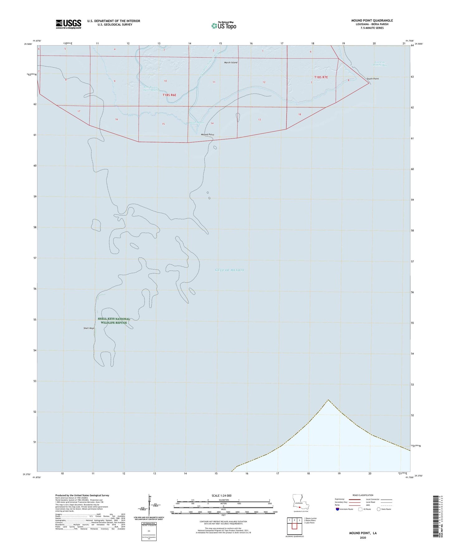
Mound Point Louisiana US Topo Map
Regular price
$16.95
Regular price
Sale price
$16.95
Unit price
per
Couldn't load pickup availability
2020 topographic map quadrangle Mound Point in the state of Louisiana. Scale: 1:24000. Based on the newly updated USGS 7.5' US Topo map series, this map is in the following counties: Iberia. The map contains contour data, water features, and other items you are used to seeing on USGS maps, but also has updated roads and other features. This is the next generation of topographic maps. Printed on high-quality waterproof paper with UV fade-resistant inks.
Quads adjacent to this one:
Northwest: Bayou Lucien
North: Bayou Blanc
Northeast: Lake Point
Contains the following named places: Mound Point, Oyster Bayou, Shell Keys, Shell Keys National Wildlife Refuge, South Point