MyTopo
Phoenix Louisiana US Topo Map
Couldn't load pickup availability
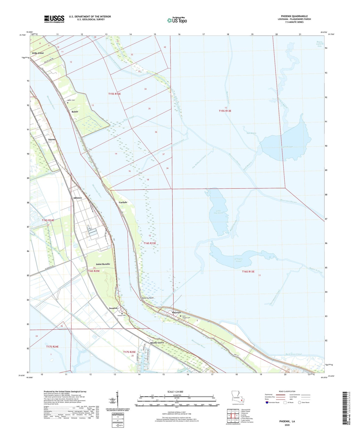
2020 topographic map quadrangle Phoenix in the state of Louisiana. Scale: 1:24000. Based on the newly updated USGS 7.5' US Topo map series, this map is in the following counties: Plaquemines. The map contains contour data, water features, and other items you are used to seeing on USGS maps, but also has updated roads and other features. This is the next generation of topographic maps. Printed on high-quality waterproof paper with UV fade-resistant inks.
Quads adjacent to this one:
West: Lafitte
Northwest: Bertrandville
North: Belle Chasse
Northeast: Delacroix
East: Lake Batola
Southeast: Pointe a la Hache
South: Lake Laurier
Southwest: Three Bayou Bay
Contains the following named places: Alliance, Alliance Revetment, Bayou Garelle, Beaumar Plantation, Belair, Belair Canal, Belair Cemetery, Burbridge, Burnbridge, Carlisle, Carlisle Post Office, Caskett Bayou, Fairview Canal, Fort De La Boulaye, Forty Arpent Canal, Harlem Revetment, Horsepower Canal, Ironton, Ironton Cemetery, Jim Williams Canal, Joe Gravolet Canal, La Reussite, Little Oak Pond, Lorez Canal, Monsecour, Monsecour Revetment, Myrtle Grove, Myrtle Grove Revetment, Naomi, Phoenix, Phoenix Gas Field, Phoenix High School, Plaquemines Parish Sheriff's Office, Poverty Point, Reussite, Riverbend Nursing and Rehabilitation Center, Saint John Church, Saint Joseph Church, Saint Pauls Baptist Church, Saint Rosalie, Schayots Canal, Shell Bayou, Spanish Lake, Spanish Lake Gas Field, Spanish Lake Oil Field, Star Spur, Sun Bayou, Timber Canal, ZIP Code: 70040