MyTopo
Delacroix Louisiana US Topo Map
Couldn't load pickup availability
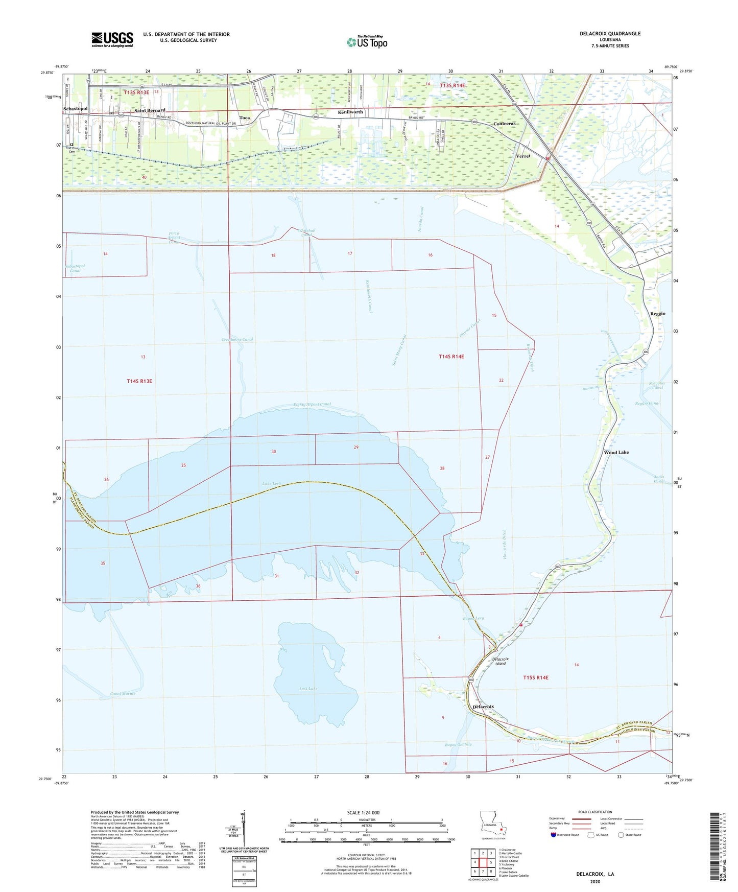
2024 topographic map quadrangle Delacroix in the state of Louisiana. Scale: 1:24000. Based on the newly updated USGS 7.5' US Topo map series, this map is in the following counties: St. Bernard, Plaquemines. The map contains contour data, water features, and other items you are used to seeing on USGS maps, but also has updated roads and other features. This is the next generation of topographic maps. Printed on high-quality waterproof paper with UV fade-resistant inks.
Quads adjacent to this one:
West: Belle Chasse
Northwest: Chalmette
North: Martello Castle
Northeast: Proctor Point
East: Yscloskey
Southeast: Lake Cuatro Caballo
South: Lake Batola
Southwest: Phoenix
This map covers the same area as the classic USGS quad with code o29089g7.
Contains the following named places: Bayou Gentilly Gas Field, Bayou Lery, Canal Marine, Contreras, Creedmore Canal, Creedmore Church, Delacroix, Delacroix Census Designated Place, Delacroix Island, Ducros Museum, Eighty Arpent Canal, Fanz Mobile Home Park, Howards Ditch, J F Gauthier Elementary School, Jacks Canal, Jourda Canal, Kenilworth, Kenilworth Canal, KQLD-FM (Port Sulphur), Lake Lery, Lake Lery Gas Field, Lost Lake, Magnolia Canal, New Canal, Olivier Canal, P G T Beauregard Middle School, Reggio, Saint Bernard, Saint Bernard Catholic Church, Saint Bernard Middle School, Saint Bernard Parish Fire Department Station 10, Saint Bernard Parish Fire Department Station 12, Saint Bernard Parish Library Ducros Museum Branch, Saint Bernard Post Office, Saint Mary Canal, Sebastopol, Sebastopol Canal, Sideline Mobile Home Park, Southern Natural Gas Company Heliport, Third Missionary Baptist Church, Toca, True Love Cemetery, Verret, Ward K, Whitehall Canal, Wood Lake