MyTopo
Redhead Branch Louisiana US Topo Map
Couldn't load pickup availability
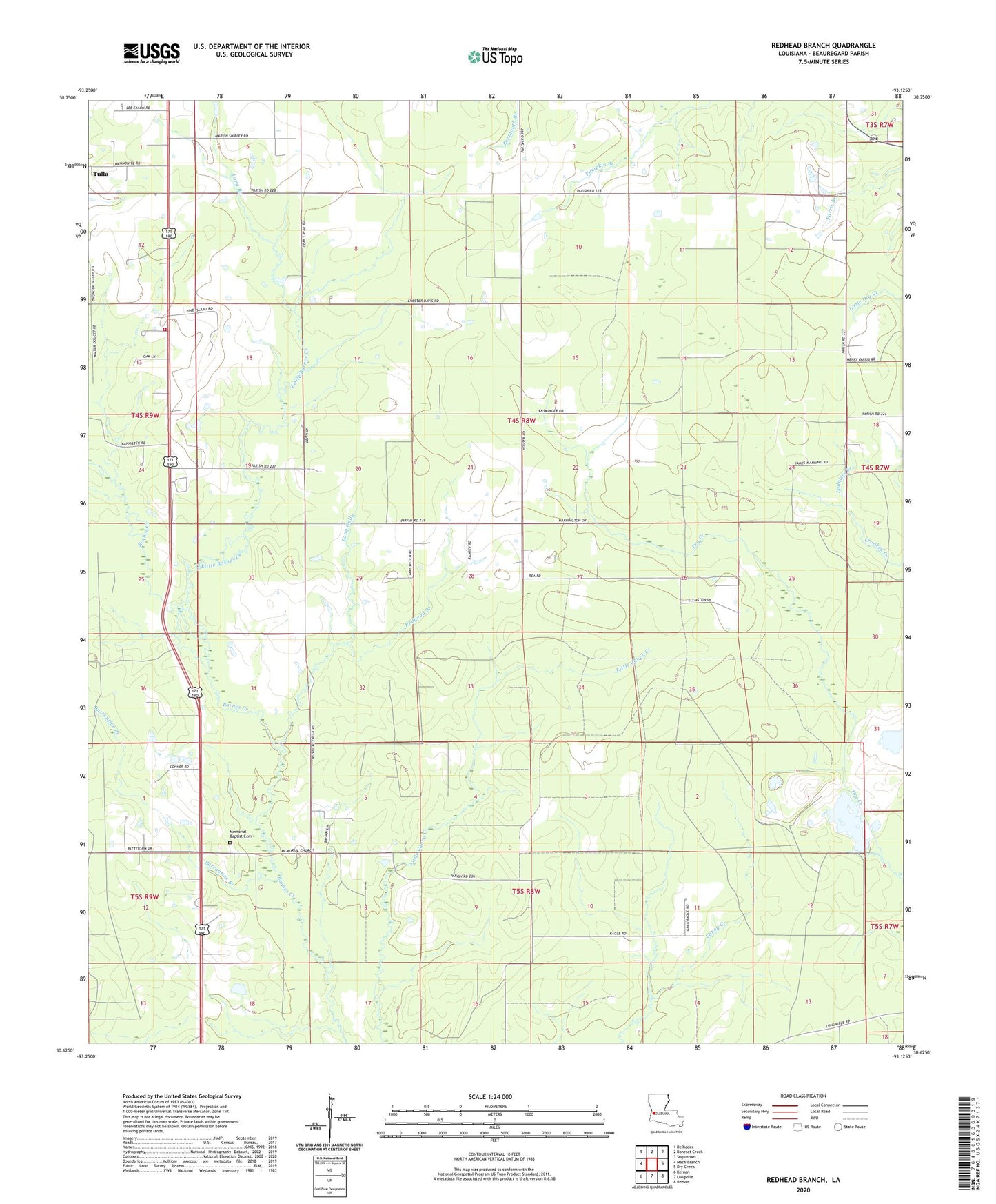
2020 topographic map quadrangle Redhead Branch in the state of Louisiana. Scale: 1:24000. Based on the newly updated USGS 7.5' US Topo map series, this map is in the following counties: Beauregard. The map contains contour data, water features, and other items you are used to seeing on USGS maps, but also has updated roads and other features. This is the next generation of topographic maps. Printed on high-quality waterproof paper with UV fade-resistant inks.
Quads adjacent to this one:
West: Mach Branch
Northwest: DeRidder
North: Boneset Creek
Northeast: Sugartown
East: Dry Creek
Southeast: Reeves
South: Longville
Southwest: Kernan
Contains the following named places: Bannister, Barrantine Branch, Beauregard Memorial Baptist Church, Beauregard Volunteer Fire Protection District 2 Broadlands Station, Broadlands Bible Church, Camp Delta, Caney Creek Oil Field, East Caney Creek Oil and Gas Field, East Tulla Gas Field, Evergreen Mobile Home Park, Insco, Ladniers Branch, Little Barnes Creek, Little Barnes Creek Gas Field, Long Branch, Long Gully, Longville Lookout Tower, Memorial Baptist Cemetery, Memorial Baptist Church, Parish Governing Authority District 4B, Redhead Branch, Sweetville, Ward Four