MyTopo
Sugartown Louisiana US Topo Map
Couldn't load pickup availability
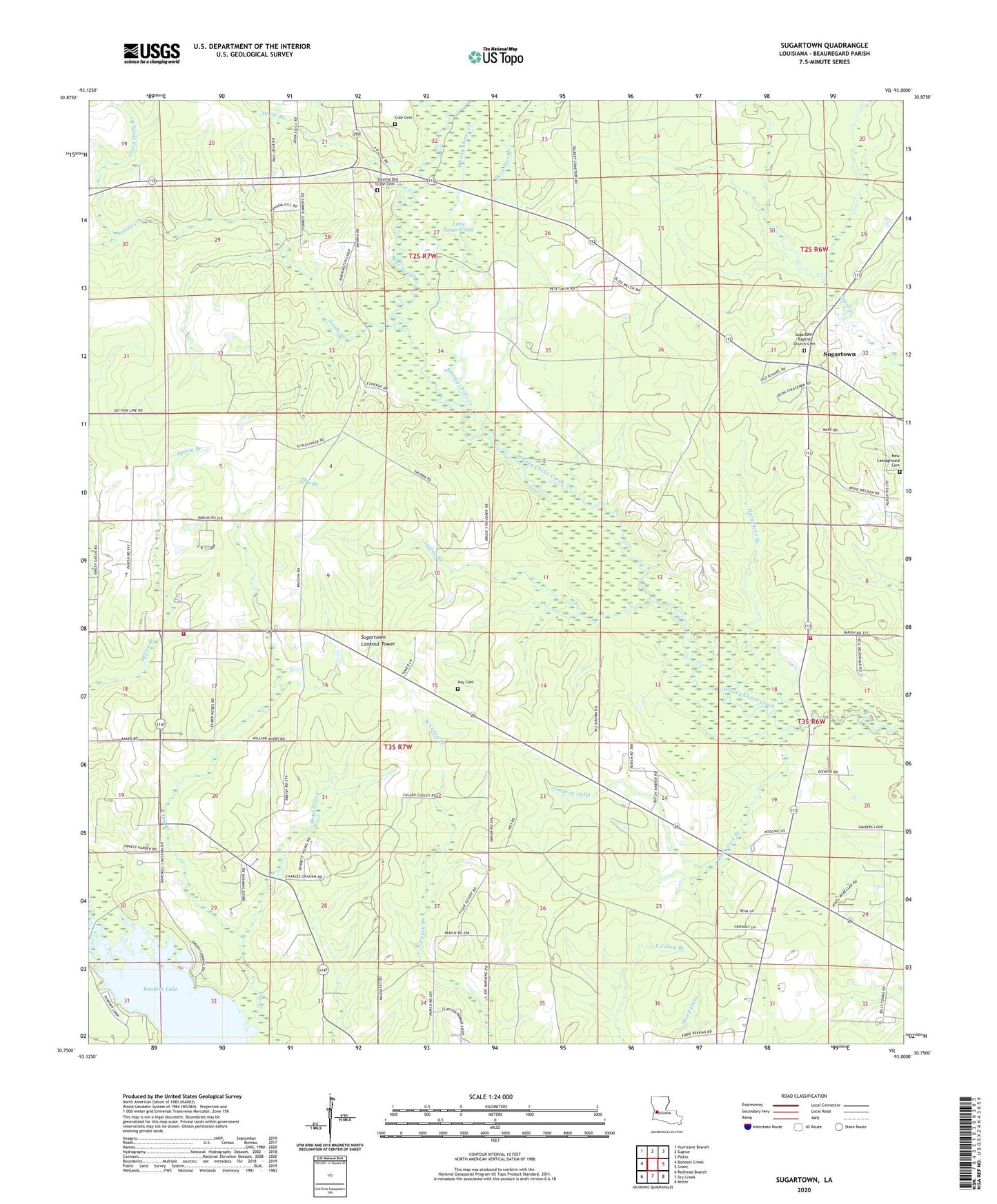
2024 topographic map quadrangle Sugartown in the state of Louisiana. Scale: 1:24000. Based on the newly updated USGS 7.5' US Topo map series, this map is in the following counties: Beauregard. The map contains contour data, water features, and other items you are used to seeing on USGS maps, but also has updated roads and other features. This is the next generation of topographic maps. Printed on high-quality waterproof paper with UV fade-resistant inks.
Quads adjacent to this one:
West: Boneset Creek
Northwest: Hurricane Branch
North: Sugrue
Northeast: Pitkin
East: Grant
Southeast: Mittie
South: Dry Creek
Southwest: Redhead Branch
This map covers the same area as the classic USGS quad with code o30093g1.
Contains the following named places: Baggett, Bear Slough, Beauregard Parish Library East Beauregard Branch, Beauregard Volunteer Fire Protection District 3 Kipling Station, Beauregard Volunteer Fire Protection District 3 Sugartown Station, Black Jack Branch, Cole Cemetery, Deep Slough, Green Holly Branch, Hargroves Branch, Horse Branch, Hoy, Hoy Cemetery, Indian Branch, Jumping Gully, Kipling, Little Sugar Creek, New Campground Cemetery, Sandy Creek, Short Prong, Smyrna Baptist Church, Smyrna Old Cole Cemetery, Spring Branch, Spring Creek Baptist Church, Sugartown, Sugartown Baptist Church, Sugartown Baptist Church Cemetery, Sugartown Census Designated Place, Sugartown Lookout Tower, Sugartown Male and Female Academy, Sugartown Pentecostal Church, Sugartown Post Office, Sugartown School, Ward Seven