
MyTopo
Saline Louisiana US Topo Map
Couldn't load pickup availability
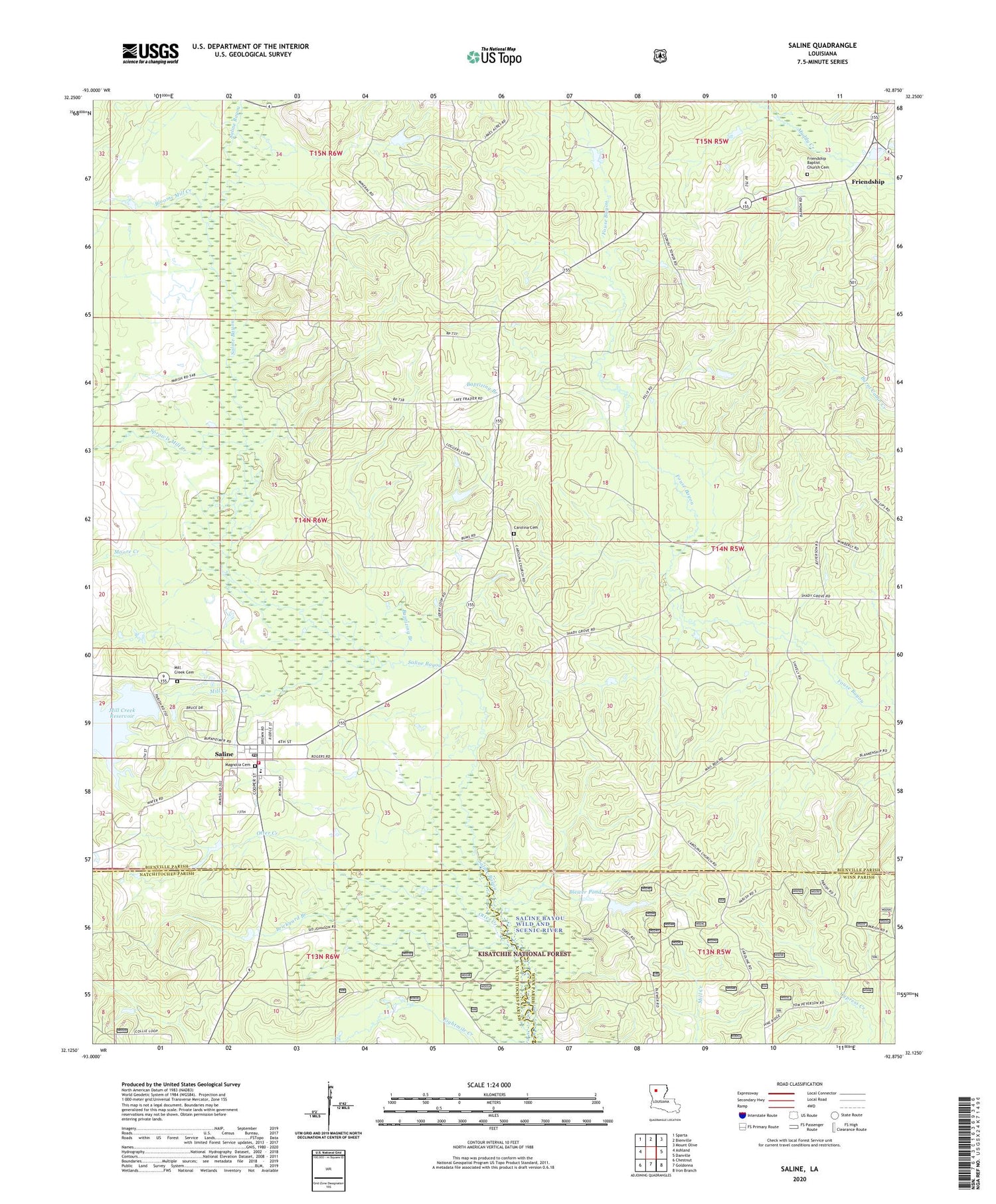
2020 topographic map quadrangle Saline in the state of Louisiana. Scale: 1:24000. Based on the newly updated USGS 7.5' US Topo map series, this map is in the following counties: Bienville, Natchitoches, Winn. The map contains contour data, water features, and other items you are used to seeing on USGS maps, but also has updated roads and other features. This is the next generation of topographic maps. Printed on high-quality waterproof paper with UV fade-resistant inks.
Quads adjacent to this one:
West: Ashland
Northwest: Sparta
North: Bienville
Northeast: Mount Olive
East: Danville
Southeast: Iron Branch
South: Goldonna
Southwest: Chestnut
Contains the following named places: Baptizing Branch, Bienville Parish Fire Protection Ward 7 Station 1 Saline, Bienville Parish Fire Protection Ward 7 Station 3 Friendship, Blewer Pond, Blewer Pond Dam, Blooms Mill Creek, Brickyard Branch, Carolina, Carolina Church, Friendship, Friendship Baptist Church, Harpes Spur, Mill Creek, Mill Creek Cemetery, Mill Creek Church, Mill Creek Dam, Mill Creek Reservoir, Moore Creek, Morning Star Church, Newman, Otter Creek, Saline, Saline Gas Field, Saline High School, Sprawls Mill Creek, Village of Saline, Ward Seven


