MyTopo
Bienville Louisiana US Topo Map
Couldn't load pickup availability
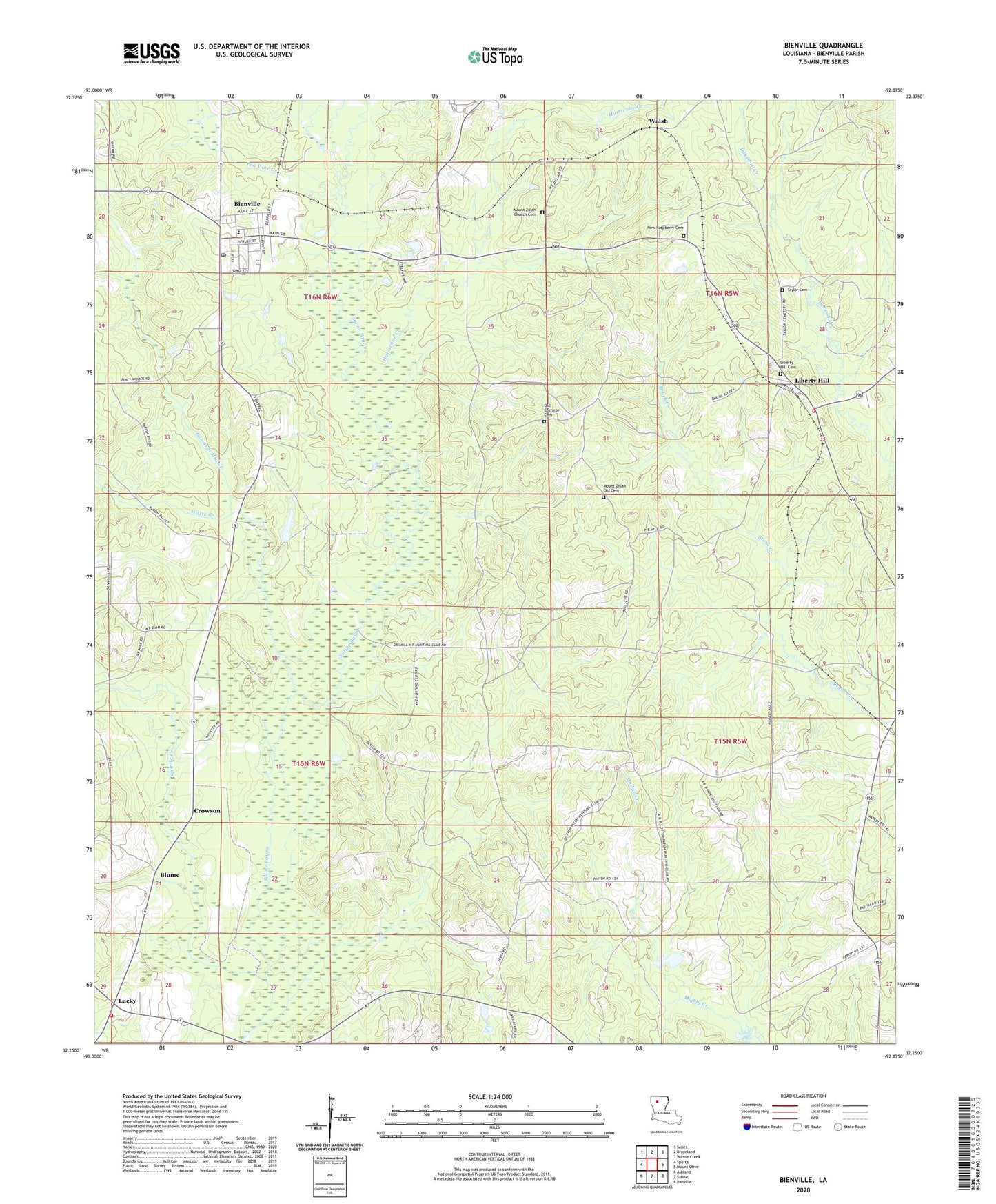
2024 topographic map quadrangle Bienville in the state of Louisiana. Scale: 1:24000. Based on the newly updated USGS 7.5' US Topo map series, this map is in the following counties: Bienville. The map contains contour data, water features, and other items you are used to seeing on USGS maps, but also has updated roads and other features. This is the next generation of topographic maps. Printed on high-quality waterproof paper with UV fade-resistant inks.
Quads adjacent to this one:
West: Sparta
Northwest: Sailes
North: Bryceland
Northeast: Wilson Creek
East: Mount Olive
Southeast: Danville
South: Saline
Southwest: Ashland
This map covers the same area as the classic USGS quad with code o32092c8.
Contains the following named places: Bienville, Bienville Educational Center School, Bienville Parish Fire Protection Ward 7 Station 4 Lucky, Bienville Parish Fire Protection Ward 7 Station 8 Liberty Hill, Bienville School, Blume, Continental Lake Dam, Cox Crossing, Crowson, Edwards Mill Creek, Elijah Church, Hurricane Creek, Liberty Hill, Liberty Hill Cemetery, Liberty Hill Gas Field, Liberty Hill Missionary Baptist Church, Lucky, Mount Villa Church, New Raspberry Cemetery, Old Liberty Hill Cemetery, Parish Governing Authority District 7, Pea Vine Creek, Price School, Sixmile Creek, Taylor Cemetery, Village of Bienville, Village of Lucky, Walsh, Watts Branch, ZIP Code: 71008