MyTopo
Singer Louisiana US Topo Map
Couldn't load pickup availability
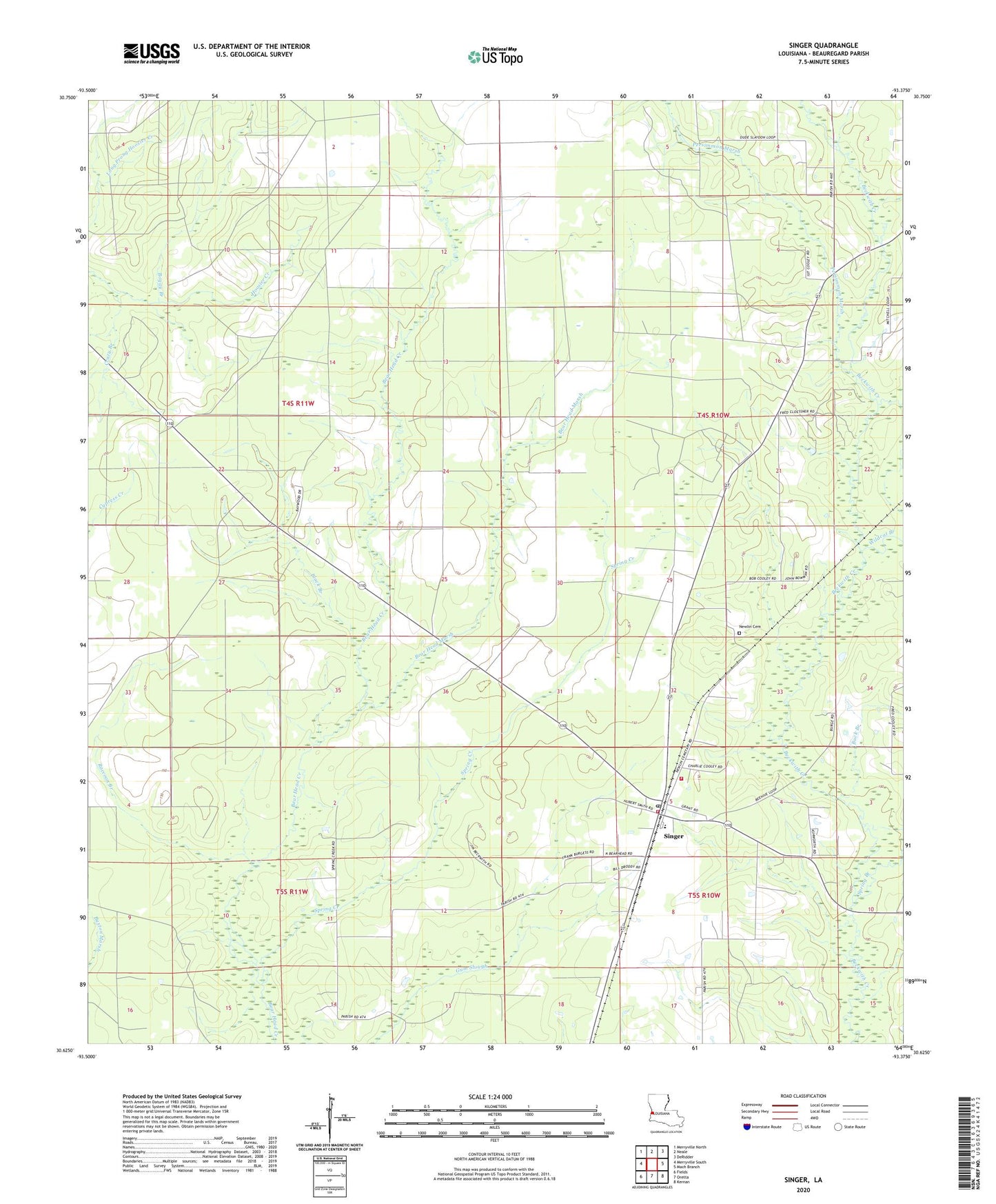
2020 topographic map quadrangle Singer in the state of Louisiana. Scale: 1:24000. Based on the newly updated USGS 7.5' US Topo map series, this map is in the following counties: Beauregard. The map contains contour data, water features, and other items you are used to seeing on USGS maps, but also has updated roads and other features. This is the next generation of topographic maps. Printed on high-quality waterproof paper with UV fade-resistant inks.
Quads adjacent to this one:
West: Merryville South
Northwest: Merryville North
North: Neale
Northeast: DeRidder
East: Mach Branch
Southeast: Kernan
South: Oretta
Southwest: Fields
Contains the following named places: Bear Head Marsh, Beauregard Parish Fire Protection District 1, Beauregard Parish Library Singer South Central Branch, Beckwith Baptist Church, Beehive Congregational Methodist Church, Black Branch, Black Branch Oil Field, Boggy Branch, Buck Branch, Cowpen Creek, Crazy Branch, Holly Grove Church, Louisiana Noname 74 Dam, Newlin, Newlin Cemetery, North Singer Oil Field, Persimmon Marsh, Raccoon Branch, Singer, Singer Baptist Church, Singer Census Designated Place, Singer High School, Singer Pentecostal Church, Singer Post Office, Singer Volunteer Fire Department Beauregard Fire District 1, Spring Branch, Spring Creek, Ward Five, West Juanita Oil Field, Wildcat Branch, Zion Church