MyTopo
Neale Louisiana US Topo Map
Couldn't load pickup availability
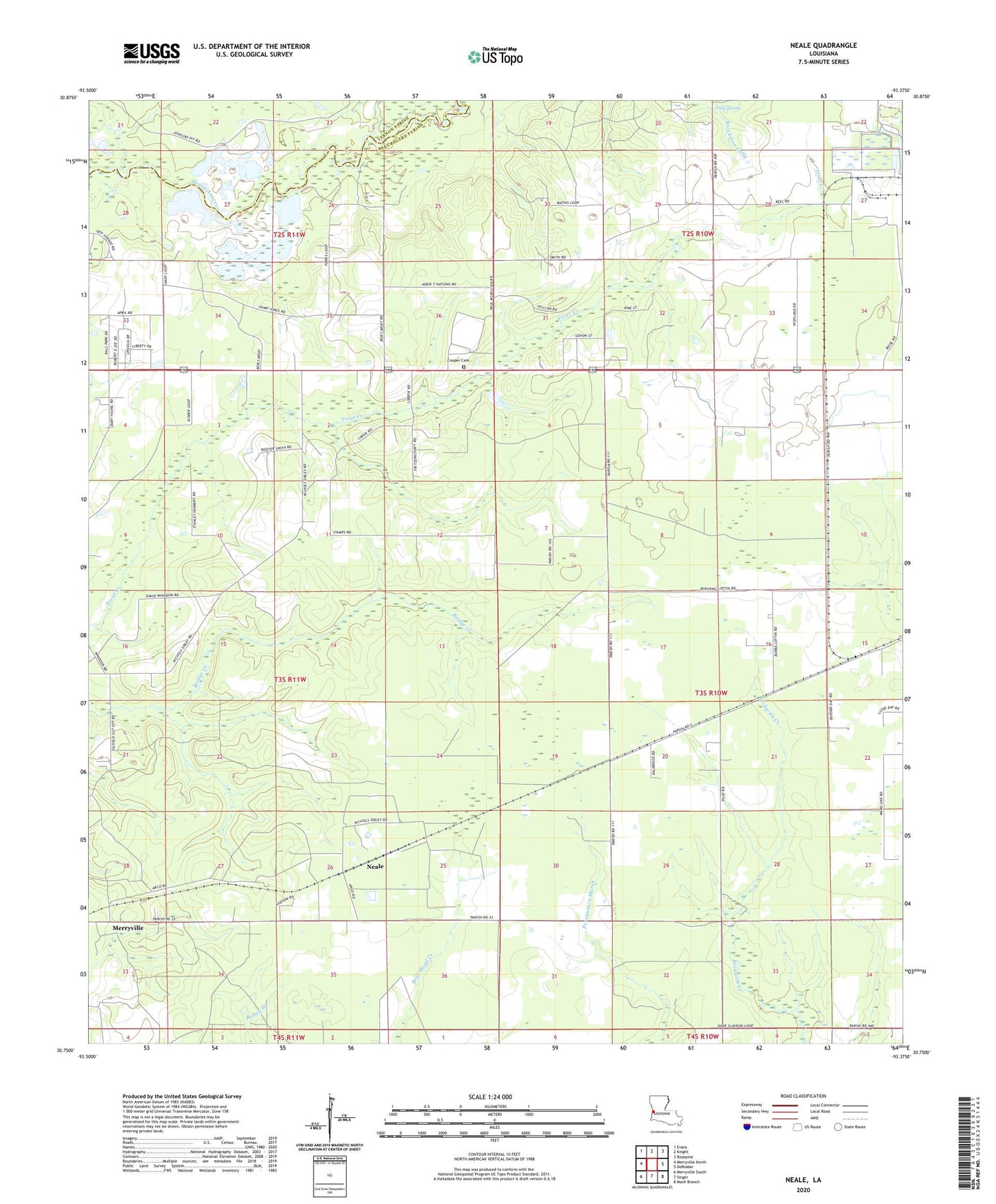
2024 topographic map quadrangle Neale in the state of Louisiana. Scale: 1:24000. Based on the newly updated USGS 7.5' US Topo map series, this map is in the following counties: Beauregard, Vernon. The map contains contour data, water features, and other items you are used to seeing on USGS maps, but also has updated roads and other features. This is the next generation of topographic maps. Printed on high-quality waterproof paper with UV fade-resistant inks.
Quads adjacent to this one:
West: Merryville North
Northwest: Evans
North: Knight
Northeast: Rosepine
East: DeRidder
Southeast: Mach Branch
South: Singer
Southwest: Merryville South
This map covers the same area as the classic USGS quad with code o30093g4.
Contains the following named places: Anacoco School, Cooper Cemetery, Cooper Church, East Neale Gas Field, Louisiana Noname 102 Dam, Louisiana Noname 65 Dam, Mathis School, Neale, Neale Oil Field, Pujo, Pujo Volunteer Fire Department District 1, Tilly Spring