MyTopo
Stonewall Louisiana US Topo Map
Couldn't load pickup availability
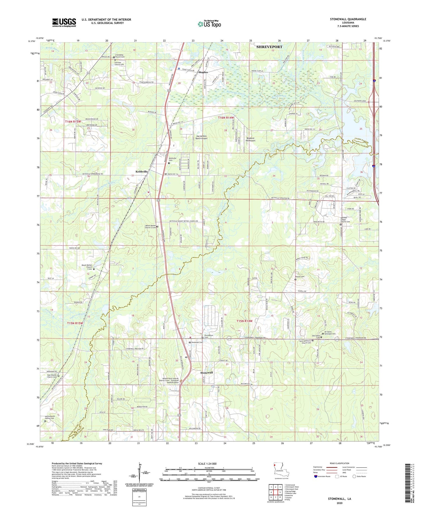
2020 topographic map quadrangle Stonewall in the state of Louisiana. Scale: 1:24000. Based on the newly updated USGS 7.5' US Topo map series, this map is in the following counties: Caddo, De Soto. The map contains contour data, water features, and other items you are used to seeing on USGS maps, but also has updated roads and other features. This is the next generation of topographic maps. Printed on high-quality waterproof paper with UV fade-resistant inks.
Quads adjacent to this one:
West: Spring Ridge
Northwest: Greenwood
North: Shreveport West
Northeast: Shreveport East
East: Wallace Lake
Southeast: Holly
South: Gloster
Southwest: Keatchie
Contains the following named places: Bluebird Hill Airport, Boggy Bayou, Brush Bayou, Buchanan Bayou, Bungalo, Caddo Parish Fire District Number 6 - Central Station, Caddo Parish Sheriff's Office, Caspiana Gas Field, Cypress Bayou, Davis Pond Dam, De Soto Fire District 3, East Mission Church, Fairview School, Foster Creek, Hall Grove School, Johnson Branch, Keatchie Bayou, Keithville, Keithville Elementary Middle School, Keithville Post Office, Louisiana State University School of Medicine Laboratory, Marshall Chapel, Mount Bethel Church, Old Hickory Ranch Airport, Parish Governing Authority District 2, Powell Cemetery, Providence Church, Saint Matthews Church, Staples, Stonewall, Stonewall Hospital, Town of Stonewall, Ward Two, ZIP Code: 71078