MyTopo
Greenwood Louisiana US Topo Map
Couldn't load pickup availability
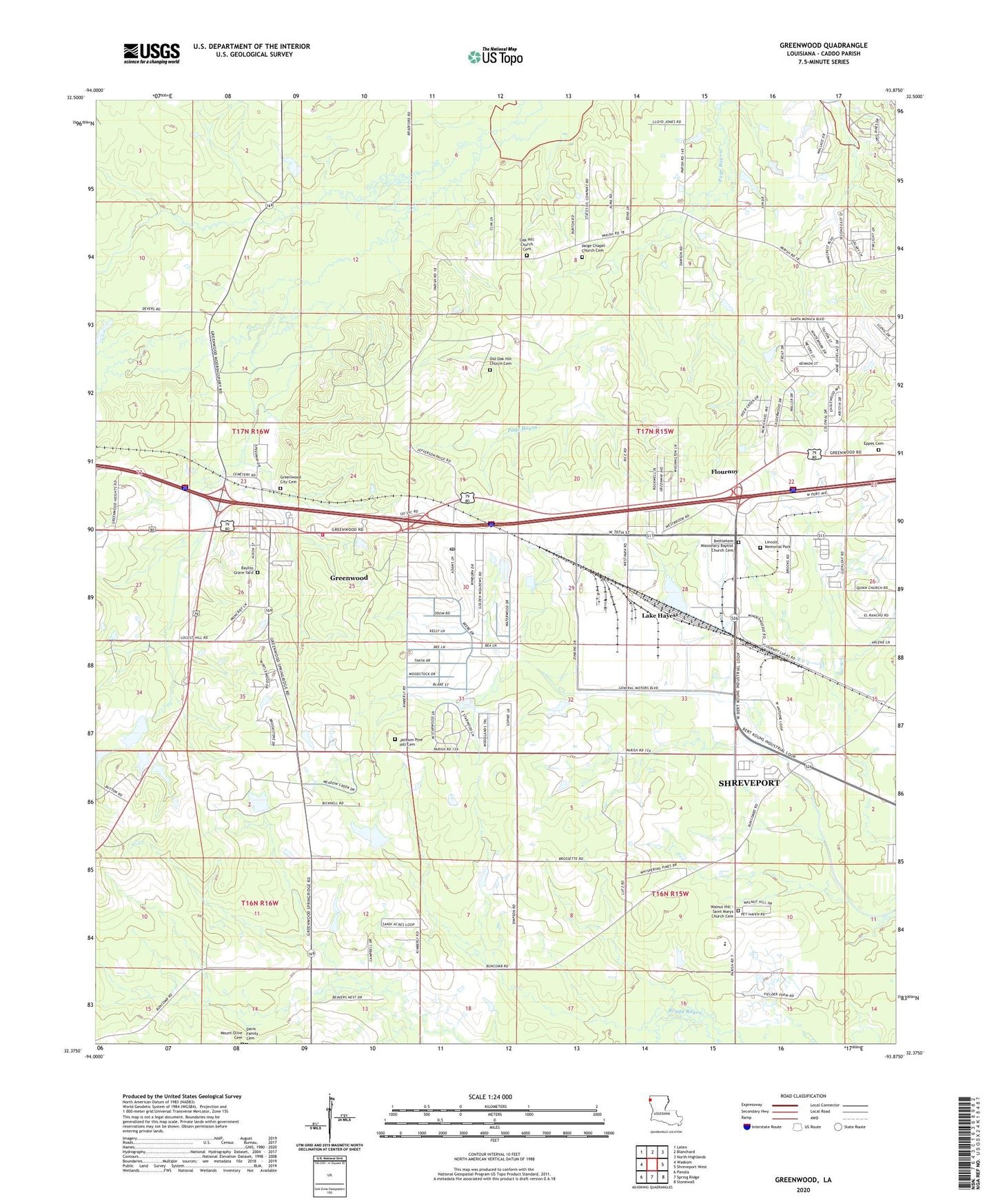
2024 topographic map quadrangle Greenwood in the state of Louisiana. Scale: 1:24000. Based on the newly updated USGS 7.5' US Topo map series, this map is in the following counties: Caddo. The map contains contour data, water features, and other items you are used to seeing on USGS maps, but also has updated roads and other features. This is the next generation of topographic maps. Printed on high-quality waterproof paper with UV fade-resistant inks.
Quads adjacent to this one:
West: Waskom
Northwest: Latex
North: Blanchard
Northeast: North Highlands
East: Shreveport West
Southeast: Stonewall
South: Spring Ridge
Southwest: Panola
This map covers the same area as the classic USGS quad with code o32093d8.
Contains the following named places: Antoine Industrial Park, Caddo Parish Fire District 3, Caddo Parish Penal Farm, Caddo-Shreveport Industrial Park, Center Pine School, Deer Creek Estates, Expressway Acres, First Baptist Church of Greenwood, First United Pentecostal Church of Greenwood, Flournoy, Greenwood, Greenwood Gas and Oil Field, Greenwood Hills, Greenwood Industrial Park, Greenwood Lookout Tower, Greenwood Police Department, Greenwood Post Office, Greenwood School, Greenwood United Methodist Church, Home Union School, Lake Hayes, Lincoln Memorial Park, Long Sycamore School, Meadow Creek Estates, Mount Olive Cemetery, Page Church, Parish Governing Authority District 12, Shreveport Fire Department Station 12, Timberlane, Town of Greenwood, Twilight Meadows, Walnut Hill Elementary / Middle School, Ward Five, Waterwood Estates, ZIP Codes: 71119, 71129