MyTopo
Bowdoinham Maine US Topo Map
Couldn't load pickup availability
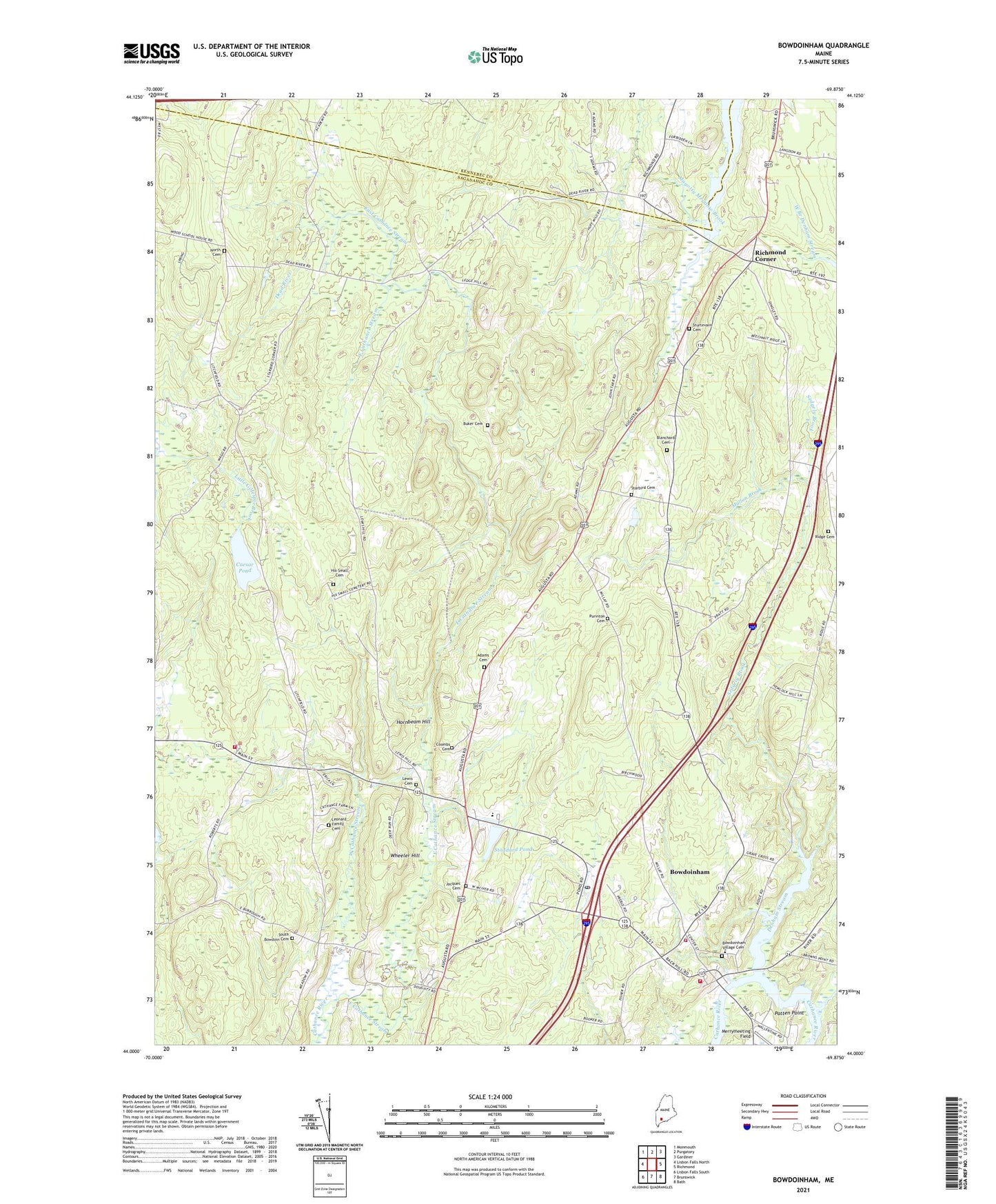
2021 topographic map quadrangle Bowdoinham in the state of Maine. Scale: 1:24000. Based on the newly updated USGS 7.5' US Topo map series, this map is in the following counties: Sagadahoc, Kennebec. The map contains contour data, water features, and other items you are used to seeing on USGS maps, but also has updated roads and other features. This is the next generation of topographic maps. Printed on high-quality waterproof paper with UV fade-resistant inks.
Quads adjacent to this one:
West: Lisbon Falls North
Northwest: Monmouth
North: Purgatory
Northeast: Gardiner
East: Richmond
Southeast: Bath
South: Brunswick
Southwest: Lisbon Falls South
Contains the following named places: Adams Cemetery, Bar B Campground Pond Dam, Blanchard Cemetery, Bowdoin Center, Bowdoin Central School, Bowdoin Fire and Rescue Department, Bowdoin School, Bowdoinham, Bowdoinham Census Designated Place, Bowdoinham Community School, Bowdoinham Fire and Rescue Department, Bowdoinham Fire Department, Bowdoinham Post Office, Bowdoinham Public Library, Bowdoinham Ridge, Bowdoinham Village Cemetery, Buker Cemetery, Caesar Pond, Coombs Cemetery, Dead River, East Cathance Stream, Hix Small Cemetery, Hornbeam Hill, Jacques Cemetery, Jaques School, Leonard Family Cemetery, Lewis Cemetery, Magotty Meadow Brook, Mallon Brook, Meacham Pond, Merrymeeting Field, North Cemetery, Patten Point, Purinton Cemetery, Richmond Corner, Ridge Cemetery, Second Baptist Church, Sedgely Brook, South Bowdoin Cemetery, Starbird Cemetery, Starbird Corner, Stoddard Pond, Sturtevant Cemetery, Town of Bowdoin, Varney Corner, WBCI-FM (Bath), West Branch Denham Stream, West Cathance Stream, Wheeler Hill, ZIP Code: 04287