MyTopo
Doubletop Mountain Maine US Topo Map
Couldn't load pickup availability
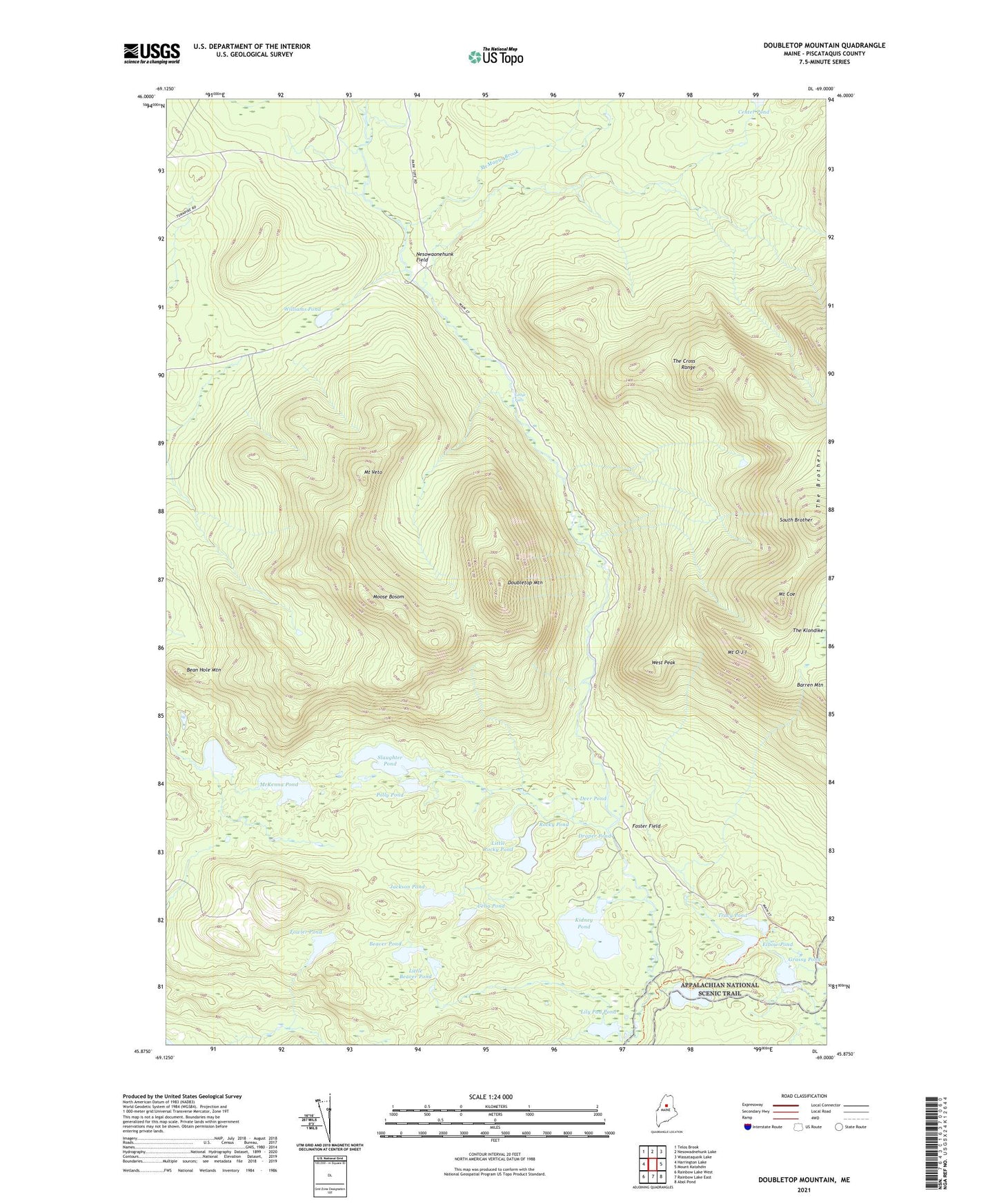
2021 topographic map quadrangle Doubletop Mountain in the state of Maine. Scale: 1:24000. Based on the newly updated USGS 7.5' US Topo map series, this map is in the following counties: Piscataquis. The map contains contour data, water features, and other items you are used to seeing on USGS maps, but also has updated roads and other features. This is the next generation of topographic maps. Printed on high-quality waterproof paper with UV fade-resistant inks.
Quads adjacent to this one:
West: Harrington Lake
Northwest: Telos Brook
North: Nesowadnehunk Lake
Northeast: Wassataquoik Lake
East: Mount Katahdin
Southeast: Abol Pond
South: Rainbow Lake East
Southwest: Rainbow Lake West
Contains the following named places: Bean Hole Mountain, Beaver Pond, Celia Pond, Daicey Pond, Deer Pond, Doubletop Mountain, Draper Pond, Elbow Pond, Foster Field, Fowler Pond, Grassy Pond, Harrington Pond, Jackson Pond, Kidney Pond, Ledge Falls, Lily Pad Pond, Little Beaver Pond, Little Nesowadnehunk Stream, Little Rocky Pond, McKenna Pond, McManus Brook, Moose Bosom, Mount Coe, Mount O-J-I, Mount Veto, Nesowadnehunk Field Camp, Nesowaonehunk Field, Polly Pond, Roaring Brook, Rocky Pond, Slaughter Brook, Slaughter Pond, Slide Dam, South Brother, T3 R10 WELS, T4 R10 WELS, The Cross Range, Tracy Pond, Unorganized Territory of Northeast Piscataquis, West Peak, Williams Pond, ZIP Code: 04462