MyTopo
Nesowadnehunk Lake Maine US Topo Map
Couldn't load pickup availability
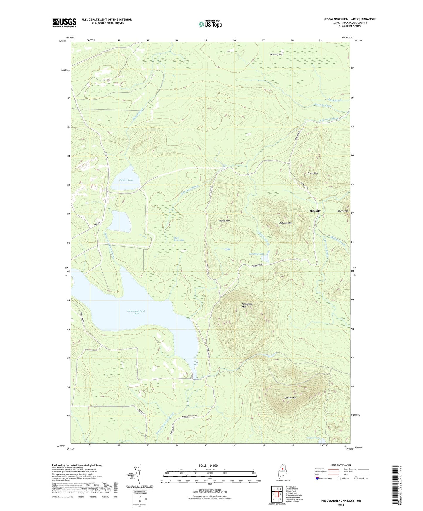
2024 topographic map quadrangle Nesowadnehunk Lake in the state of Maine. Scale: 1:24000. Based on the newly updated USGS 7.5' US Topo map series, this map is in the following counties: Piscataquis. The map contains contour data, water features, and other items you are used to seeing on USGS maps, but also has updated roads and other features. This is the next generation of topographic maps. Printed on high-quality waterproof paper with UV fade-resistant inks.
Quads adjacent to this one:
West: Telos Brook
Northwest: Telos Lake
North: Webster Lake
Northeast: Frost Pond
East: Wassataquoik Lake
Southeast: Mount Katahdin
South: Doubletop Mountain
Southwest: Harrington Lake
This map covers the same area as the classic USGS quad with code o46069a1.
Contains the following named places: Black Brook, Black Spruce Bog, Burnt Mountain, Burnt Mountain Lookout Tower, Camp Phoenix, Center Mountain, Center Pond, Dwelley Brook, Dwelley Pond, Hathorn Brook, Kennedy Bog, Little Nesowadnehunk Lake, McCarty, McCarty Mountain, Morse Mountain, Nesourdnahunk Township, Nesowadnehunk Dam, Nesowadnehunk Lake, Strickland Mountain, Thissell Pond