MyTopo
Minot Maine US Topo Map
Couldn't load pickup availability
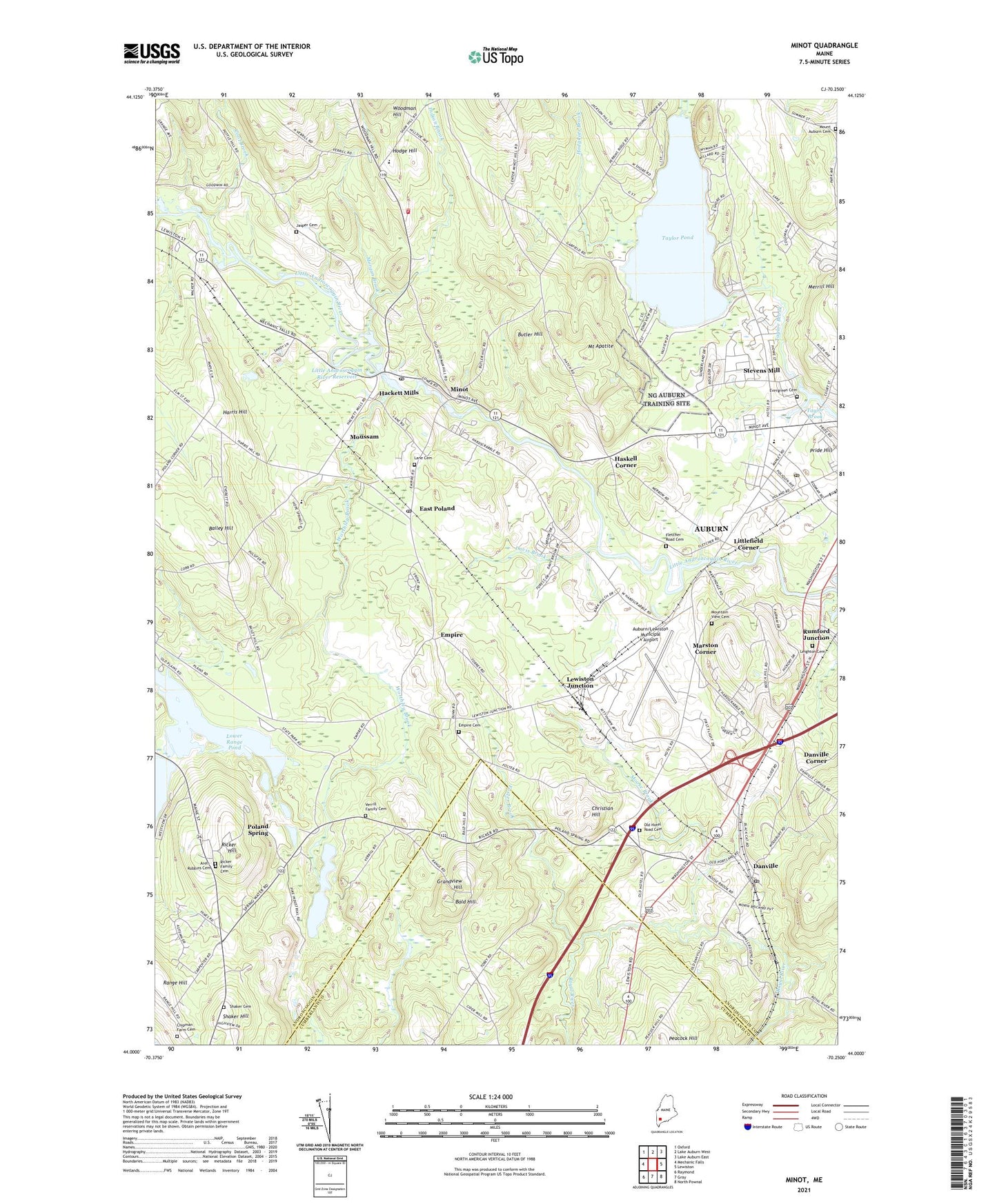
2021 topographic map quadrangle Minot in the state of Maine. Scale: 1:24000. Based on the newly updated USGS 7.5' US Topo map series, this map is in the following counties: Androscoggin, Cumberland. The map contains contour data, water features, and other items you are used to seeing on USGS maps, but also has updated roads and other features. This is the next generation of topographic maps. Printed on high-quality waterproof paper with UV fade-resistant inks.
Quads adjacent to this one:
West: Mechanic Falls
Northwest: Oxford
North: Lake Auburn West
Northeast: Lake Auburn East
East: Lewiston
Southeast: North Pownal
South: Gray
Southwest: Raymond
Contains the following named places: Advent Church, All Souls Chapel, Arel - Robbins Cemetery, Auburn Business Park, Auburn Drive-In, Auburn Middle School, Auburn Post Office, Auburn/Lewiston Municipal Airport, Auburn-Lewiston Airpark Industrial Park, Bailey Hill, Bald Hill, Bog Brook, Butler Hill, Chipman Farm Cemetery, Christian Hill, Cool Brook, Danville, Danville Corner, Davis Brook, East Poland, Empire, Empire Cemetery, Empire Grove Campground, Empire Grove Church, Evergreen Cemetery, Fletcher Road Cemetery, Foster Brook, Grace Lutheran Church, Grandview Hill, Hackett Mills, Hackett Mills Dam, Harris Hill, Haskell Corner, Hodge Hill, Hodgkins Brook, Indian Brook, Jasper Cemetery, Kittyhawk Industrial Park, Lane Cemetery, Lapham Brook, Leighton Cemetery, Lewiston Junction, Little Androscoggin River Reservoir, Littlefield Corner, Lower Range Pond, Lower Range Seaplane Base, Maine Commerce and Industrial Center, Maine State Building, Margaret Murphy Center for Children, Marston Corner, Marstons Corner Baptist Church, Martindale Golf Course, Mid-State College, Mid-State College Library, Minot, Minot Consolidated School, Minot Fire Department Central Station, Minot Post Office, Moose Brook, Morgan Brook, Mount Apatite, Mount Apetite-Auburn Suburban Little League Park, Mountain View Cemetery, Moussam, Naval Auxiliary Air Facility Lewiston, Old Hotel Road Cemetery, Paul and Gails Campground and Marina, Poland Spring, Poland Spring Academy, Poland Spring Country Club, Poland Spring Station, Pride Hill, Range Pond Family Campground, Range Ponds State Park, Ricker Family Cemetery, Ricker Hill, Shaker Cemetery, Shaker Hill, South Poland, Stevens Mill, Stevens Mill Church, Stevens Mill School, Taylor Brook, Taylor Brook Mall Shopping Center, Taylor Pond, Twin Cities Tabernacle, United Ambulance Service Auburn Station, Verrill Family Cemetery, Worthley Brook, Worthley Pond