MyTopo
North Pownal Maine US Topo Map
Couldn't load pickup availability
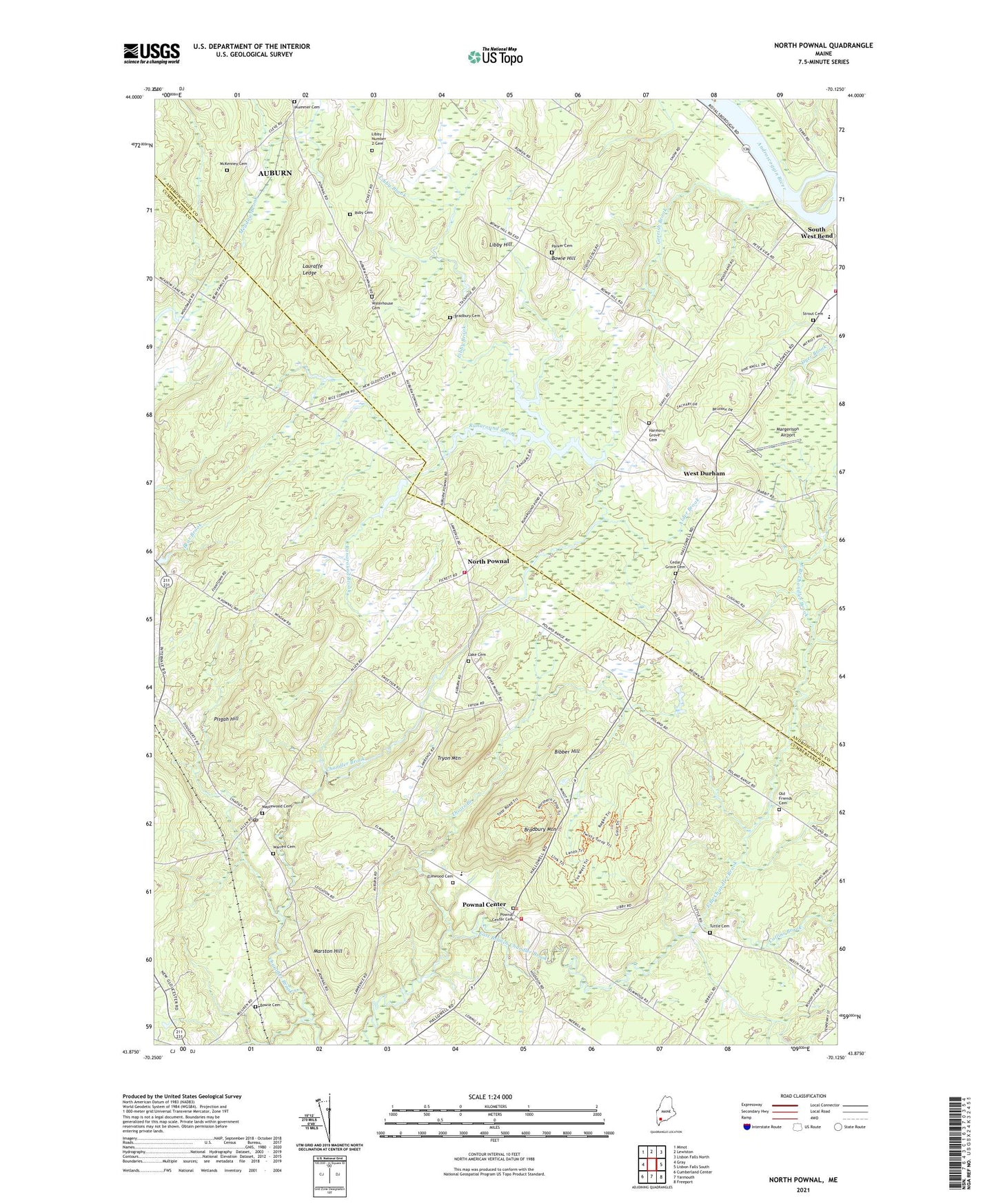
2024 topographic map quadrangle North Pownal in the state of Maine. Scale: 1:24000. Based on the newly updated USGS 7.5' US Topo map series, this map is in the following counties: Cumberland, Androscoggin. The map contains contour data, water features, and other items you are used to seeing on USGS maps, but also has updated roads and other features. This is the next generation of topographic maps. Printed on high-quality waterproof paper with UV fade-resistant inks.
Quads adjacent to this one:
West: Gray
Northwest: Minot
North: Lewiston
Northeast: Lisbon Falls North
East: Lisbon Falls South
Southeast: Freeport
South: Yarmouth
Southwest: Cumberland Center
This map covers the same area as the classic USGS quad with code o43070h2.
Contains the following named places: Alder Brook, Bibber Hill, Blueberry Pond Campground, Blueberry Pond Observatory, Bowie Cemetery, Bowie Hill, Bradbury Cemetery, Bradbury Mountain, Bradbury Mountain State Park, Cedar Grove Cemetery, Collins Brook, Durham Community School, Durham Fire and Rescue Station, Dyer Brook, Elmwood Cemetery, First Congregational Church, Foggs Corner, Gerrish Brook, Harmony Grove Cemetery, Lake Cemetery, Lauraffe Ledge, Libby Brook, Libby Hill, Libby Number 2 Cemetery, Maplewood Cemetery, Margerison Airport, Marston Hill, McKenney Cemetery, North Pownal, Old Friends Cemetery, Parker Cemetery, Pisgah Hill, Plummer Cemetery, Pownal Airport, Pownal Center, Pownal Center Cemetery, Pownal Elementary School, Pownal Fire and Rescue Center Station, Pownal Fire and Rescue North Station, Pownal Post Office, Ruby Cemetery, Runaround Brook, Runaround Pond, Runaround Pond Dam, South West Bend, Strout Cemetery, Talking Brook, Thoits Branch, Town of Durham, Town of Pownal, Tryon Mountain, Tuttle Cemetery, Warren Cemetery, Waterhouse Cemetery, West Durham, West Pownal, ZIP Codes: 04069, 04222