MyTopo
Mount Blue Maine US Topo Map
Couldn't load pickup availability
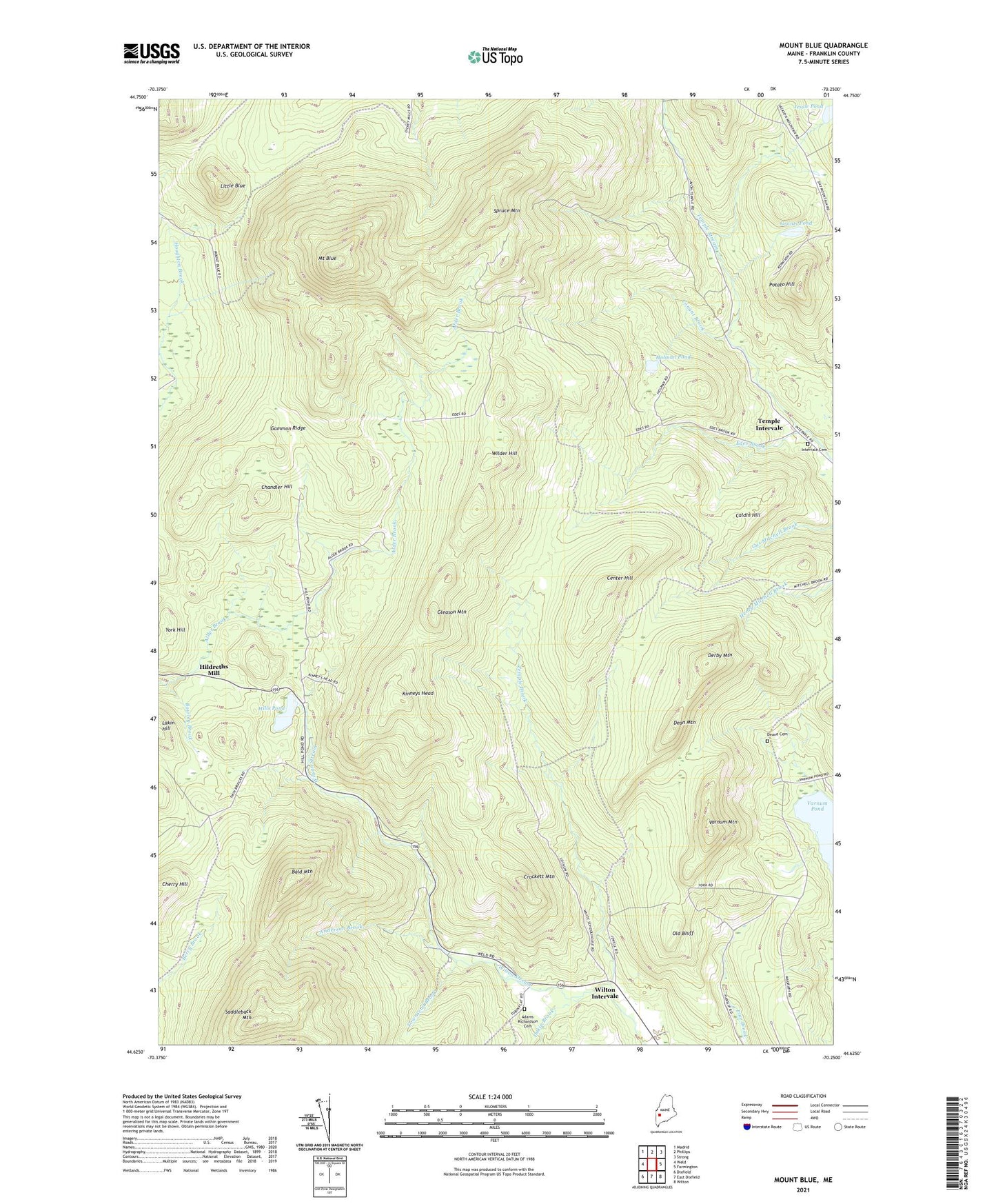
2021 topographic map quadrangle Mount Blue in the state of Maine. Scale: 1:24000. Based on the newly updated USGS 7.5' US Topo map series, this map is in the following counties: Franklin. The map contains contour data, water features, and other items you are used to seeing on USGS maps, but also has updated roads and other features. This is the next generation of topographic maps. Printed on high-quality waterproof paper with UV fade-resistant inks.
Quads adjacent to this one:
West: Weld
Northwest: Madrid
North: Phillips
Northeast: Strong
East: Farmington
Southeast: Wilton
South: East Dixfield
Southwest: Dixfield
Contains the following named places: Adams Richardson Cemetery, Alder Brook, Anderson Brook, Bald Mountain, Caldin Hill, Center Hill, Chandler Hill, Conant Brook, Crockett Mountain, Dakin Brook, Dean Mountain, Deane Cemetery, Derby Mountain, Edes Brook, Gammon Ridge, Gleason Mountain, Grants Pond, Hildreths Mill, Hills Pond, Holman Pond, Jessie Pond, Kinneys Head, Little Blue, Mount Blue, Old Bluff, Perkins Township, Potato Hill, Saddleback Mountain, Spruce Mountain, Temple Brook, Temple Intervale, Temple Intervale Cemetery, Town of Temple, Townsend Brook, Twin Bridges, Unorganized Territory of South Franklin, Varnum Mountain, Washington Township, Wilder Hill, Wilton Intervale, ZIP Codes: 04294, 04984