MyTopo
Weld Maine US Topo Map
Couldn't load pickup availability
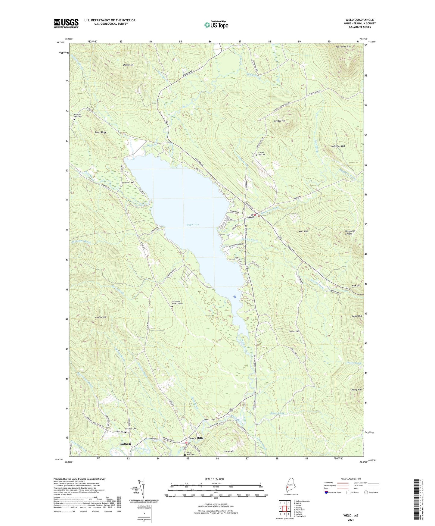
2024 topographic map quadrangle Weld in the state of Maine. Scale: 1:24000. Based on the newly updated USGS 7.5' US Topo map series, this map is in the following counties: Franklin. The map contains contour data, water features, and other items you are used to seeing on USGS maps, but also has updated roads and other features. This is the next generation of topographic maps. Printed on high-quality waterproof paper with UV fade-resistant inks.
Quads adjacent to this one:
West: Roxbury
Northwest: Jackson Mountain
North: Madrid
Northeast: Phillips
East: Mount Blue
Southeast: East Dixfield
South: Dixfield
Southwest: Rumford
This map covers the same area as the classic USGS quad with code o44070f4.
Contains the following named places: Bachelor Brook, Basin Brook, Berry Brook, Berry Mills, Berry Mills Cemetery, Bowley Brook, Carthage Volunteer Fire Department, Center Hill, Center Hill Cemetery, Chase Corner, Cherry Hill, Cobble Hill, Dunning Brook, East Brook, Fran Brook, Green Brook, Green Hill, Hedgehog Hill, Holt Hill, Houghton Brook, Houghton Ledges, Hurricane Mountain, Hutchinson Brook, Keyes Brook, Lakin Hill, Lapham Brook, Mount Blue State Park, Mountain View Cemetery, Newman Cemetery, Old Tainter Burial Ground, Parlin Brook, Potter Hill, Rand Brook, Rand Ridge, Robertson Cemetery, Snowman Brook, Swett Brook, Town of Weld, Webb Lake, Weld, Weld Corner, Weld Elementary school, Weld Elementary School, Weld Post Office, Weld Public Library, Weld Volunteer Fire Station, West Brook, Yeaton Brook, York Hill, ZIP Code: 04285