MyTopo
Oxford Maine US Topo Map
Couldn't load pickup availability
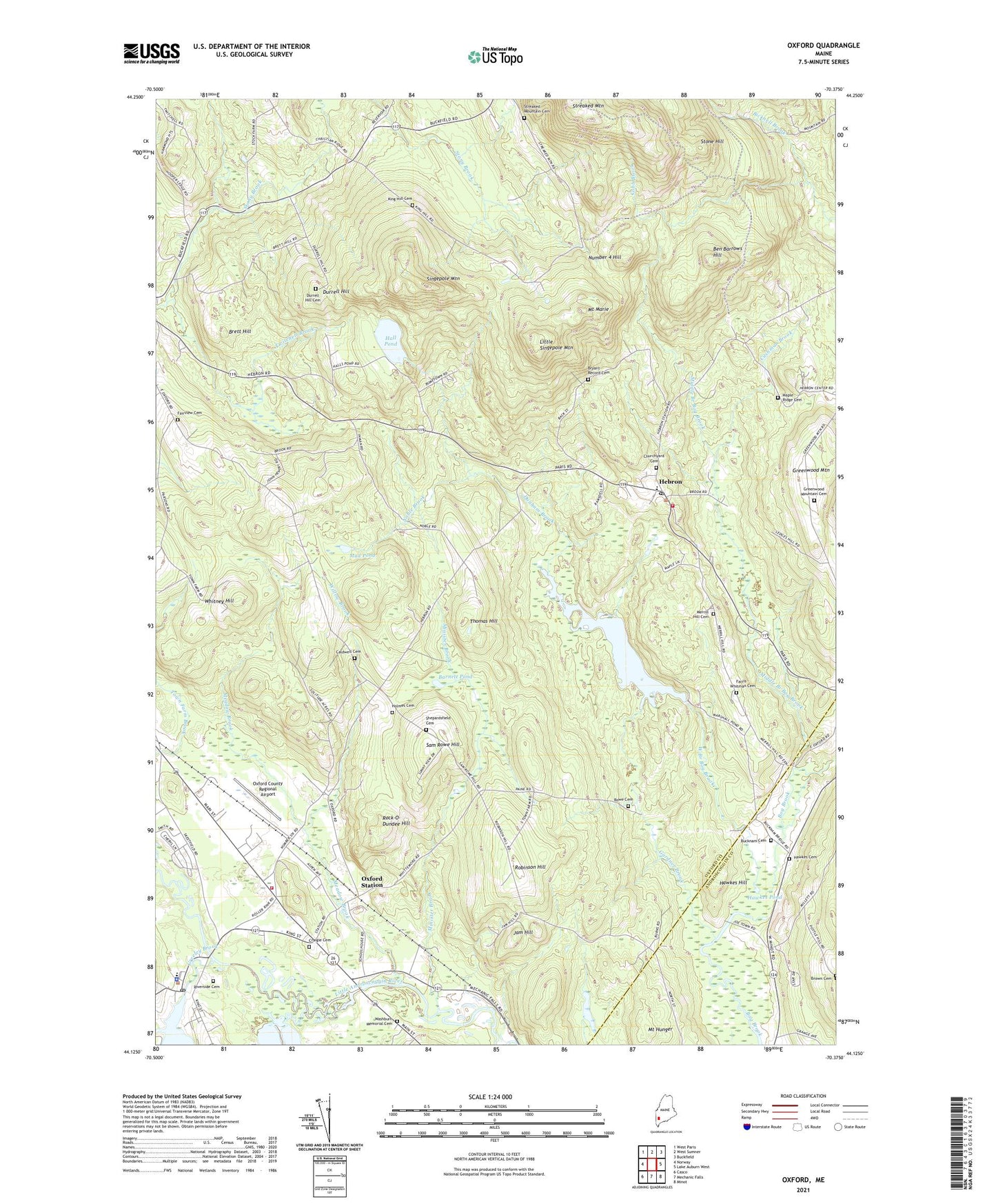
2021 topographic map quadrangle Oxford in the state of Maine. Scale: 1:24000. Based on the newly updated USGS 7.5' US Topo map series, this map is in the following counties: Oxford, Androscoggin. The map contains contour data, water features, and other items you are used to seeing on USGS maps, but also has updated roads and other features. This is the next generation of topographic maps. Printed on high-quality waterproof paper with UV fade-resistant inks.
Quads adjacent to this one:
West: Norway
Northwest: West Paris
North: West Sumner
Northeast: Buckfield
East: Lake Auburn West
Southeast: Minot
South: Mechanic Falls
Southwest: Casco
Contains the following named places: Barnett Pond, Ben Barrows Hill, Brett Hill, Brimstone Corner, Bryant Record Cemetery, Bucknam Cemetery, Caldwell Cemetery, Caldwell Corner, Churchyard Cemetery, Cobb Brook, Craigie Cemetery, Currier Cemetery, Cushman Brook, Dunham Brook, Durrell Hill, Durrell Hill Cemetery, Fairview Cemetery, Farris - Whitman Cemetery, First Congregational Church, Freeland Holmes Library, Gardner Brook, Greenwood Mountain, Greenwood Mountain Cemetery, Hall Pond, Hall Pond Dam, Hawkes Cemetery, Hawkes Hill, Hawkes Pond, Hebron, Hebron Academy, Hebron Community Baptist Church, Hebron Elementary School, Hebron Fire Department Station 1, Hebron Post Office, Hebron Public Lands, Holmes Cemetery, Hupper Library, Jam Hill, Kimballs Airport, King Hill Cemetery, Little Androscoggin River Reservoir, Little Singepole Mountain, Maple Ridge Cemetery, Marshall Pond, Marshall Pond Dam, Meadow Brook, Merrill Hill Cemetery, Middle Branch Bog Brook, Minister Brook, Mount Hunger, Mount Marie, Mud Pond, Noble Brook, Number 4 Hill, Oxford, Oxford County Regional Airport, Oxford Elementary School, Oxford Fire and Rescue Central Station, Oxford Plains Speedway, Oxford Police Department, Oxford Post Office, Oxford Station, Paine Corner, Pratt Corner, Riverside Cemetery, Robinson Hill, Rock-O-Dundee Hill, Rowe Cemetery, Saint Marys Roman Catholic Church, Sam Rowe Hill, Shepards Field Cemetery, Singepole Mountain, Stone Hill, Streaked Mountain, Streaked Mountain Cemetery, The Church of Jesus Christ of Latter Day Saints, Thomas Hill, Thompson Lake Dam, Town of Hebron, Town of Oxford, Town of Paris, Twitchell Brook, Washburn Memorial Cemetery, Welchville, Welchville Dam, West Branch Bog Brook, Western Maine Sanatorium, Whitney Hill, Willow Brook, ZIP Codes: 04238, 04281