MyTopo
West Sumner Maine US Topo Map
Couldn't load pickup availability
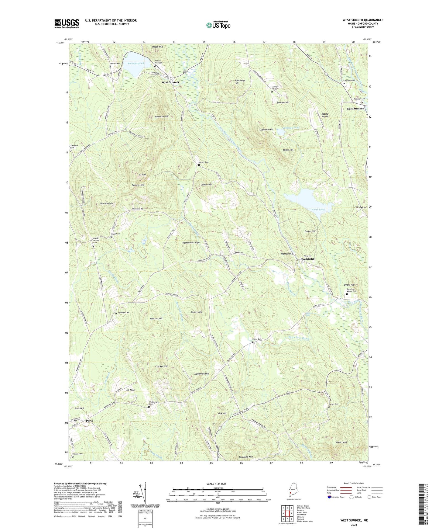
2024 topographic map quadrangle West Sumner in the state of Maine. Scale: 1:24000. Based on the newly updated USGS 7.5' US Topo map series, this map is in the following counties: Oxford. The map contains contour data, water features, and other items you are used to seeing on USGS maps, but also has updated roads and other features. This is the next generation of topographic maps. Printed on high-quality waterproof paper with UV fade-resistant inks.
Quads adjacent to this one:
West: West Paris
Northwest: Mount Zircon
North: Worthley Pond
Northeast: Canton
East: Buckfield
Southeast: Lake Auburn West
South: Oxford
Southwest: Norway
This map covers the same area as the classic USGS quad with code o44070c4.
Contains the following named places: Abbots Airport, Basin Falls, Basin Falls Brook, Buckfield Village Cemetery, Crocker Hill, Cummings Airport, Cushman Hill, Cushman Pond, Damon Hill, Darnit Brook, Deans Hill, Downs Hill, East Sumner, East Sumner Congregational Church, Forbes District Cemetery, Grays Cemetery, Hammond Ledge, Hartford Sumner Elementary School, Heath Hill, Hedgehog Hill, Hersey Cemetery, Hillside Cemetery, Mount Mica, Mount Tom, North Buckfield, North Pond, North Pond Dam, Oak Hill, Owls Head, Paris Hill, Paris Hills Country Club, Paris Hills Historic District, Paris Post Office, Parsonage Hill, Partridge Cemetery, Pleasant Pond, Prince Cemetery, Robinson Cemetery, Ryemoor Hill, Ryerson Hill, Shack Hill, Spruce Hills, Stetson Cemetery, Sumner Hill, Sumner Hill Cemetery, The Pinnacle, Town of Sumner, Tuelltown Cemetery, Turner Cemetery, Turner Hill, Warren Hill, West Sumner, West Sumner Baptist Church, West Sumner Christian School, Whittemore Cemetery, ZIP Code: 04271