MyTopo
Weir Pond Maine US Topo Map
Couldn't load pickup availability
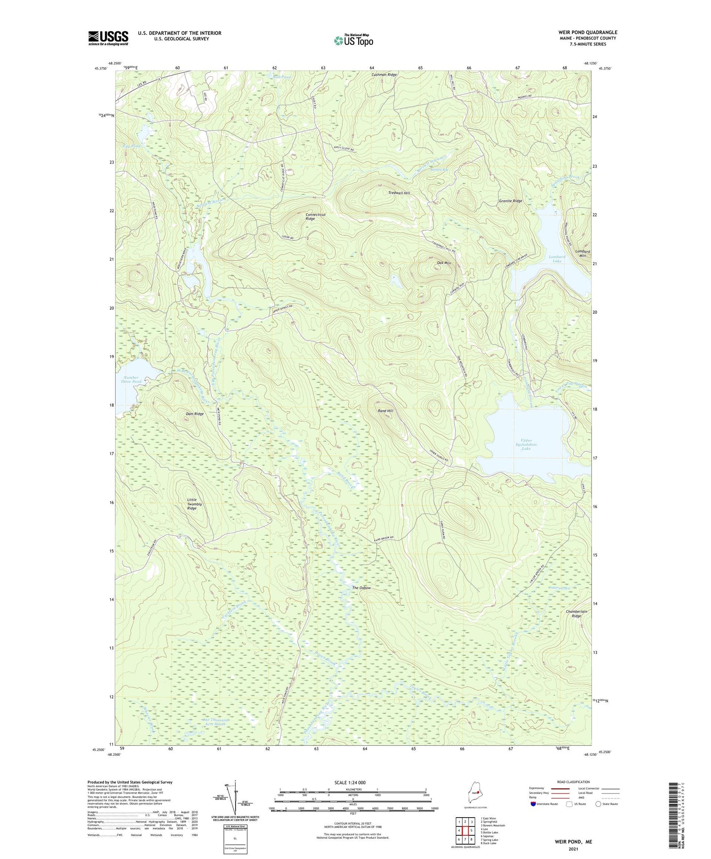
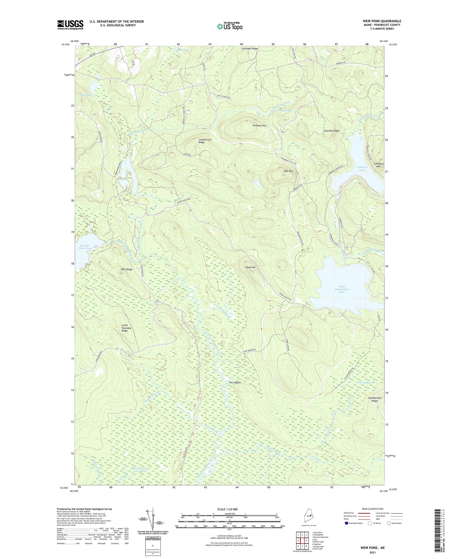
2021 topographic map quadrangle Weir Pond in the state of Maine. Scale: 1:24000. Based on the newly updated USGS 7.5' US Topo map series, this map is in the following counties: Penobscot. The map contains contour data, water features, and other items you are used to seeing on USGS maps, but also has updated roads and other features. This is the next generation of topographic maps. Printed on high-quality waterproof paper with UV fade-resistant inks.
Quads adjacent to this one:
West: Lee
Northwest: East Winn
North: Springfield
Northeast: Bowers Mountain
East: Bottle Lake
Southeast: Duck Lake
South: Spring Lake
Southwest: Saponac
Contains the following named places: Bartlett Bog, Bartlett Stream, Brown Brook, Budge Farm, Camp Number Eleven, Camp Number Nine, Carry Farm, Connecticut Ridge, Cushman Ridge, Dam Ridge, Drake Place, East Branch Passadumkeag River, Egg Pond, Granite Ridge, Little Taylor Brook, Little Twombly Ridge, Lombard Lake, Lombard Stream, Lower Pug Stream, McGoon Pond, Oak Mountain, One Thousand Acre Heath, Patterson Bog, Rand Brook, Rand Hill, Spaulding Brook, Taylor Brook, The Oxbow, Thurlow Brook, Tredwell Hill, Turkloin Brook, Upper Sysladobsis Lake, Weir Pond, West Branch Passadumkeag River