MyTopo
Lee Maine US Topo Map
Couldn't load pickup availability
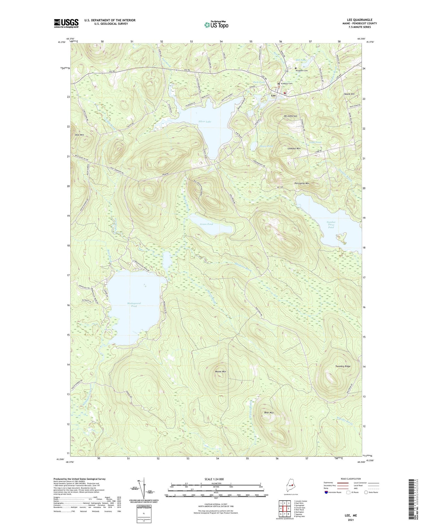
2024 topographic map quadrangle Lee in the state of Maine. Scale: 1:24000. Based on the newly updated USGS 7.5' US Topo map series, this map is in the following counties: Penobscot. The map contains contour data, water features, and other items you are used to seeing on USGS maps, but also has updated roads and other features. This is the next generation of topographic maps. Printed on high-quality waterproof paper with UV fade-resistant inks.
Quads adjacent to this one:
West: Lincoln East
Northwest: Lincoln Center
North: East Winn
Northeast: Springfield
East: Weir Pond
Southeast: Spring Lake
South: Saponac
Southwest: Burlington
This map covers the same area as the classic USGS quad with code o45068c3.
Contains the following named places: Academy Cemetery, Bear Brook, Bear Mountain, Beaver Brook, Blackman Brook, Cobb Pond, Coffin Brook, Green Pond, House Pond, Jackson Brook, Lee, Lee Academy, Lee Baptist Church, Lee Dam, Lee Post Office, Lee Volunteer Fire Station, Little Madagascal Pond, Lookout Mountain, Madagascal Pond, Mattakeunk Pond Dam, Merrill Brook, Merrill Pond, Mill Pond, Mill Pond Dam, Moose Mountain, Mount Jefferson, Mount Jefferson Junior High School, Number Three Pond, Park Pond, Pool Brook, Porcupine Mountain, Silver Lake, Skunk Hill, Sucker Brook, T3 R1 NBPP, Town of Lee, Twombly Ridge, Unorganized Territory of Twombly Ridge, Woodlawn Cemetery, ZIP Code: 04455