MyTopo
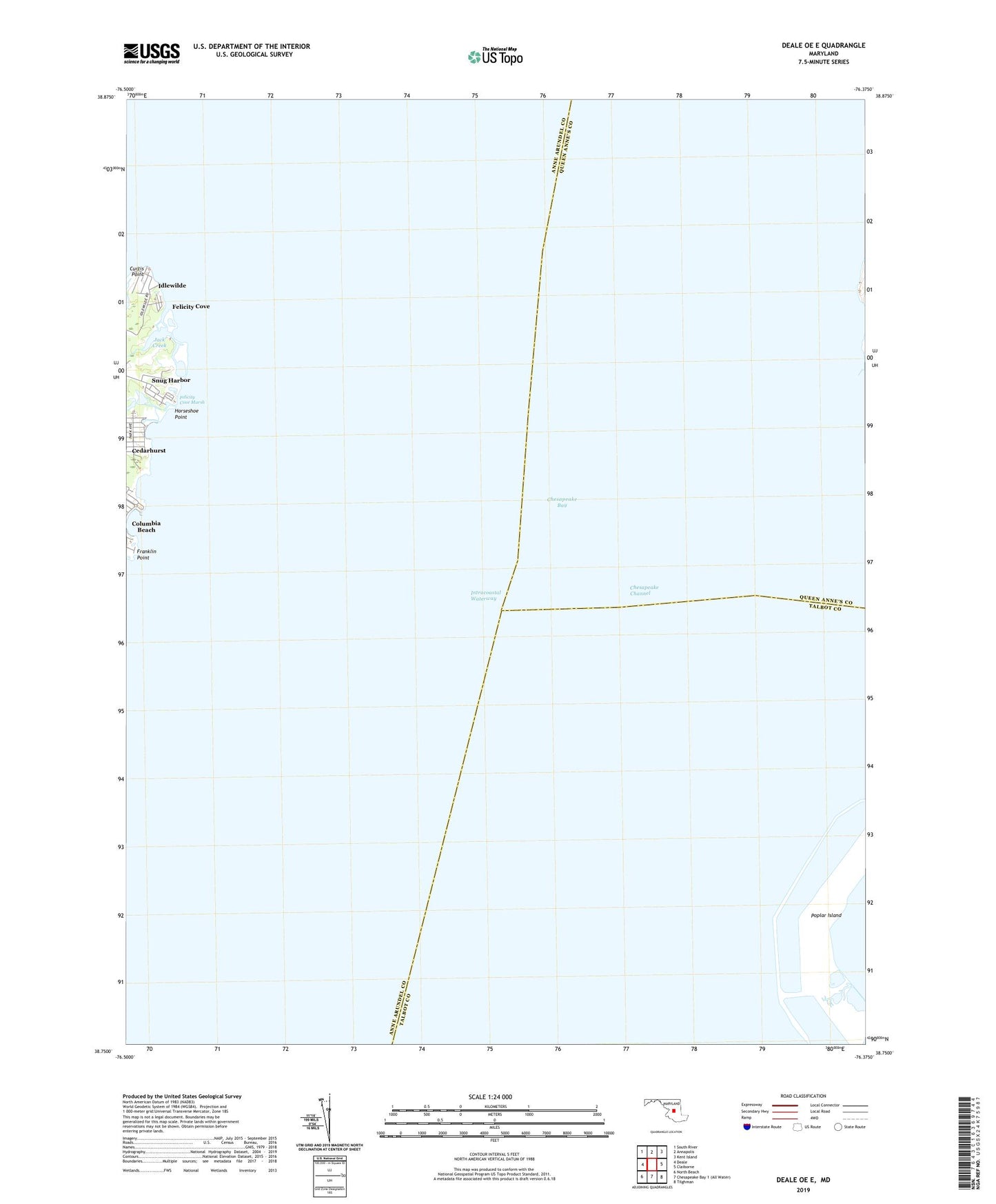
Deale OE E Maryland US Topo Map
Couldn't load pickup availability
2019 topographic map quadrangle Deale OE E in the state of Maryland. Scale: 1:24000. Based on the newly updated USGS 7.5' US Topo map series, this map is in the following counties: Anne Arundel, Talbot, Queen Anne's. The map contains contour data, water features, and other items you are used to seeing on USGS maps, but also has updated roads and other features. This is the next generation of topographic maps. Printed on high-quality waterproof paper with UV fade-resistant inks.
Quads adjacent to this one:
West: Deale
Northwest: South River
North: Annapolis
Northeast: Kent Island
East: Claiborne
Southeast: Tilghman
Southwest: North Beach
Contains the following named places: Bloody Point Creek, Curtis Point, Felicity Cove, Felicity Cove Marsh, Franklin Point, Horseshoe Point, Idlewilde, Jack Creek, Poplar Island, Snug Harbor, Valliant