MyTopo
Kedges Straits Maryland US Topo Map
Couldn't load pickup availability
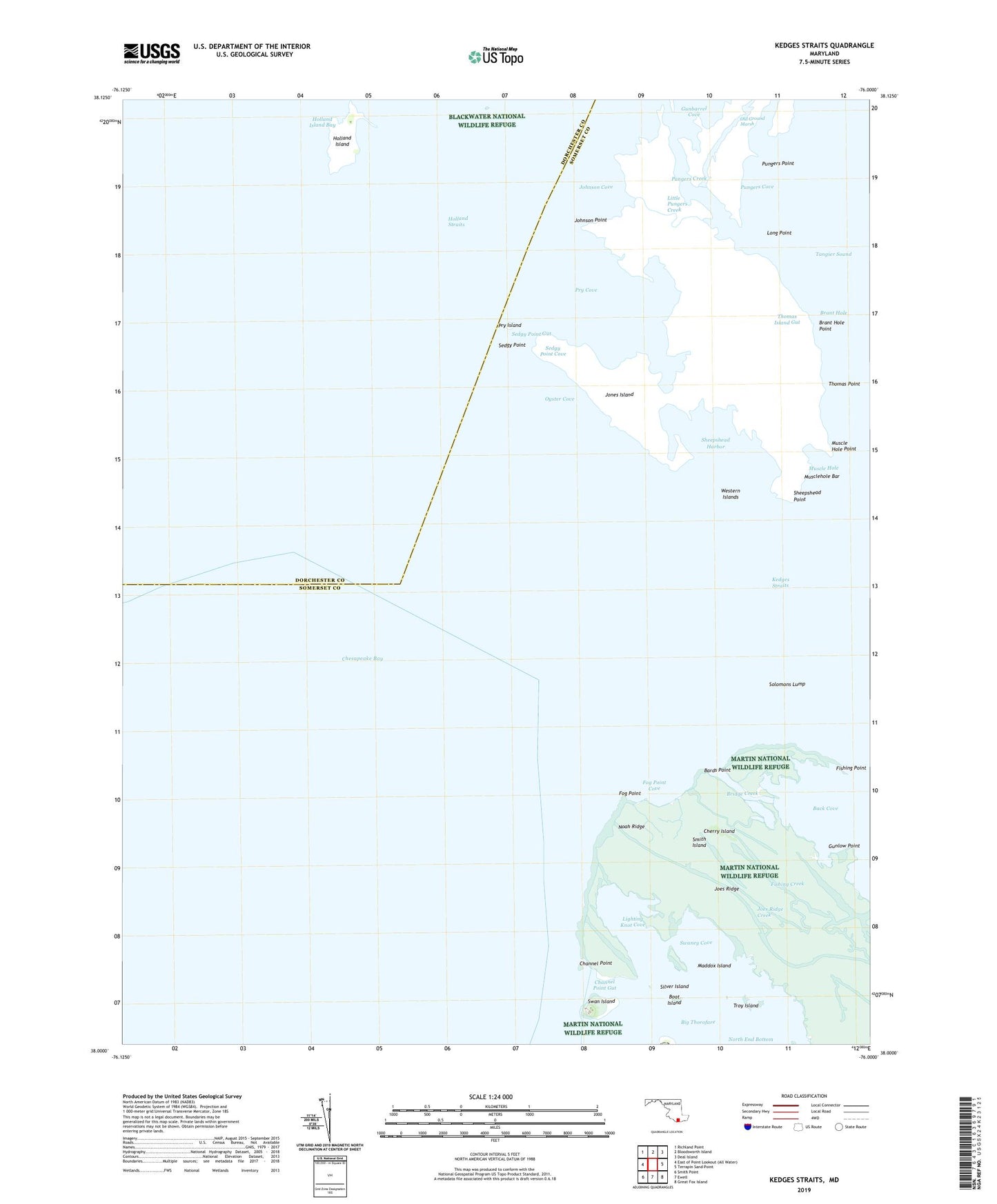
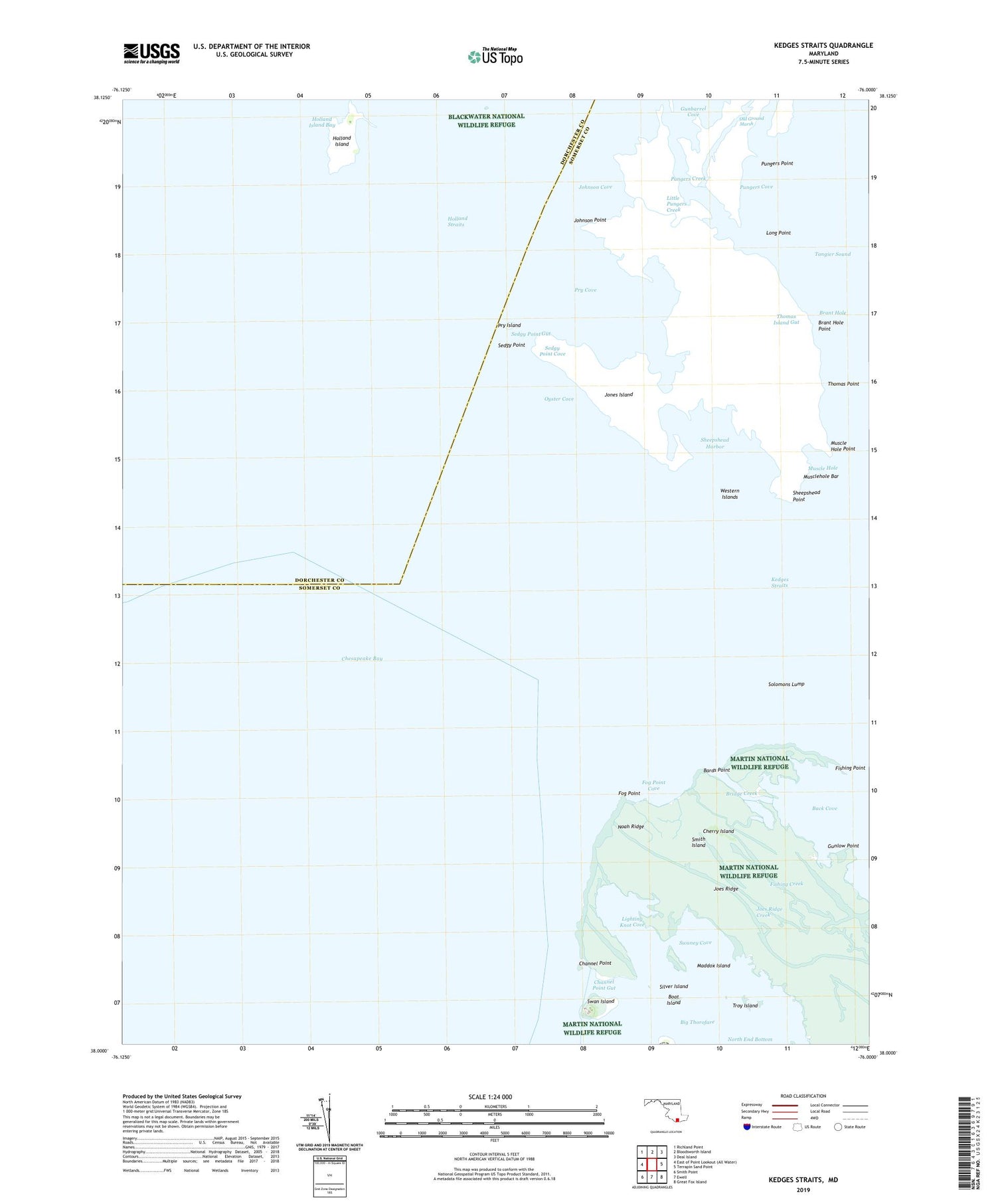
2019 topographic map quadrangle Kedges Straits in the state of Maryland. Scale: 1:24000. Based on the newly updated USGS 7.5' US Topo map series, this map is in the following counties: Somerset, Dorchester. The map contains contour data, water features, and other items you are used to seeing on USGS maps, but also has updated roads and other features. This is the next generation of topographic maps. Printed on high-quality waterproof paper with UV fade-resistant inks.
Quads adjacent to this one:
Northwest: Richland Point
North: Bloodsworth Island
Northeast: Deal Island
East: Terrapin Sand Point
Southeast: Great Fox Island
South: Ewell
Southwest: Smith Point
Contains the following named places: Bards Point, Big Thorofare River West Light, Boat Island, Brant Hole, Brant Hole Point, Bridge Creek, Channel Point, Channel Point Gut, Cherry Island, District 10 Smith Island, Fishing Creek, Fishing Point, Fog Point, Fog Point Cove, Goose Creek, Gunbarrel Cove, Gunlow Point, Holland Island, Holland Island Bar Lighthouse, Joes Ridge, Joes Ridge Creek, Johnson Cove, Johnson Point, Jones Island, Kedges Straits, Lighting Knot Cove, Little Pungers Creek, Long Point, Maddox Island, Martin National Wildlife Refuge, Muscle Hole, Muscle Hole Point, Musclehole Bar, Noah Ridge, North End Bottom, Old Ground, Old Ground Gut, Old Ground Marsh, Oyster Cove, Pry Cove, Pry Island, Pungers Cove, Pungers Creek, Pungers Point, Sedgy Point, Sedgy Point Cove, Sedgy Point Gut, Sheepshead Harbor, Sheepshead Point, Silver Island, Solomons Lump, Solomons Lump Lighthouse, Sound Gut, Swan Island, Swaney Cove, Thomas Island Gut, Thomas Point, Troy Island, Western Islands