MyTopo
Great Fox Island Virginia US Topo Map
Couldn't load pickup availability
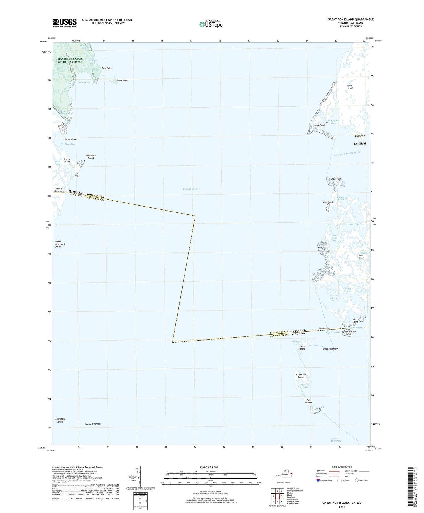
2022 topographic map quadrangle Great Fox Island in the states of Maryland, Virginia. Scale: 1:24000. Based on the newly updated USGS 7.5' US Topo map series, this map is in the following counties: Accomack, Somerset. The map contains contour data, water features, and other items you are used to seeing on USGS maps, but also has updated roads and other features. This is the next generation of topographic maps. Printed on high-quality waterproof paper with UV fade-resistant inks.
Quads adjacent to this one:
West: Ewell
Northwest: Kedges Straits
North: Terrapin Sand Point
Northeast: Marion
East: Crisfield
Southeast: Chesconessex
South: Tangier Island
Southwest: Goose Island
Contains the following named places: Anderson Creek, Bulls Point, Cedar Island, Cedar Island Creek, Cedar Island State Wildlife Management Area, Cedar Straits, Clump Island, Cow Point, Cow Point Creek, District 7 Crisfield, Does Hammock, Drum Point, Ellinger Cove, Fishing Creek, Fox Islands, Great Fox Island, Great Point, Great Point Pond, Green Harbor Island, Green Straits, Horse Hammock, Horse Hammock Gut, Horse Hammock Point, House Island, Island Point, Janes Island Gut, Janes Island Light, Little Annemessex River, Little Thorofare, Long Point, Muddy Creek, Old House Cove, Otter Island, Planner Cove, Pond Creek, Reach Hammock, Rock Creek, Somers Cove Lighthouse, Thorofare Island, Twitch Cove, Watkins Point, Watkins Pointe, Wellridge Creek, Yorkshire Island