MyTopo
Kingston Maryland US Topo Map
Couldn't load pickup availability
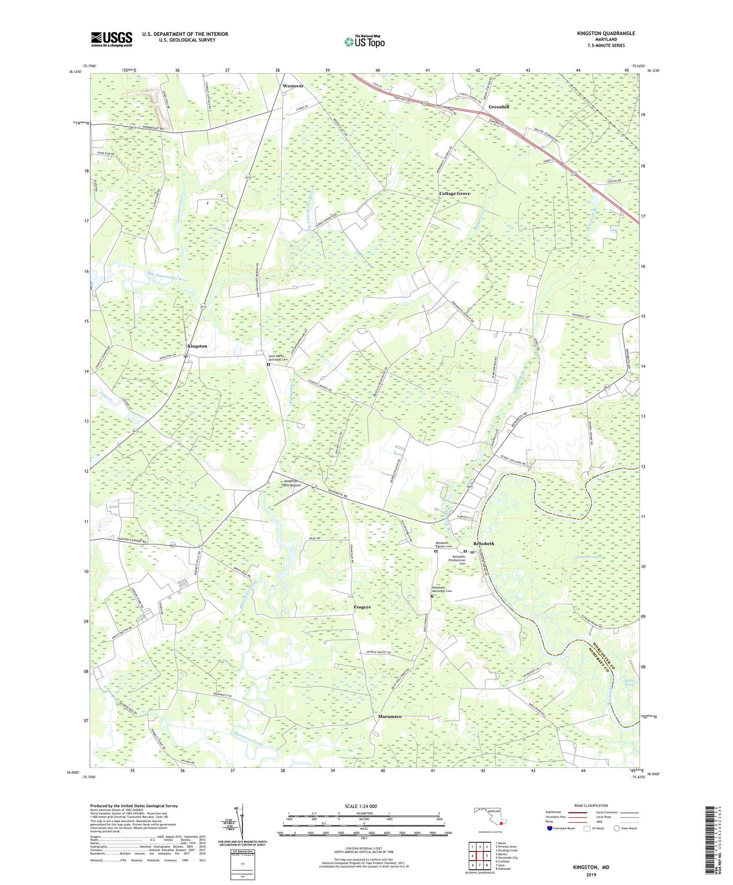
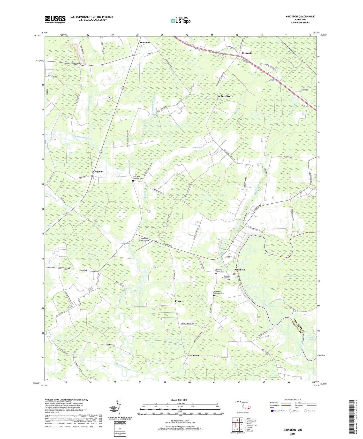
2019 topographic map quadrangle Kingston in the state of Maryland. Scale: 1:24000. Based on the newly updated USGS 7.5' US Topo map series, this map is in the following counties: Somerset, Worcester. The map contains contour data, water features, and other items you are used to seeing on USGS maps, but also has updated roads and other features. This is the next generation of topographic maps. Printed on high-quality waterproof paper with UV fade-resistant inks.
Quads adjacent to this one:
West: Marion
Northwest: Monie
North: Princess Anne
Northeast: Dividing Creek
East: Pocomoke City
Southeast: Hallwood
South: Saxis
Southwest: Crisfield
Contains the following named places: Anderson Farm Airport, Annemessex Creek, Christ Church, Conners Corner, Cottage Grove, Coventry Parish Church, Cypress Swamp, District 13 Westover, District 3 Brinkleys, Ebenezer Church, Frogeye, Great Hope Golf Course, Greenhill, Holly Grove Christian School, Holly Grove Church, Hudson Corner, J M Towes Vocational School, Kingston, Kingston Post Office, Liberia Church, Marumsco, Moores Chapel, Multi Service Community Center, Murphy Airport, Pauls Corner, Quindocqua Church, Rehobeth, Rehobeth Baptist Cemetery, Rehobeth Baptist Church, Rehobeth Branch, Rehobeth Methodist Cemetery, Rehobeth Post Office, Rehobeth Presbyterian Cemetery, Rehobeth Presbyterian Church, Rehoboth United Methodist Church, Saint Elizabeths Church, Saint James Church, Saint Marks Church, Saint Marks Episcopal Cemetery, Saint Pauls Church, Somerset County Landfill, Somerset Intermediate School, Wesley Church, Westover, WOLC-FM (Princess Anne), ZIP Codes: 21838, 21871