MyTopo
Monie Maryland US Topo Map
Couldn't load pickup availability
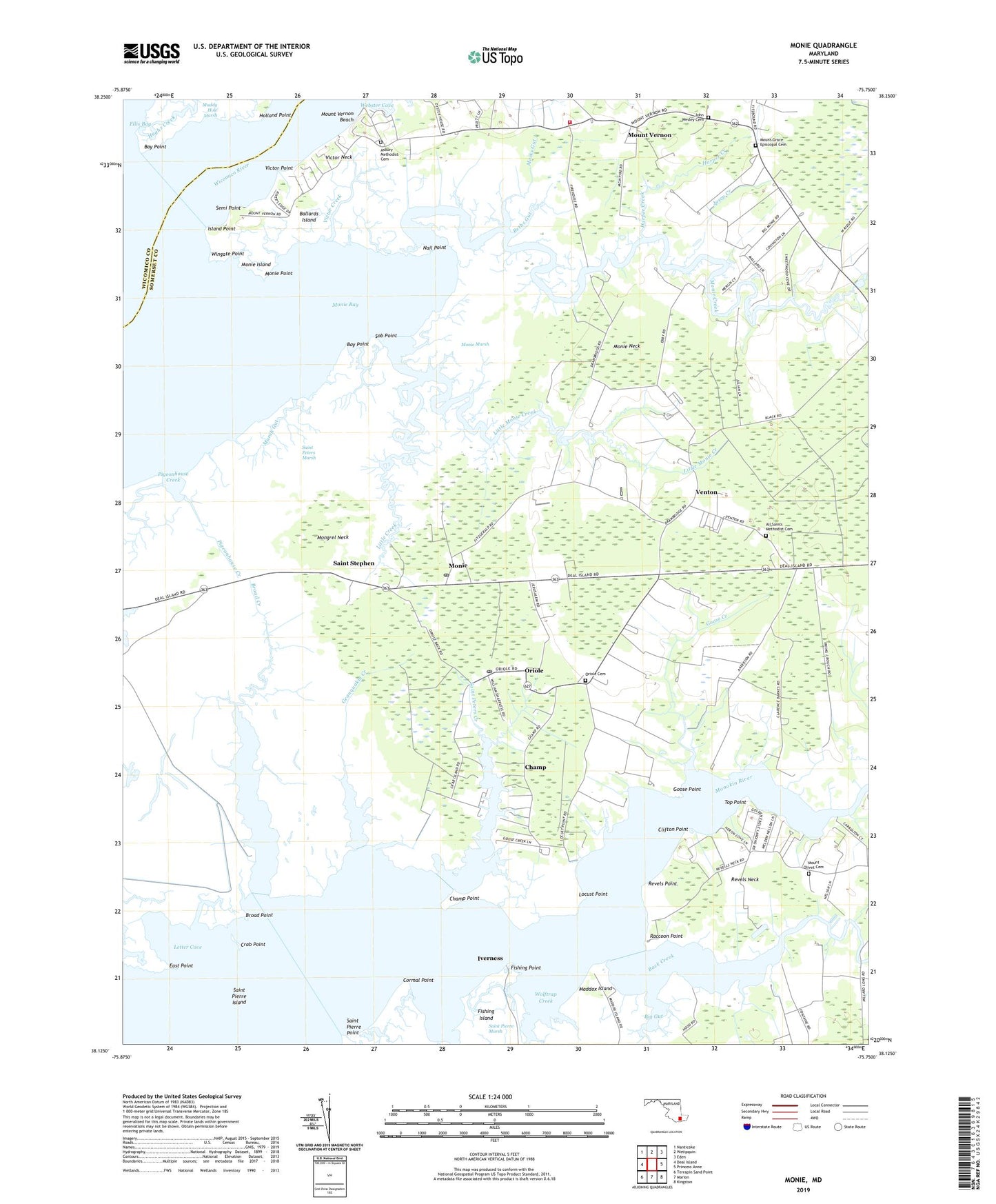
2023 topographic map quadrangle Monie in the state of Maryland. Scale: 1:24000. Based on the newly updated USGS 7.5' US Topo map series, this map is in the following counties: Somerset, Wicomico. The map contains contour data, water features, and other items you are used to seeing on USGS maps, but also has updated roads and other features. This is the next generation of topographic maps. Printed on high-quality waterproof paper with UV fade-resistant inks.
Quads adjacent to this one:
West: Deal Island
Northwest: Nanticoke
North: Wetipquin
Northeast: Eden
East: Princess Anne
Southeast: Kingston
South: Marion
Southwest: Terrapin Sand Point
This map covers the same area as the classic USGS quad with code o38075b7.
Contains the following named places: All Saints Church, All Saints Methodist Cemetery, Asbury Methodist Cemetery, Ashbury Church, Back Creek, Ballards Island, Bay Point, Bethel, Beths Gut, Big Gut, Bluemel Field, Broad Creek, Broad Point, Champ, Champ Point, Clifton Point, Cormal Point, Crab Point, Deal Island State Wildlife Management Area, District 2 Saint Peters, District 5 Mount Vernon, East Point, Edwin, Fishing Island, Fishing Point, Geanquakin Creek, Goose Creek, Goose Point, Grace Church, Harper Creek, Holland Point, Hughs Creek, Island Point, Iverness, Jason Creek, John Wesley Cemetery, Letter Cove, Letter Creek, Little Creek, Little Monie Creek, Locust Point, Macks Gut, Maddox Island, Marsh Gut, Mongrel Neck, Monie, Monie Bay, Monie Creek, Monie Island, Monie Marsh, Monie Neck, Monie Point, Monie Post Office, Mount Grace Episcopal Cemetery, Mount Olive Church, Mount Olivet Cemetery, Mount Vernon, Mount Vernon Beach, Mount Vernon Census Designated Place, Mount Vernon Elementary School, Mount Vernon Volunteer Fire Department Station 6, Nail Point, Oriole, Oriole Cemetery, Oriole Post Office, Pigeonhouse Creek, Pine Beach, Raccoon Point, Revels Point, Saint James Church, Saint Peters Church, Saint Peters Creek, Saint Peters Marsh, Saint Pierre Island, Saint Pierre Point, Saint Stephen, Saint Stephen United Methodist Church, Semi Point, Sob Point, Somersett Town, Top Point, Venton, Victor, Victor Creek, Victor Neck, Victor Point, Webster Cove, Wesley Church, Wingate Point, Wolftrap Creek