
MyTopo
Nanjemoy Maryland US Topo Map
Couldn't load pickup availability
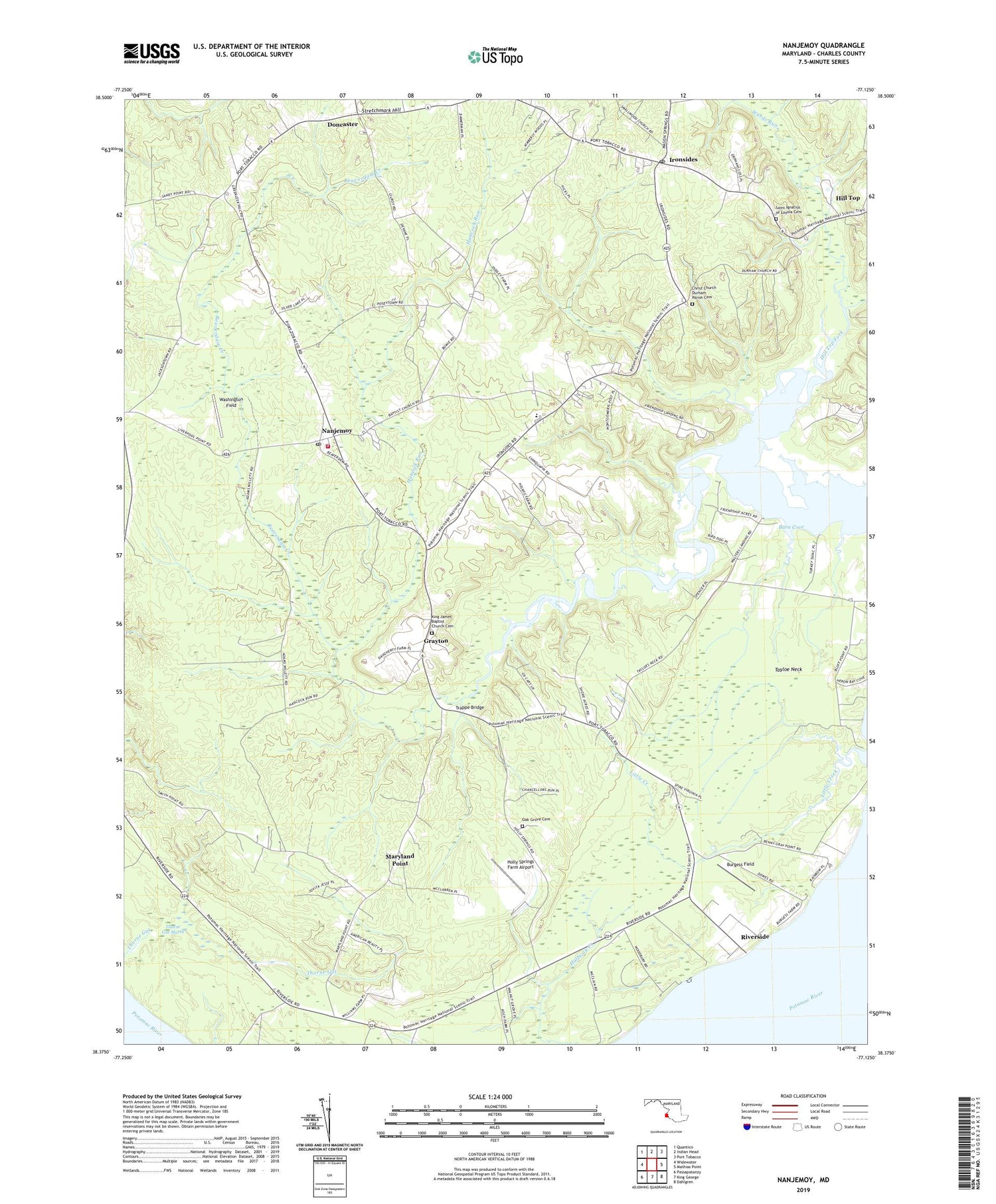
2019 topographic map quadrangle Nanjemoy in the state of Maryland. Scale: 1:24000. Based on the newly updated USGS 7.5' US Topo map series, this map is in the following counties: Charles. The map contains contour data, water features, and other items you are used to seeing on USGS maps, but also has updated roads and other features. This is the next generation of topographic maps. Printed on high-quality waterproof paper with UV fade-resistant inks.
Quads adjacent to this one:
West: Widewater
Northwest: Quantico
North: Indian Head
Northeast: Port Tobacco
East: Mathias Point
Southeast: Dahlgren
South: King George
Southwest: Passapatanzy
Contains the following named places: Barn Cove, Beaverdam Creek, Bishopville Pond, Bunting Branch Dam, Burgess Field, Burgess Landing, Chapel Hill School, Christ Church Durham Parish Cemetery, District 3 Nanjemoy, Doncaster, Durham Church, Emory Chapel, Friendship Acres, Friendship Landing, Grafton, Grayton, Green Leek School, Hancock Run, Hickory Hill, Hill Top Fork, Holly Springs Farm Airport, Holly Springs School, Ironsides, Ironsides Post Office, Ironsides Volunteer Rescue Squad Company 58, Jacksontown, King James Baptist Church Cemetery, Little Creek, Marshope, Maryland Point, Mount Hope, Mount Hope - Nanjemoy Elementary School, Mount Hope Baptist Church, Mount Hope School, Nanjemoy, Nanjemoy Creek Environmental Education Center, Nanjemoy Episcopal Church, Nanjemoy Post Office, Nanjemoy School, Nanjemoy Volunteer Fire Department, Neck Landing, Oak Grove Cemetery, Oak Grove Church, Oak Grove School, Riverside, Saint Ignatius Church, Saint Ignatius of Loyola Cemetery, Smith Point School, Stretchmark Hill, Tayloe Neck, Thomas Point, Thorne Gut Marsh, Trappe Bridge, Wards Run, Washington Field, ZIP Code: 20662


