MyTopo
Dahlgren Virginia US Topo Map
Couldn't load pickup availability
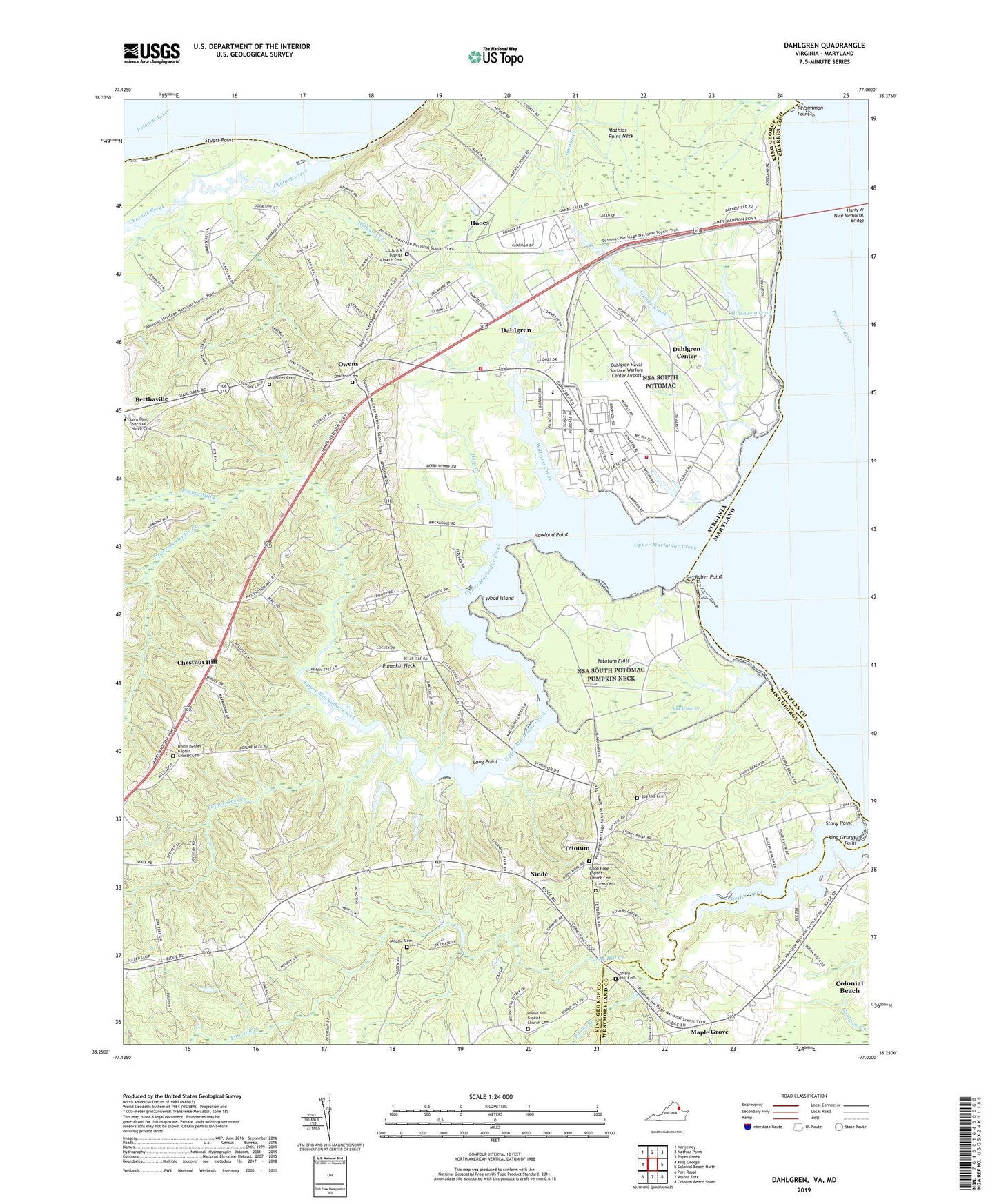
2022 topographic map quadrangle Dahlgren in the state of Virginia. Scale: 1:24000. Based on the newly updated USGS 7.5' US Topo map series, this map is in the following counties: King George, Charles, Westmoreland. The map contains contour data, water features, and other items you are used to seeing on USGS maps, but also has updated roads and other features. This is the next generation of topographic maps. Printed on high-quality waterproof paper with UV fade-resistant inks.
Quads adjacent to this one:
West: King George
Northwest: Nanjemoy
North: Mathias Point
Northeast: Popes Creek
East: Colonial Beach North
Southeast: Colonial Beach South
South: Rollins Fork
Southwest: Port Royal
This map covers the same area as the classic USGS quad with code o38077c1.
Contains the following named places: Alden, Allnut, Baber Point, Berrys Wharf, Black Marsh, Brick House Wharf, Bumbrey Cemetery, Carruthers Corner, Chestnut Hill, Chotank Creek, Company 2, Dahlgren, Dahlgren Census Designated Place, Dahlgren Center Census Designated Place, Dahlgren District, Dahlgren Naval Surface Warfare Center Airport, Dahlgren Post Office, Dahlgren Rescue Station 2, Dahlgren United Methodist Church, Deep Creek, Frank Landing, Gambo Creek, Good Hope Baptist Church, Good Hope Baptist Church Cemetery, Grace Presbyterian Church, Harry W Nice Memorial Bridge, Hideaway Pond, Hoge Wharf, Hooes, Howland Point, King George Fire and Rescue Company 2 Dahlgren, King George Point, Little Ark Baptist Church Cemetery, Little Ark Church, Little Ferry Landing, Long Point, Lucas Cemetery, Maple Grove, Mildale Cemetery, Naval District Washington Fire Department Dahlgren, Naval Surface Warfare Center Dahlgren Mainside, Naval Surface Warfare Center Pumpkin Annex, Ninde, Ninde Post Office, Oakland Cemetery, Oakland Church, Owens, Oyster Shell Landing, Pepper Mill Creek, Persimmon Point, Pine Hill Creek, Poplar Neck Creek, Potomac Elementary School, Pumpkin Neck, Rescue Squad Station 2, Round Hill Baptist Church Cemetery, Round Hill Church, Sacred Heart Chapel, Saint Pauls Church, Saint Pauls Episcopal Church Cemetery, Sharp Hill Cemetery, Spy Hill Cemetery, Stony Point, Stuart Point, Tetotum, Tetotum Flats, Union Bethel Baptist Church Cemetery, Union Bethel Church, United States Naval Proving Grounds Dam, United States Naval Proving Grounds Pond, Upper Machodoc Creek, WGRQ-FM (Colonial Beach), Williams Creek, Wood Island, ZIP Code: 22448