MyTopo
Taylors Island Maryland US Topo Map
Couldn't load pickup availability
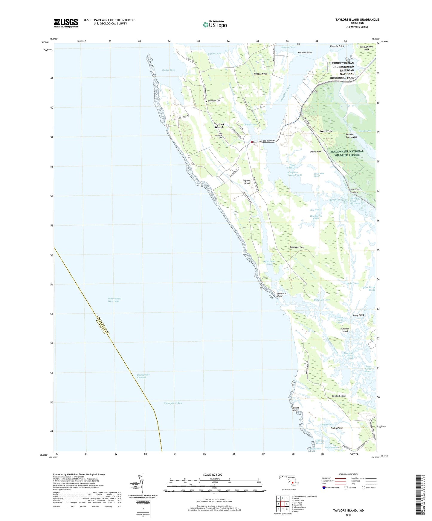
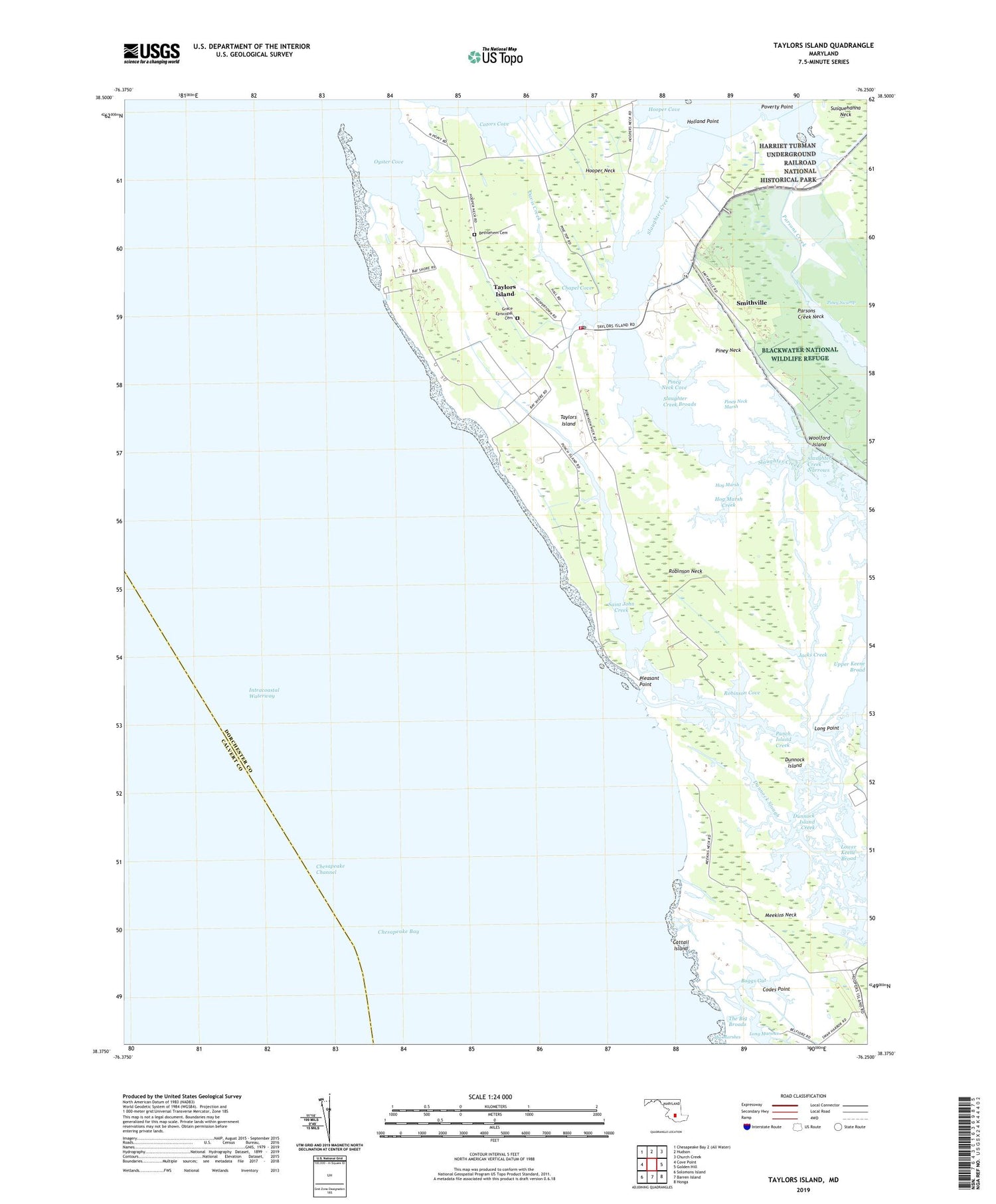
2019 topographic map quadrangle Taylors Island in the state of Maryland. Scale: 1:24000. Based on the newly updated USGS 7.5' US Topo map series, this map is in the following counties: Dorchester, Calvert. The map contains contour data, water features, and other items you are used to seeing on USGS maps, but also has updated roads and other features. This is the next generation of topographic maps. Printed on high-quality waterproof paper with UV fade-resistant inks.
Quads adjacent to this one:
West: Cove Point
North: Hudson
Northeast: Church Creek
East: Golden Hill
Southeast: Honga
South: Barren Island
Southwest: Solomons Island
Contains the following named places: Ant Bar, Bethlehem Cemetery, Bethlehem Church, Boggs Gut, Buzzard Island Creek, Cators Cove, Cattail Island, Chapel Cove, Chaplen Memorial Church, Codes Point, Davis Creek, District 4 Taylors Island, Dunnock Island, Dunnock Island Creek, Dunnock Slough, Goose Dam, Grace Episcopal Cemetery, Hog Marsh, Hog Marsh Creek, Holland Point, Hooper Neck, Jacks Creek, James Island, Jefferson Memorial Church, Lane Church, Long Point, Lower Keene Broad, Meekins Neck, Mulberry Grove, Old Trinity Church, Oyster Cove, Parsons Creek Neck, Piney Neck, Piney Neck Cove, Piney Neck Marsh, Pleasant Point, Poverty Point, Punch Island, Punch Island Creek, Ridgeton, Robinson Cove, Robinson Neck, Saint John Creek, Saint Peters Church, Slaughter Creek, Slaughter Creek Broads, Slaughter Creek Narrows, Smithville, Swan Harbor, Taylors Island, Taylors Island Census Designated Place, Taylors Island Post Office, Taylors Island Volunteer Fire Company Station 66, Taylors Island Wildlife Management Area, The Big Broads, Willings Creek, Woolford Island, ZIP Code: 21669