MyTopo
Honga Maryland US Topo Map
Couldn't load pickup availability
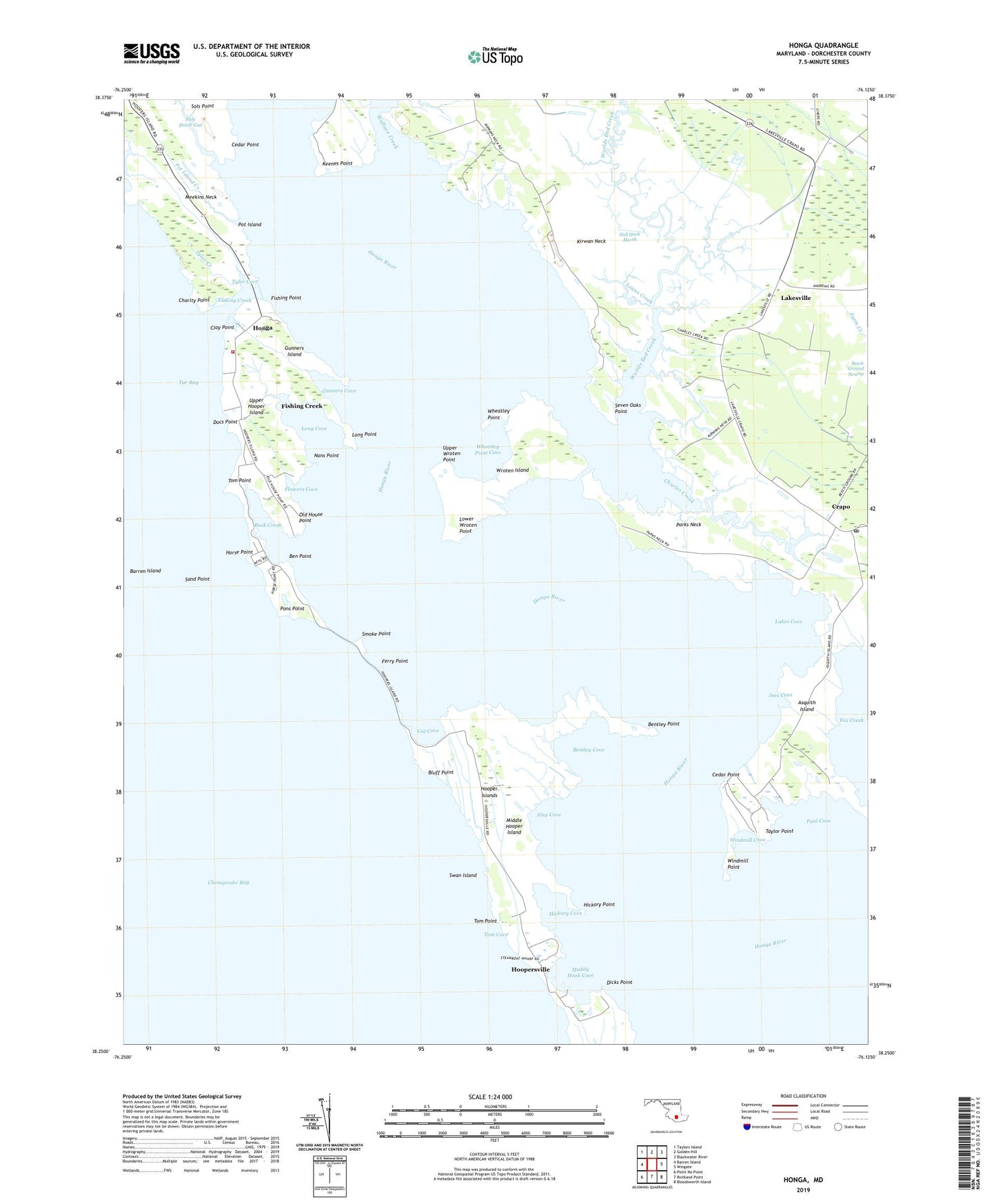
2023 topographic map quadrangle Honga in the state of Maryland. Scale: 1:24000. Based on the newly updated USGS 7.5' US Topo map series, this map is in the following counties: Dorchester. The map contains contour data, water features, and other items you are used to seeing on USGS maps, but also has updated roads and other features. This is the next generation of topographic maps. Printed on high-quality waterproof paper with UV fade-resistant inks.
Quads adjacent to this one:
West: Barren Island
Northwest: Taylors Island
North: Golden Hill
Northeast: Blackwater River
East: Wingate
Southeast: Bloodsworth Island
South: Richland Point
Southwest: Point No Point
This map covers the same area as the classic USGS quad with code o38076c2.
Contains the following named places: Asquith Island, Back Creek, Ben Point, Bentley Cove, Bentley Point, Bluff Point, Cat Cove, Cedar Point, Charity Point, Charles Creek, Clay Point, Crapo, Crapo Post Office, Dicks Point, District 5 Lakes, District 6 Hoopers Island, Docs Point, Ferry Point, Fishing Creek, Fishing Creek Census Designated Place, Fishing Creek Post Office, Fishing Point, Flag Cove, Flowers Cove, Gunners Cove, Gunners Island, Hell Hook Marsh, Hickory Cove, Hickory Point, Honga, Hooper Island Lighthouse, Hooper Island Pier, Hooper Islands, Hoopers Island United Methodist Church, Hoopers Island Volunteer Fire Company Station 51, Hoopers Memorial Church, Hoopersville, Horse Point, Hosier Memorial United Methodist Church, Joes Cove, Keenes Point, Kirwan Neck, Lakes Cove, Lakesville, Lakesville Post Office, Long Cove, Long Point, Lower Wroten Point, Lowes Creek, Middle Hooper Island, Muddy Hook Cove, Nans Point, Old House Point, Opossum Island, Parks Neck, Paul Cove, Pons Point, Pot Island, Pot Island Creek, Sand Point, Seven Oaks Point, Smoke Point, Sols Point, Sols Point Gut, Swan Island, Taylor Point, The Canal, Tom Cove, Tom Point, Tyler Cove, Tyler Creek, Upper Hooper Island, Upper Wroten Point, Wallace Creek, Wheatley Point, Wheatley Point Cove, Windmill Cove, Windmill Point, Worlds End Creek, Wroten Island, Wroten Island Airport, ZIP Code: 21634