MyTopo
Alberta Michigan US Topo Map
Couldn't load pickup availability
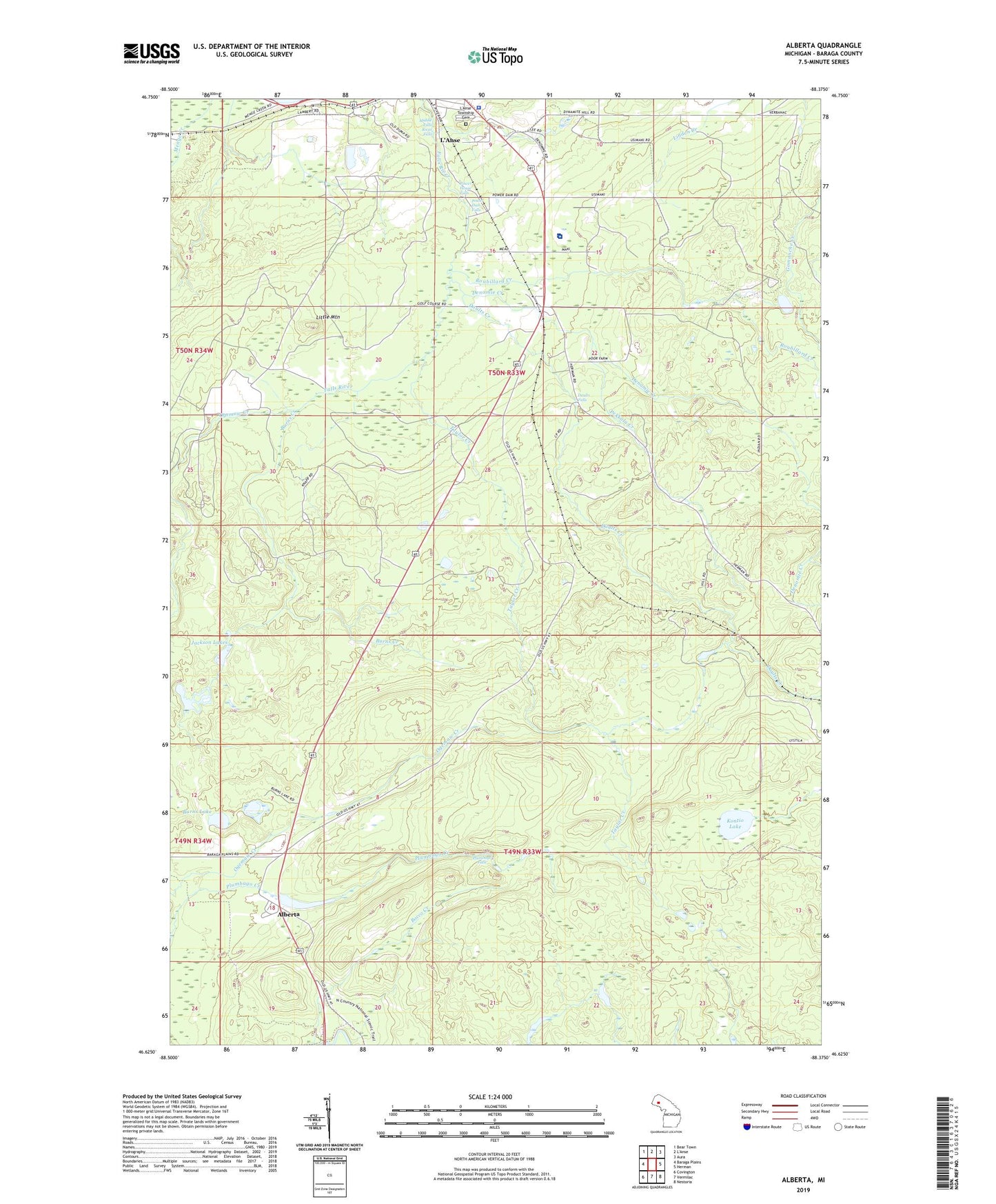
2019 topographic map quadrangle Alberta in the state of Michigan. Scale: 1:24000. Based on the newly updated USGS 7.5' US Topo map series, this map is in the following counties: Baraga. The map contains contour data, water features, and other items you are used to seeing on USGS maps, but also has updated roads and other features. This is the next generation of topographic maps. Printed on high-quality waterproof paper with UV fade-resistant inks.
Quads adjacent to this one:
West: Baraga Plains
Northwest: Bear Town
Northeast: Aura
East: Herman
Southeast: Nestoria
South: Vermilac
Southwest: Covington
Contains the following named places: Alberta, Baraga County Memorial Hospital, Baraga County Sheriff's Office, Bishop Baraga Shrine, Bovine, Burns Creek, Burns Lake, Daults Creek, Daults Falls, Denomie Creek, Henry Ford Alberta Village Museum, Jackson Lakes, Kontio Lake, L'Anse Golf Club, L'Anse Mobile Home Court, L'Anse Township Cemetery, L'Anse-Lac Vieux Desert Trail Historical Marker, Little Mountain, Menge Creek, Middle Falls River Falls, Pekkala Creek, Plumbago Falls, Power Dam Falls, Power House Falls, Roubillard Creek, Taylor Creek